STAGE 14 – The A675 near TOCKHOLES to ABBEY VILLAGE via DARWEN TOWER
6.25 miles – 2.5 hours walk.
880 feet climbed – highest point 1,270 feet – Darwen Moor
A brief crossing of Tockholes Woods and then a modest climb up Darwen Moor culminating in the iconic monument of Darwen Tower, which celebrates the diamond jubilee of Queen Victoria – 1897. More great views, including the first part of the Northern Loop and Pendle Hill. Return to Tockholes woods and then descend to Abbey Village by three small reservoirs, which are part of and feed the Rivington reservoir system of earlier Stages.
A map of Stage 14 can be found below courtesy of Ordnance Survey maps. You can subscribe yourself using this link, https://osmaps.ordnancesurvey.co.uk, which will enable you to import the GPX file which can be downloaded below.
To download the GPX file for this stage click on the link above.
ROUTE DESCRIPTION
Cross the A675 (carefully – it was renowned for speeding bikers and cars before mobile police cameras and average speed cameras!) and proceed right in a south easterly direction for about 100 metres. Take the track on your left shortly after the property – it is marked by a footpath sign and has a substantial metal barrier followed by another gate with a pedestrian kissing gate. This track enters some woods and then reaches the ruins of Hollinshead Hall where the track splits. Turn left here along the track and immediately look out for two stone posts on your right. Do not continue along the track, which bends to the right and climbs up a small hill, but pass through the gateposts and pick up a path through the woods almost behind the ruins.
You may want to investigate the ruins – unfortunately, when last here, the information board had been badly vandalized. There is still one building intact in the NE corner of the grounds, which is the Well House, and which gives an impression of the house that must have once stood here and commanded the valley above and below the site. Do try and peer inside and see the architecture and the lion heads from which the spring flows. Behind the building is a pool. Folklore suggests that the site was used by monks and that the waters were used for their curative qualities.
Continue through the woods and exit through the wall onto the road. Turn left and take the Bridleway almost immediately opposite on the other side of the road. Follow the very good track, initially through the field, and then start to climb the slope of Darwen Moor. Ignore the path on the left and zig zag to the top of the slope. Pass through the gate on the summit and then continue along the same track on top of the moor. Ignore the first track on your left having just passed through the gate and then two further tracks on your right which follow in quick succession – keep on the same stoned path, which bears left. You can see Darwen Tower straight ahead. After about 300m look out for a path on your right, which heads in an easterly direction. It is at the top of small slope where a fence comes to the path on the left .Turn 90 degrees right and follow the non stoned path in an eastwards direction. You could continue along the good stoned path that we have been following as this does make its way to the Tower but we will use this later to return back from the Tower. After a few hundred meters take the track to your left, which then heads in a northerly direction direct to the Tower. Continue until you reach the Tower.
The path up to the tower gives great views to the east of the town of Darwen, which is set in the valley below, and the Rossendale Moors further to the east. The most prominent landmark in the town, which can be seen from the path up to the Tower, is the chimney of India Mill, which was built in 1867 in the style of an Italian Campanile (think St Mark’s Square, Venice!) and was almost 300 feet high, but removal of a cast iron crown in 1943 reduced this by 20ft. The mill, once one of over 50 in the town, bankrupted the owners with its lavish architecture and ambitious size. The cotton industry suffered first in the late 19th century with the War in America and then later with the boycott by India of British products as it pushed for independence from the British Empire. Perhaps Darwen’s most famous visitor was Mohandas Ghandi, who was known as Mahatma, meaning great soul. He was invited by Percy Davies, later the firts Lord of Darwen) and his family, who owned a mill in the town. It was hoped that the visit would show the impact of the boycott on the Lancashire towns and the resultant poverty. The visit was friendly but Ghandi, whilst he sympathized with the workers, could only respond by stating to one weaver “My dear, you have no idea what poverty is”. It took over another 20 years before India gained independence!
To the NE you can see excellent views of Pendle Hill, the Bowland Fells to the North and all the way to the West with both Blackpool Tower and the Ribble Estuary particularly prominent.
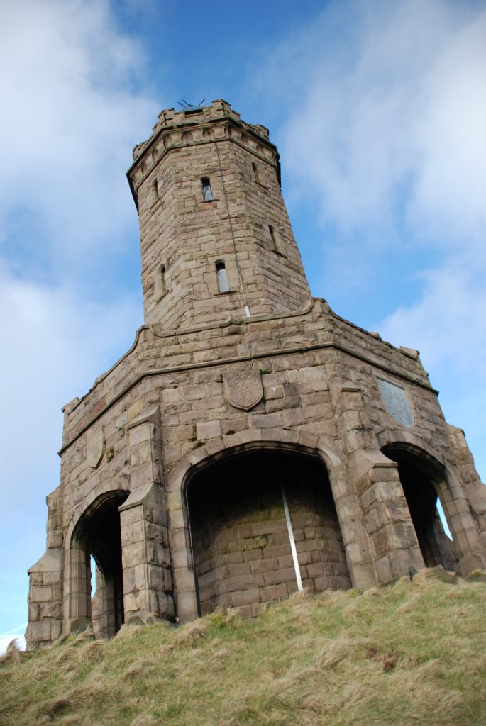
Darwen Tower was built in 1897 to commemorate sixty years of Queen Victoria’s reign. The idea of a tower was first put forward in the Darwen News of January 13, 1897: “… a landmark to be seen far and wide and, whilst commemorating the record year, it would also fulfil a similar function with regard to the celebration of the Freedom of the Darwen Moor.” The latter referred to the ending of many years of dispute with the local landowners about access to the Moors, which was finally won by the locals in 1896. A local councillor, Robert Shorrock, formally proposed that a monument be built and £1500 was quickly raised by public subscription. Work started in June of 1897, with a local builder from Wheelton, James Whalley, winning the tender for its construction at just over £777. The red sandstone came from the local Red Delph Quarry. The octagonal tower stands 85ft tall on a base that is 1225ft high and was completed in 1898. In the 120 or so years since, the tower has withstood not only the weather in its exposed position, but vandalism, moorland fires, soot and pollution from the mills below and even offers to buy it from America! Thankfully it was restored in the 1970’s and again in 2011 when the dome and weathervane were blown off in storms in November 2010, all with the help of local businesses. Please do take the steps to the very top, although it can be dark and wet inside the tower.
Exit the tower on the north side and take the path to the left, which heads along the top of the hill in a SW direction. Ignore the first path, which descends the hill and joins on the right and then another path to your right, which runs along a fence and then down a steep cutting in the hillside – a short cut to the bottom of the valley to the right, which we will descend into by a safer path. Take the next path on the right, through the fence and marked by a Darwen Tower path marker stone. Follow the path with zig zags into the valley below. At the bottom, there is a track, turn left and follow the track around, over the brook and into the small coppice that clothes the other side of the valley. Do not take the track up the valley itself ie do not follow the brook upstream. There are two gates on exiting the coppice. Go through the right hand gate and follow the grassy track to the end of the small terrace of houses. Pass the last house and then turn left into a small car park and bus turning area. There is a pub (Royal Arms) here for refreshments and a small café with toilets at the Roddlesworth Information Centre. The Main car park next to the Centre is actually the site of another mill!!
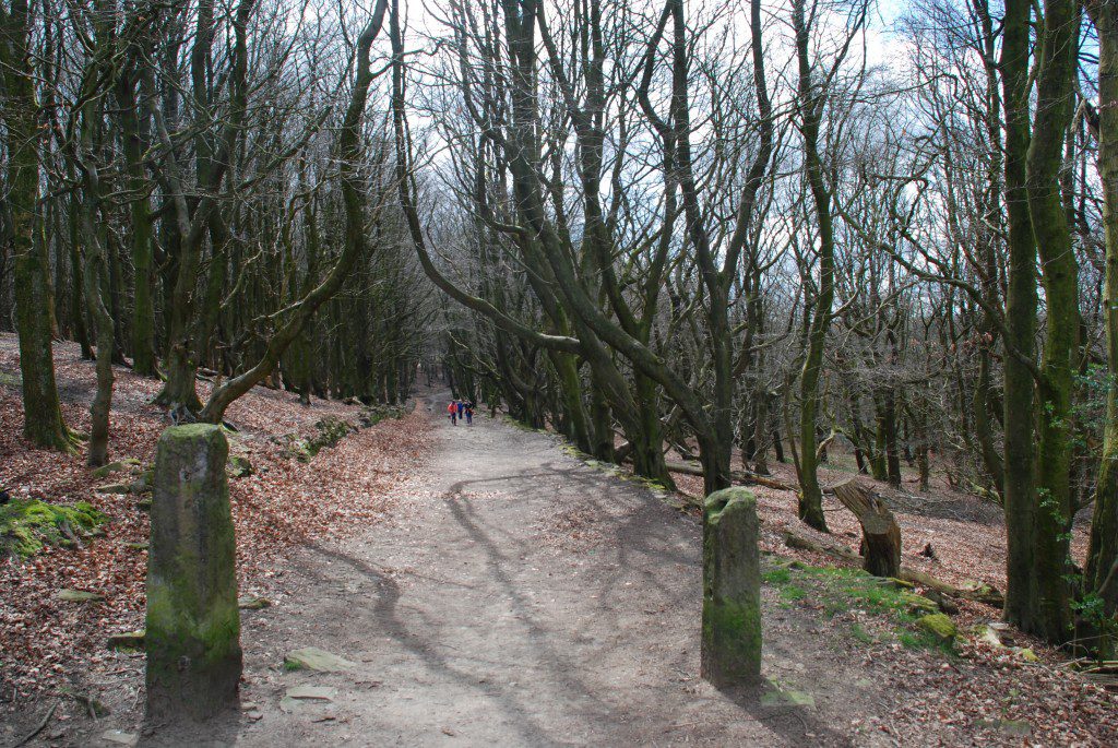
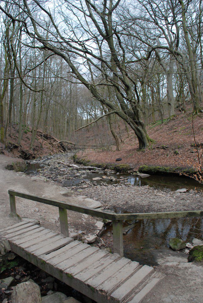
Cross the road opposite the bus stop and find the gate into the woods opposite. Follow the track through the woods, which initially is prettily lined by trees – see photo. The track heads down the hill and then joins another track. Turn left at this point and join another track with a bridge over the stream running in the bottom of the valley.
Cross the bridge and immediately on you right pass through the old steel kissing gate. Then follow the path, which runs along the side of the stream as it descends the valley. You can see the excellent rock formations in both the stream-bed and the cuttings, which the stream has made. Then take the steps up to a brand new wide stoned road. Follow the road for about 200m then look out for a path on your right with steps back down to the stream. At this point there is a path to your left. Please follow this rather than continuing on to cross a small concrete bridge over the brook.
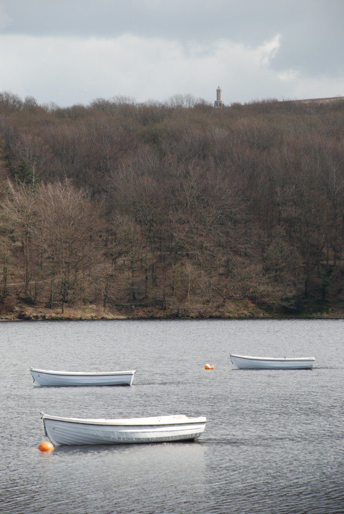
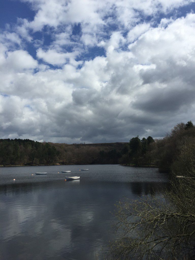
Originally the Way did cross the stream and then followed a substantial track along the eastern shores of the Roddlesworth Reservoirs but on balance the paths along the western edge are better and it is more direct. Follow the path through the woods, which before long reaches the shore of the first reservoir and then the first dam on your right. If you want excellent views of the reservoirs and Darwen Tower in the distance, as seen in some of the photos, then please access the dam. There used to be a public footpath along the dam but unfortunately United Utilities have re-routed the path to the base of the dam, which has no views at all. The path along the dam is wide but apparently reserved for casting anglers although many people still use it to create a good circular walk. So please do take in the views providing you are careful if anglers are present.
Go back to the footpath and continue in WNW direction past the building on your right and on to a track/road. Bear right to a fence and pick up a path that runs down through the woods in NNW direction. At the bottom of the hill you reach the shores of the second Lower Roddlesworth Reservoir. Follow the shoreline to a footbridge.
Cross the footbridge on to the dam of the Lower Roddlesworth Reservoir. There are more excellent views back up the valley to Darwen Tower and in the opposite direction you can glimpse the southern hills of the Trough of Bowland including Parlick, which we will one day reach!
Turn left. The track takes you over a substantial stoned overflow channel – by a bridge or across the stones themselves when dry. You then reach a property, presumably once occupied by the Water Authorities. There is short cut footpath to the right of the property past a chicken coop. Turn right and rejoin the track, which then makes its way along the right hand side of final reservoir – Rake Brook Reservoir. This brings you back out on to the A675 Bolton Road by the Hare and Hounds Pub. But just before that, observe the watercourse at the end of the final reservoir and the tunnel under the road. This feeds the Goit, which passes through Brinscall and White Coppice and ultimately feeds into the Anglezarke and Rivington Reservoirs, which we visited recently.
END OF STAGE 14
The accommodation options are the same as the end of Stage 13. The best option is to start Stage 15 and after about a mile at GR 631 223 come off the route by continuing along the road to the Oak Royal Hotel, which is about a third of a mile on. Alternatively take a bus or taxi into Chorley – Chorley North Premier Inn (4 miles away) or the Hartwood Hall hotel.
Click here to go straight to Stage 15
CIRCULAR/DAY WALKS
Complete Stage 14. You can park by Piccadilly on the main road or there is a proper car park just south along the Belmont Road – it is marked on the OS Maps and is called Crookfield. When you have completed Stage 14 carry on to Stage 15 until you arrive in Withnell. Rather than come off the old railway continue straight on into Brinscall. Pass the swimming baths and then follow the Goit all the way to White Coppice. Then climb up to Great Hill and finish Stage 13. Total distance 12 miles.

