THE LANCASHIREWAY “FIFTY MILE ROUTE”
The Lancashire Way is primarily a long distance walk/path and so I am aware that it will only be relevant to a few who like their long distance walking. Even though it has been split into four manageable Loops, each between 80 and 110 miles long and therefore walkable for most within a week’s holiday, its appeal will still be limited. To make it more accessible each Stage, there are 59 in total covering the 396 miles, has suggestions as to shorter, often circular walks, that incorporate the Lancashire Way. I also hope it will appeal to those who just love Lancashire and can follow the walk without taking a step and see the wonderful scenery and discover its fascinating history from the comfort of their own home. There is so much to discover!
I have toyed with the idea of producing a linear version of the Lancashire Way from Preston, or possibly further south, to Lancaster, but that is a big undertaking but I may do it one day. I had also thought about a shorter route, one that would include the very best of Lancashire. A taster and a starter for walking the longer Loops which take significantly more commitment. Being a member of the Long Distance Walkers Association (LDWA) I was aware that 2022 marked its 50th Anniversary and was looking to celebrate this with a series events that publicised the organisation. The West Lancashire Group suggested a 50 mile walk would be an apt way of celebrating the 50th Anniversary and so I volunteered to put together a route based upon the Lancashire Way. And so was born the 50 mile route, which is therefore a product of the natural evolution of the Lancashire Way and also the celebration of the first fifty years of the LDWA – www.ldwa.org.uk.
There were several options to consider but one based upon the Central Loop seemed the most appropriate. It includes the Ribble Valley, Pendle Hill, which is probably the most well known hill in the county, the Hodder valley, which is apparently one of the Queen’s favourite places in England and the Bowland Fells and much more. So here is the route.
| THE FIFTY MILE ROUTE | |||||||||
|---|---|---|---|---|---|---|---|---|---|
| Lancashire Way | |||||||||
| Stage No | Name | Miles | Hours | Four days Route | Cum Miles | Cum Hrs | Highest Ft | Climb ft | Cum Climb ft |
| N/a | Hurst Green to Whalley | 4.6 | 2.00 | 4.6 | 2.0 | 343 | 301 | 301 | |
| 21R | Downham via Pendle Hill | 8.9 | 4.50 | 13.5 | 13.5 | 6.5 | 1,822 | 1,760 | 2,061 |
| 22 | Grindleton | 3.3 | 1.50 | 16.8 | 8.0 | 528 | 297 | 2,358 | |
| 23+ | Slaidburn | 6.7 | 3.00 | 23.5 | 11.0 | 1,219 | 1,170 | 3,528 | |
| 23R | Newton | 1.8 | 1.00 | 11.8 | 25.3 | 12.0 | 487 | 127 | 3,655 |
| N/a | Dunsop Bridge | 3.1 | 1.50 | 28.4 | 13.5 | 484 | 164 | 3,819 | |
| 25 | Chipping via Fiensdale/Fair Snape | 11.0 | 5.00 | 14.1 | 39.4 | 18.5 | 1,701 | 1,882 | 5,701 |
| 26 | Hurst Green | 11.5 | 5.00 | 11.5 | 50.9 | 23.5 | 1,134 | 1,655 | 7,356 |
Download file for GPS
THE ROUTE
Stage A – Hurst Green to Whalley – 4.6 miles – 343ft of ascent.
DIVERSION – Please see below for details of a temporary diversion due to house building on the outskirts of Whalley.
Beginning in Hurst Green follow Stage 27 of the Lancashire Way to the other side of the Dinckley footbridge on the River Ribble. Click here to go to Stage 27
On the other side of the bridge the Central Loop of the Lancashire Way turns right and follows the Ribble downstream to Ribchester and then onto Preston in Stage 28.
However, the 50 mile route turns left and follows the river north/upstream. Pick up the track on the left, which heads to a gate into a field. However, do not enter the field but take the path to the left which heads directly along the river bank on your left with the field on your right. After 150m you will cross onto the drive which heads on to Dinckley Hall and a couple of other properties. Turn right and use the drive to walk away from the properties and then bear right and up the slope through a wooded area. Towards the top of the slope at the end of the wooded area on your left, turn left and follow the footpath, which runs roughly parallel with the woods on your left.
Cross into the next field and then bear right and follow the boundary on your right. Cross into the next field and bear right again and follow the boundary on your right to the property called Cravens. Turn left and follow the follow the bottom of the field to the drive to another property. Cross over and take the path which heads in the same direction (ENE) and skirts the property on your left. Cross into the next field and follow the boundary on your right and at the bottom of the field, turn left and then shortly afterwards turn right and head down the slope and then into the woods and down to and over a footbridge. Pick up the track on the other side and head up the slope, which brings you out on a tarmac road.
To the left, down the road, is the entrance to the Blackburn Rovers Academy whilst to the right the road heads up into Brockhall Village in Old Langho. This was once the site of a large hospital. It opened in 1904 as the Lancashire Inebriates Reformatory, for women who had broken the law under the influence of alcohol. These immoral women needed to be locked up! In 1914 it was widened to take in women with “mental defectives”. In the late 1920’s it took in both men and women with learning difficulties until it closed in 1992. The hospital was then largely demolished and houses built and some of the land bought by Blackburn Rovers to house their training complex. The most tangible reminder of the hospital is the cemetery, in which over 600 people are buried, although few have individual memorials. Unfortunately, the cemetery is on the other side of the village next to St Leonard’s Church in Old Langho.
Cross the road and look for the track opposite. Follow this track, with the training pitches on your left, which then bears left and up a slope and through a gate into a field. Follow the boundary on your right to the road, which carries on to the large Brockhall Farm. Turn right and then almost immediately left and head across the field towards the woods opposite. Pass over the stile and then down through the woods to the edge of the River Ribble. Turn right and follow the bank of the river until you come to the confluence of the Calder and Ribble. Then bear right away from the river and across the drive that serves Hacking Hall to your right and carries on to Hacking Barn on your left. Pass through the field, bearing right shortly afterwards and pick up the drive at the front of Hacking Hall. Take the drive to the main road.
Carry straight on along the road until it turns sharp right just after Chew Mill.
DIVERSION – The footpath just beyond the A59 is currently closed due to house building in the fields. There are two options. The shorter route is to cross the A59 and then follow the A59 in a NE direction and pass over the River Calder. Then you can scramble down to the track that runs along the north bank of the river and then head east to the Gateway – see below, where you can pick up the original route again. The longer but simpler alternative is to continue along Elker Lane after Chew Mill, cross the A59 and continue to the main road just after the School. Turn left and then pick up the footpath near Whittam’s Farm which joins up with the original route.
ORIGINAL ROUTE Take the footpath which continues through two fields in the same direction and ends at the A59.Cross the A59 carefully – fast traffic. On the other side turn left and then right and follow the footpath again in the same direction until you come to some new houses.
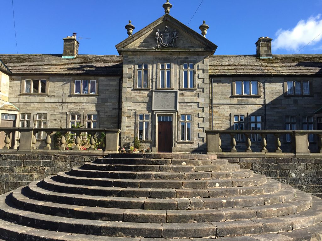
Pass through the gate on to the road. Turn left and follow to the railway viaduct. Turn left and follow a ginnel parallel with the viaduct with a factory on your left. Pass over the footbridge over the river Calder and then straight on to a road. Turn right, head under the viaduct through two prominent brick arches and on to the old Gateway to Whalley Abbey. Pass through this and then follow the road past the entrance to the Abbey and onto the parish Church of Whalley, the Church of St Mary and All Saints. This is the end of the first stage of the 50 mile walk.
Stage B – Whalley to Downham 8.9 miles – 1,760ft of ascent.
Follow Stage 20 to just beyond the Nick of Pendle. Click here to go to Stage 20
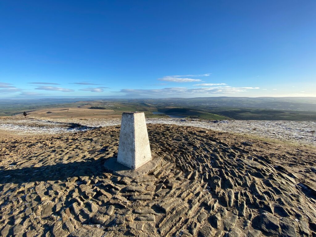
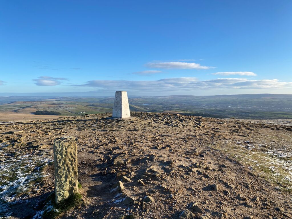
At the point marked by the words “Badger Wells Hill” on the OS maps, Stage 20 of the Lancashire Way heads east towards the Deerstones and Spence Moor before descending to the villages of Newchurch-in-Pendle and then Barley. It then climbs up to the summit of Pendle Hill via the Ogden Reservoirs. The 50 mile route, however, heads directly to the top of Pendle Hill from here by continuing to head in an approximate NE direction. So when the path from the Nick of Pendle starts to bear right and off in an easterly direction, ignore this and turn left and follow the track which continues up the hill in the same direction as you have been following from the Nick. At the top of the slope, you will see the Ogden Clough valley to your right and you will come across a couple of stone cairns. From here the track becomes a path and bears slightly left so that you are heading in a NNE direction. This brings you to just above the stream that occupies Ogden Clough. Continue upstream with the stream on your right. After about 750m of following the stream the path crosses the stream and goes through a gate. Beyond the gate there is an excellent flagged path across the moor, which takes you to a gravel path and shortly after the trig point on the summit of Pendle Hill.
From the summit of Pendle Hill follow Stage 21 of the Lancashire Way to Downham. Click here to go to Stage 21
Stage C – Downham to Grindleton – 3.3 miles – 528ft of ascent
Follow Stage 22 of the Lancashire Way. Click here to go to Stage 22
Stage D – Grindleton to Slaidburn – 6.7miles – 1,219ft of ascent.
Follow Stage 23 of the Lancashire Way as far as the property called Skelshaw – Grid Reference SD 722 505. Click here to go to Stage 23
Then follow the directions below.
Continue along the track down from Fell Side to the front vehicular entrance to Skelshaw. Turn right off the track and go through the gate next to the entrance to the property. Follow the boundary of the field on your right to a medium sized wooden gate. Pass through the gate then onto a smaller wooden gate. Pass through the gate on to a to small stream – Skelshaw Brook. Cross over and then pass through the gate opposite. In the next field bear left and head up the slope and then down in the direction of Broadhead Farm. Pass through two gates and then head to the front of the farm. Turn right and head around the side of the farm and then pick up the drive to the main road. Follow to the main road.
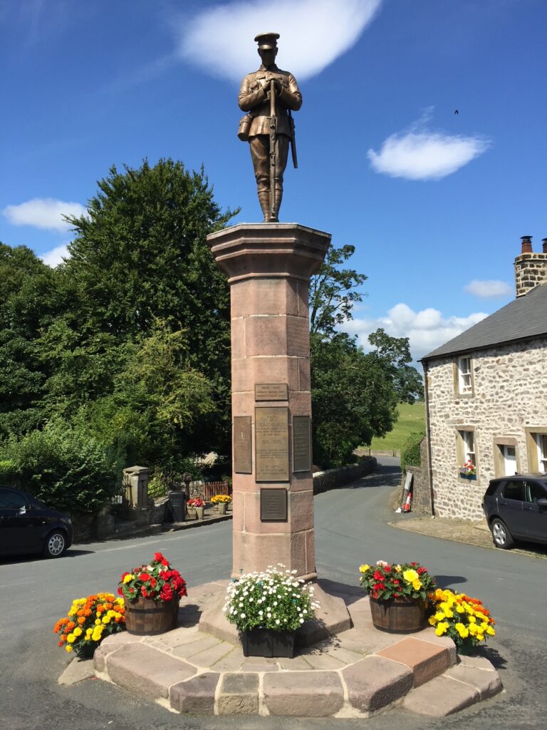
Cross the main road and pass through a gate into the adjacent field. Head up the field with the boundary wall just to your left. At the top corner of the field pass through the gate on your left and then continue in the same direction as before on the opposite side of the wall. Go down the slope passing a wood on your right to a wall stile next to a gate. Cross over the stile and then turn left in the next field and roughly follow the wall on your left. Then bear way from the wall and head down the steep slope to a gate and the main road. Pass through the gate, turn left and follow the road down around the hairpin bend and then over the bridge over the River Hodder into Slaidburn. The Stage actually ends a few 100m further on at the junction with the War Memorial passing the car park, café and village Hall on your way. You should not miss the War Memorial – it is one of the best in Lancashire! Hopefully you will also investigate the rest of the village. There is a pub – the Hark and Bounty, with rooms, a youth hostel and village stores so it is a good place to stay.
Stage E- Slaidburn to Newton – 1.8 miles – 127 feet of climb.
We are now actually following the end of Stage 23 of the Lancashire Way in reverse. However, I will describe the route in detail.
Make your way back from the War Memorial to the Village Hall. Head across the car park and find the path at the end. Follow this through a small wooded area. Ignore the stile gate on your right and carry on to the next stile gate, which is a just a short distance further on. Pass through into the large field. Follow the path along the river bank until you come to a small water works. Turn right and follow the fence around a piece of waste ground (the path actually enters and exits this via large ladder stiles, but please ignore) and then use the stile on your right to cross on to a track.
Follow the track which skirts the edge of the large distinctive hill, Little Dunnow. Ignore the path across the field. The track then bears left and heads towards a distinctive small wrought iron bridge over the river. Do not follow this but carry straight on towards the edge of the next hill called Great Dunnow. These prominent hills by the river Hodder are a form of reef or mud mounds (Waulsortian) that grew in the Carboniferous seas over 340 million years ago. There are various examples in the Hodder and Ribble valleys with perhap Worsaw Hill near Downham being one of the most prominent
In the corner of the field there is a stile and gate. Pass through and head through the wooded area with the river now almost directly to your left. After 200m exit into another field. Go straight on until the path passes into a fenced area on the right of the field. Exit this fenced path at the end through a gate. Then turn right and pass through the gate and follow the track up through another gate and through a farm yard to the main road.
NB Just on the opposite side of the road are some steps which go up to a free car park, which can be useful for logistics.
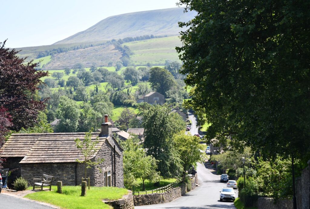
Turn left and follow the road into Newton-in-Bowland past some interesting old properties. The Stage ends at the bus stop and a distinctive old road sign post.
Stage F – Newton-in-Bowland to Dunsop Bridge 3.1 miles – 164ft of ascent.
This Stage does not follow any of Lancashire Way but follows another pretty section of the River Hodder!
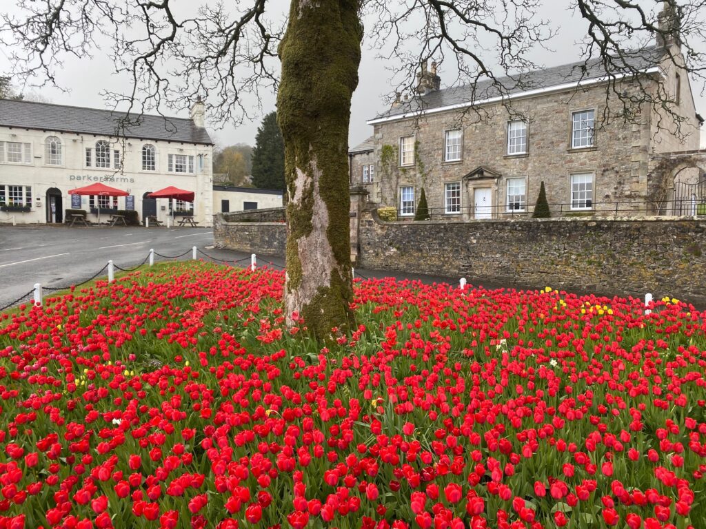
From the distinctive signpost turn left and follow the road down past a small green, the Parkers Arms to the road bridge over the Hodder. Immediately after the bridge take the gate with a prominent finger sign post into the field on your right. Follow the path with the river on your right. Climb over the stile into another field. The path splits at this point. Do not bear left but continue straight on along the edge of the river. Use a stile to pass into another field and initially carry straight on. You will begin to approach a fence at this point but bear left and head up away from the river to a gate. Pass through the gate and onto another. In the next field head towards the corner behind a property. In the hedge on your left just before the rear boundary of the property you will see a gap in the hedge and a small still, which takes you through on to the road.
Turn right and follow the road over a stream and then past a drive on your left and some properties on your right. Just after these also on your right you will see the start of a drive which goes to Knowlmere Manor. Turn right and follow the drive for almost a mile when you will pass the Manor. Carry straight on to a farm called Mossthwaite. At this point the drive becomes a track. Follow the track for about 500m. At this point the track begins to bear around to left and head in a SW direction. Come off the track here and follow the path that continues in an easterly direction. Pass into another field and then head towards Thorneyholme Hall. When you reach the corner of the property by the river bank follow the river bank to the bridge that crosses the Hodder and serves the Hall. Turn right and cross the bridge and follow the drive to the main road. Turn left and follow the main road into the centre of Dunsop Bridge. The Stage ends at the bridge over the Hodder by the tea rooms called Puddle Ducks.
Stage G – Dunsop Bridge to Chipping – 10.5 miles – 1,882ft of ascent
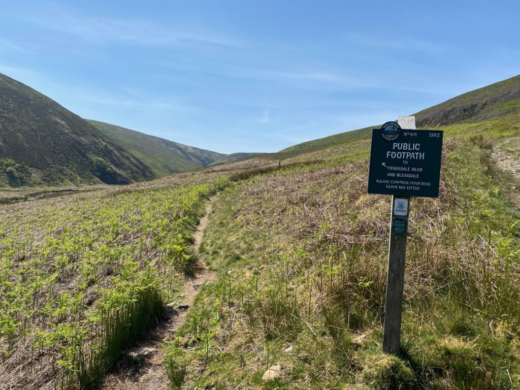
Follow Stage 25 of the Lancashire Way. Click here to go to Stage 25
Walking up the Langden Valley
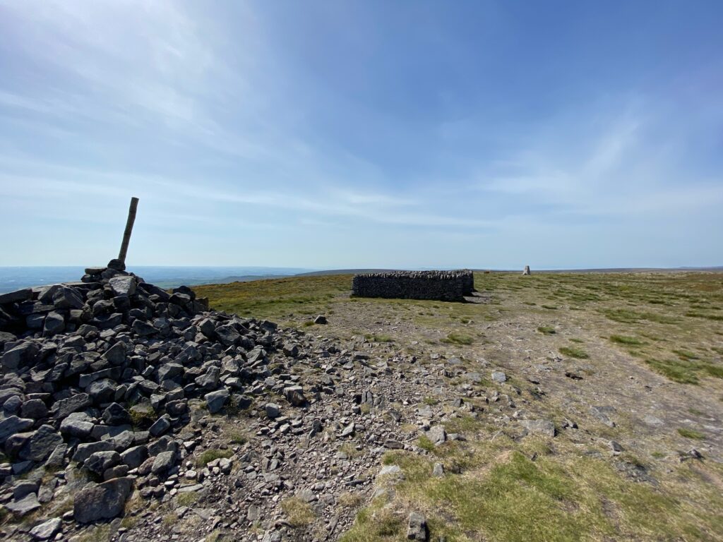
Paddy’s Pole on Fair Snape Fell
NB If this route, which has a significant climb, is too arduous or the weather is poor, then you can use the Alternative Stage 25, but this is four miles less so will result in a 46 mile overall walk. Click here to go to Alternative Stage 25
Stage H – Chipping to Hurst Green – 11.5 miles – 1,655ft of ascent.
Follow Stage 26 of the Lancashire Way. Click here to go to Stage 26
DIVERSION – Please See Stage 26 for details of the diversion within Longridge Forest.
Finish at the War memorial by the main road.
LOGISTICS OF COMPLETING THE WALK.
Below are suggestions on how to walk the 50 mile route with overnight accommodation options at the end of each day. A very good alternative is to base yourself at one location and employ the services of a taxi. I would suggest Clitheroe, which is the largest town in the Ribble Valley with many great facilities and a maximum of 10 miles from the end of any of the days. There are a number of hotels, pubs with accommodation and B&Bs in and around Clitheroe.
FOUR DAYS
I suggest that it is completed in four days for most as follows
Day 1 Stages A and B – 13.5 miles. Accommodation – Assheton Arms in Downham. Distance from Clitheroe = 3.5 miles. There are buses from Downham to Clitheroe and more regular services from nearby Chatburn.
Day 2 Stages C, D and E – 11.8 miles. Accommodation – Parkers Arms in Newton or Clerk Laithe Lodge, which is a B&B with several rooms just outside Newton. Just 7 miles from Clitheroe but no bus services so taxi it must be.
Day 3 Stages F and G – 14.1 miles. Accommodation – There is no longer any accommodation in Chipping itself. It is a mile to the Gibbon Bridge Hotel nearby but this is expensive. My personal recommendation would be a taxi to the Derby Arms on the outskirts of Longridge. You could start the final stage and then walk to the Derby Arms from Thornley Hall. It is just over two miles. There is also the Ferraris Country House next to the Derby Arms. Chipping is the furthest place from Clitheroe at 9 miles. There is a regular bus service to Clitheroe with eleven buses a day. It is Service no 5, which also visits Longridge and Hurst Green.
Day 4 Stage H – 11.5 miles. Accommodation – The Shireburn Arms or the Bailey Arms in Hurst Green. Just 5 miles from Clitheroe to which it is connected by bus service no5.
With all the accommodation do book early as it is quite limited.
Stage E can be moved to Day 3 if you wish.
Hurst Green is served by a bus service (5 or 5A) which links it with Clitheroe and Longridge/Chipping. There are twelve buses a day Monday to Saturday with five on Sunday. Clitheroe has rail links with Bolton and therefore Manchester and also Blackburn and therefore Preston. Longridge has an excellent fast and frequent bus service with Preston.
THREE DAYS
Change the start and finish to Whalley. This is a better location as it has a railway station, which links with Blackburn and therefore Preston and Manchester. You can also take the train to Clitheroe, with accommodation and train slinks to Bolton and Manchester. It does, however, not work so well with the Four Day split!
Day 1 Stages B, C and D – 18.9 miles. Accommodation – Hark the Bounty in Slaidburn or the Youth Hostel. Slaidburn is 9 miles from Clitheroe.
Day 2 Stages E, F and G – 15.4 miles. Accommodation – see notes above on accommodation and other options.
Day 3 Stage H and A – 16.1 miles. Accommodation – The Swan Hotel in Whalley. There are others in the vicinity or use the railway to access other places to stay.
TWO DAY
Please see the Four day option and combine Days 1 and 2 and Days 3 and 4. Day 1 is a 25.3 mile walk and day 2 is 25.1 miles – the almost perfect split!
ONE DAY – 24 HOURS
I am hoping that some of you will treat this has a 24 hour challenge. I would always try and plan the walk around where you would like to be either sunset or sunrise. The section from Fiensdale Head to Parlick has great views at sunset, looking out west to the coast as the sunsets on the horizon so find out what time the sun sets at that time of year. If we assume it will take 20 hours then by beginning at 7am you will finish at 3am but be on this section at around 8pm to 9pm, which at mid summer is just perfect – sunset at around 9.20pm. You can of course begin the route at any point to suit yourself and rework accordingly. For details of a example of the 24 hour walk follow the link below

