STAGE 62 (W3) – LYTHAM TO KIRKHAM via Wrea Green
7.5 miles – 3 hours walk
147 feet climbed – highest point 108 feet at Ribby Hall
A great start to this Stage as we say goodbye to Lytham and the Ribble Estuary but the remainder of the stage is just an ordinary walk to Kirkham with one exception, the lovely village of Wrea Green.
A map of Stage 62 can be found below courtesy of Ordnance Survey maps. You can subscribe yourself using this link, https://osmaps.ordnancesurvey.co.uk, which will enable you to import the GPX file which can be downloaded below.
To download the GPX file for this stage click on the link above.
I am still not set upon this route and therefore there is an Alternative W3 Stage, which uses the Lancashire Coastal Path to Freckleton around the back of the Warton Airbase. It is occupied by BAE Systems and is home of the Typhoon fighter jet. This has the advantage of more great views of the Ribble and Freckleton is interesting. The route then is a slog along roads. It is also 3.5 miles longer and misses Wrea Green and Kirkham Grammar School. The path along the coast is poorly maintained in parts, although this may change when it officially becomes part of the King Charles III coastal path. Sections can also be very wet and muddy. The actual Stage has quite a bit of road too and the paths are not always easy. So, if in a hurry follow the actual Stage otherwise go for the Alternative.
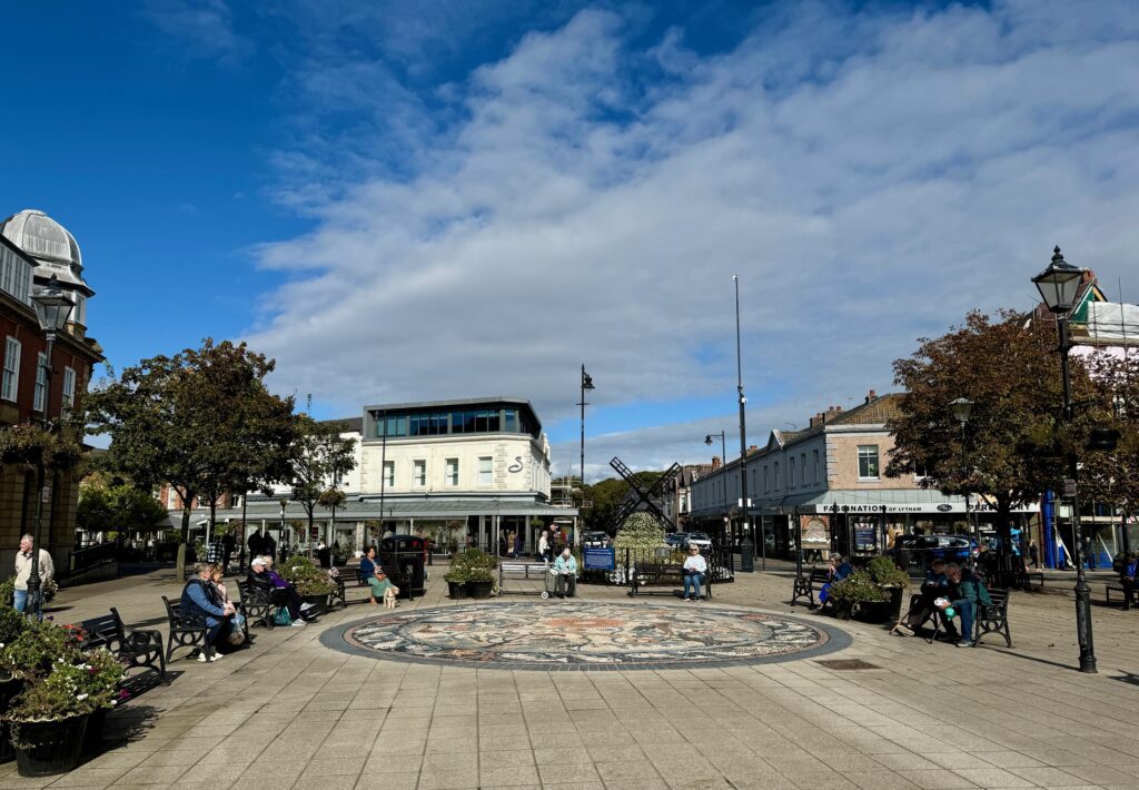
From the Railway station walk straight ahead through the small gardens past the monument in memory of John Talbot Clifton of Lytham Hall, and onto the main road. Follow the main road past the impressive Wesleyan Chapel to the road junction. We are now at the very centre of Lytham, which on a summer’s day has a really nice atmosphere with its many street cafes and bars. Note some of the impressive buildings including the Heritage Centre.
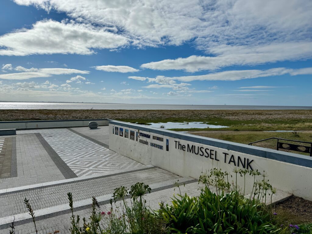
Cross the road and carry straight on through the pedestrian area to the main road at the front. Cross and follow the road opposite with parking spaces to the path that follows the sea front. Turn left. The first structure you come to on your left is a replica of a Mussel Tank, which were built after several cases of food poisoning. These tanks of water allowed the shellfish to self-cleanse themselves.
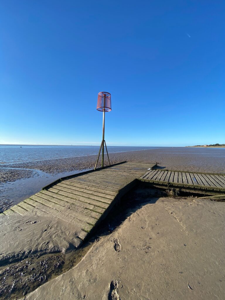
Pass the sailing club and RNLI station. At this point you may want to turn right and follow the wooden jetty down to the Estuary itself. It is not always possible dependent upon tide levels and is often slippery so beware.
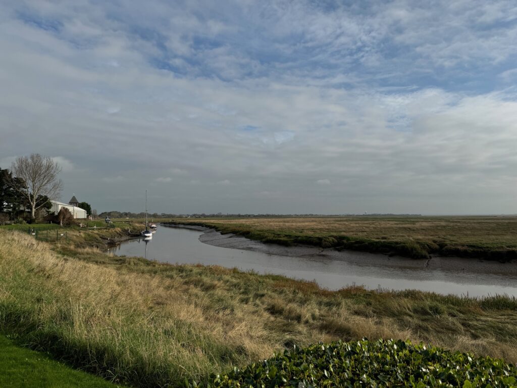
We have seen the River Ribble at various points on the Lancashire Way, most notably on the Central Loop and at the start of the Southern Loop, when we started to follow the river out of Preston towards the sea but had to head inland when we reached the River Douglas. Now finally, we have made it to the Ribble Estuary itself. It has been a busy stretch of water back to Roman times, when it was used to support forts at Kirkham and Ribchester and the industrial site at Walton-le-Dale. It was also apparently used by the Vikings on a route from Dublin to York. It has supported a significant fishing industry too.
The estuary has always been plagued by silting and as early as 1806, the Ribble Navigation Company started to build training walls, whose remains can still be seen at low tide. Preston Docks developed during the 19th Century to support the Industrial Revolution and therefore this stretch of water was a busy one for over a hundred years with the need for constant dredging until trade declined and the docks were closed in 1981.
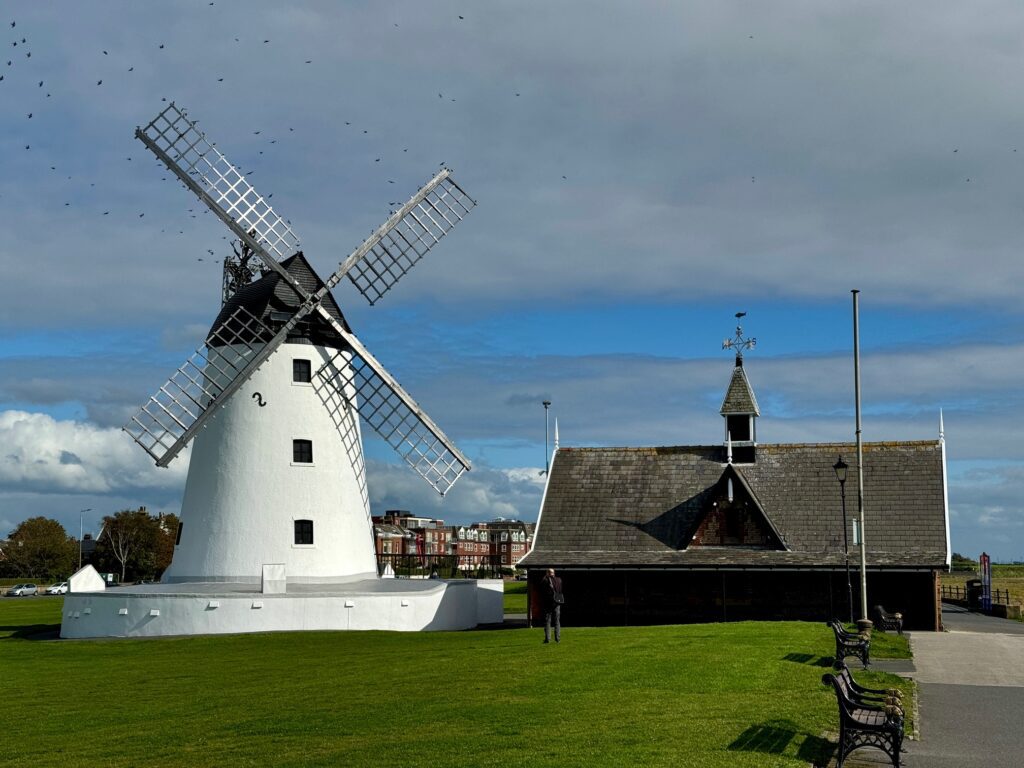
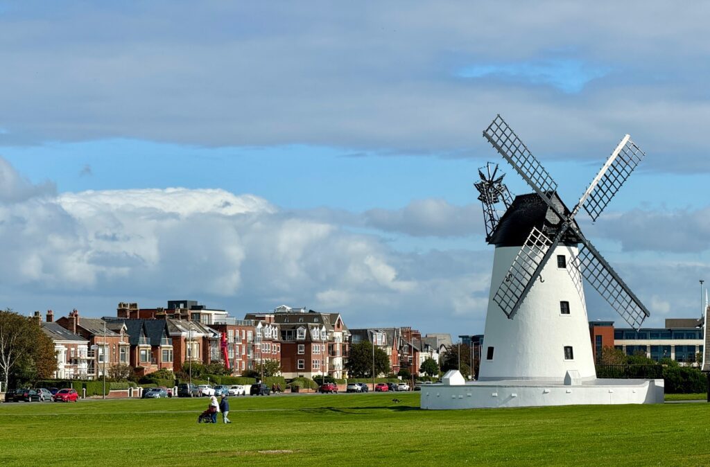
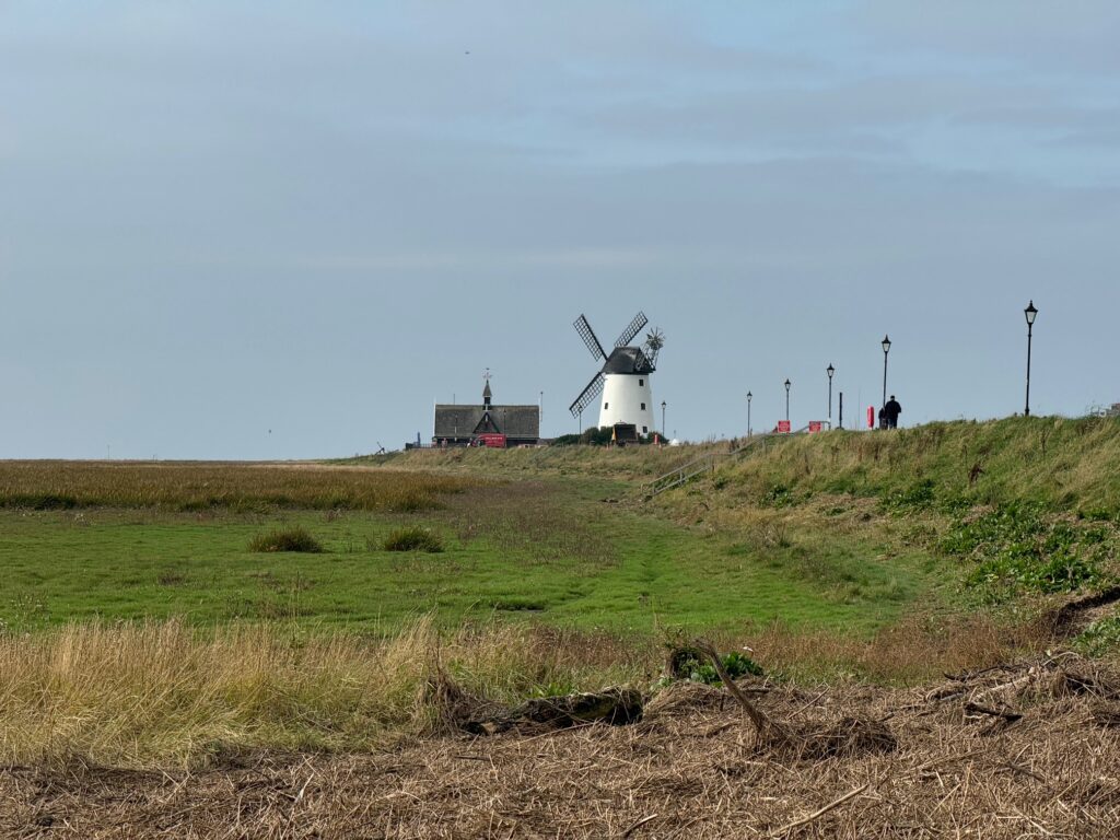
Carry on along the seafront in an easterly direction and ahead of you is the iconic landmark of Lytham – its windmill sitting on the green that fronts the village. The current “Windy Milne” was built in 1805 by the Squire of Lytham and leased back to millers. It was in constant use and even had a gas engine installed for use during calm weather. It has always been a tourist attraction even when working. But in 1909 a small boy from Manchester became too curious and caught hold of the sail but was unable to hang on and fell to his death. In 1919, a severe gale caused the sails to run out of control and a fire started which gutted the building. It remained derelict until, in 1921, it was handed over to the people of Lytham. In 1987 it was extensively restored and has since stood proudly on the green and is even open to visitors on certain days.
Next to the Windmill is a building built of bricks and cobbles, which is the original Lifeboat House built by the RNLI in 1863 to accommodate its new boat the “Wakefield”, which was drawn to the water on a large, wheeled carriage. This was replaced in 1931 by a motorised lifeboat moored permanently in the Ribble Estuary. A new station was built in 1960, which we passed just before.
Continue in the same direction until the end of seafront path.
You have two options here. The actual route takes a leisurely stroll along the front, but you may conclude that it is easier to head to the road and carry on in an easterly direction out of Lytham. The beginning of the actual route can also be wet as it can be affected by tides.
For the seafront option, take the steps on your right down to the shore and follow the path (often wet) around the corner and then up another set of steps on your left which takes you up to a path along the seafront. This is private land with public access. You have good views along and across the Ribble Estuary and of the entrance to Lytham Docks, now little used.
To your left are a series of very large houses with amazing views across the estuary. I am reliably informed that celebrities own some of these including two of football fame. I can only say that the window cleaners must be in much demand!
Exit the seafront by the black metal gates onto Vanguard Wharf. Carry straight on and then turn right and follow Victory Boulevard as it snakes around to the end. Turn left at the T-junction and this takes you back to the main road. Turn right. Cross over the bridge and look for the footpath sign immediately after. Turn right and follow this path along the river. Then bear left and make your way around the back of various industrial units to pick up another river. Turn left and follow the river back to the road. To your right you can see part of Lytham Docks. NB You could just have kept to the road.
Turn right and cross over the bridge.
You now have to decide whether to take the Alternative Stage W3 or the shorter actual Stage 3. The directions below are for the actual Stage.
Continue along the main road, ignoring the Lancashire Coastal Way on your right. After about 500m, cross the road and turn left into Lodge Lane. Follow the lane, past Warton Hall, which unfortunately you cannot really see. The road bends twice to the right and then look out for the footpath sign before Carr Farm. This is the start of a track called Huck Lane. Follow the track, ignoring the footpath on the left at the first bend, past Woodside farm and on to Cartmell Lane. Turn right and follow the quiet road past Moss Side Villa, then ignore the lane to your left, pass Smeath Hill Farm and then look out for a stile on your left. If you come to a sharp bend, then you have missed the path.
Follow the path to the main road. This path can be wet and overgrown, and the stiles are in poor repair but it avoids roads and is direct. At one point towards the end there is a small, enclosed section of path of about 100m long between two hedges. It can be very overgrown. To avoid this, take the gate on your right, rather than take the stile into the enclosed path, turn left and then follow the field to another gate which exits on to a track by the exit from the enclosed path.
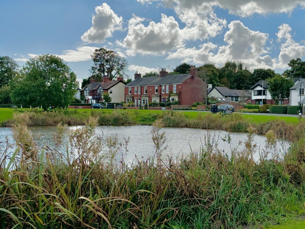
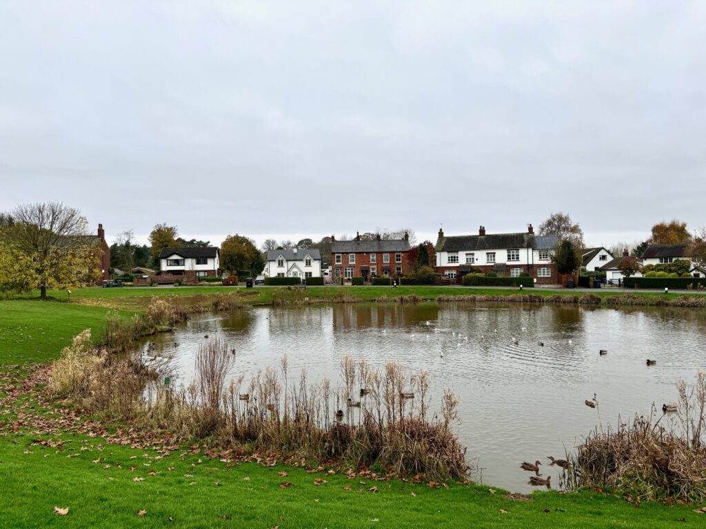
At the main road, cross over and then turn right and follow the pavement into Wrea Green. You can either bear left and follow the road around the Green or cut diagonally across the Green passing the large duck pond known as the “Dub”. This is thought to date back to when villagers dug for daub to build cottages. It is a pretty and charming village dominated by this green and with many pretty properties plus another windmill, which you may catch glimpses of but unfortunately it is in private grounds so cannot be visited.
The Green has some interesting facts courtesy of www.wreagreen.com
“The village green is the largest in Lancashire and up to the middle of the twentieth century, it was not uncommon for cattle and horses to graze on the green. There were at least three ponds on the green, although two were filled in and levelled at the bequest of the cricket team, for a level cricket pitch.
There are still some bylaws concerning the Green that make interesting reading:
- No person shall drive or wheel any cart, truck or other vehicle onto the village Green.
2. No person shall beat or shake carpets or rugs.
3. No person shall dig, cut or remove any sods.
4. No person shall light a fire.
5. No person shall hold a public meeting, religious, political or otherwise on the green.
Additional interesting notes from old minute books include facts such as:
In 1897, Wrea Green suffered a plague of sparrows. 1/2d was paid per sparrow’s egg, sparrow or rat’s tail.
In 1898, it was decreed that any traveller placing a horse on the green should pay sixpence a day.
In 1905, Wrea Green Cricket Club asked permission to level and lay out a portion of the green as a cricket pitch. In 1916, John Marquis of the Grapes Hotel was sent a letter asking him to take steps to prevent his pigs from damaging and disturbing the soil and surface of the village Green.
At the crossroads, with the Primary School on your left, cross over and carry straight on along the B5259. Pass the Parish Church of St Nicholas – a pretty church with a well-kept churchyard. Continue along this road out of the village and then on past the entrance to Ribby Leisure Village, with its holiday homes, hotel and spa. Just before you come to a roundabout with the main A583 to Blackpool, turn right and follow a path which runs along the continuation of the stone walls of Ribby Hall. This cuts the corner off and avoids some of the main road.
At the road, cross at the junction – BEWARE fast traffic. Take the road opposite which comes off the dual carriageway and goes into Kirkham.
Almost immediately we pass Kirkham Grammar School. It is a selective, co-educational private day and boarding school and one of the best known in Lancashire. It was founded in 1549 and was originally sited at St Michael’s church in the village, which we will pass on the next Stage. It has a colourful history, with many benefactors including the Worshipful Company of Drapers, who took control from the Thirty Men of Kirkham in 1673. Amongst their first acts was to prohibit the education of girls in 1701. They were still involved in 1909 when they provided a grant of £3,000 towards the building of the current school here in Ribby Road. In 1979 the school became independent and began to admit girls again. It currently has around 850 pupils.
We will now follow this road into the centre of Kirkham, where the Stage ends at a major crossroads with traffic lights.
END OF STAGE
Click here to go straight to Stage 63 (W4)
If you turn left at the crossroads and follow Station Road, you will come to the railway station after about 600 metres. Trains return to Lytham and carry on to Blackpool or go to Preston in the opposite direction.
Kirkham is a good place to obtain provisions and refreshments with many small shops, cafes and a large Morrisons on the left just after the end of the Stage.
Kirkham is centred upon a couple of modest hills, which you will notice when walking along the high street. One of these, Carr Hill, was the location of a Roman fort and is now occupied by a Secondary School. Their modest height would have given it a strategic advantage over the surrounding land. The Romans provisioned it from the river at Freckleton which was linked to the Ribble. It was on a main Roman road from Ribchester to the mouth of the Wyre. Unfortunately, nothing remains, although in 1792 a brass shield was found by a local schoolmaster and can now be found in the British Museum. The hill was later the site for horse racing, taking place from 1852 until the start of World War II.
Kirkham appears in the Domesday book of 1086 and was granted its market charter in 1269 by King Henry III. It remained a small market town until the late 17th century when it grew into a thriving textile centre. At one point, it had eleven mills with the last being built in 1915. The “Last Loom” is on display in the town, but we just miss this.

