STAGE 7 – PARBOLD to GATHURST
6.5 miles – 3 hours walk.
671 feet climbed – highest point 566 feet – Ashurst’s Beacon
Through the village of Newburgh and then a climb up to Ashurst’s Beacon, at the summit of the next sandstone ridge. Then descend back to the River Douglas at Gathurst where all forms of transport converge in the valley – the M6 motorway, the Manchester to Southport Railway and the Leeds Liverpool Canal.
A map of Stage 7 can be found below courtesy of Ordnance Survey maps. You can subscribe yourself using this link, https://osmaps.ordnancesurvey.co.uk, which will enable you to import the GPX file which can be downloaded below.
Download file for GPS
To download the GPX file for this stage click on the link above.
ROUTE DECRIPTION
From the Windmill Pub head to the left of the Windmill itself to pick up the continuation of the towpath on the southern side of the canal. Continue along and over the small viaduct that takes the canal over the River Douglas. For a short period goods would have been trans-shipped here off the Douglas Navigation on to the Leeds Liverpool canal. Enter a field and then take a footpath on the left, which runs at ninety degrees through the field to the main road. We are now in the village of Newburgh.
Turn right and after about 200m cross the road and pick up the footpath which heads between Spring Cottage and another property away from the road. However, just before this you will see the Red Lion pub, which also has accommodation and is an ideal overnight stopping point.
From the main road continue straight on between buildings and then past stables on your left into another field. At the end of a field cross over a footbridge into another field currently full of Christmas trees. Again carry straight on through the Christmas trees for about 100m until you come to a track. Turn right and head to the lone oak tree and then bear left along the same track to the top of the Christmas tree field. Head through the hedge and along the side of a field with a wood on your right. The path then turns right and down into the pretty wood, which is locally known as Bluebell Wood, and then heads up the stream that occupies the bottom of the small valley.
Cross over a footbridge on to the other side of the stream and continue upstream until you come to steps that take you out of the wood. NB There are a few fallen trees on this section so be prepared to navigate these. Once out of the wood, the path then strictly heads west to a main road, along this busy main road and then back east but you can avoid this this by crossing the stile on your left and follow the wood on your left until you come to a gate with a redundant footbridge next to it. This is not a public right of way but all the local dog walkers seem to use it so hopefully you will have no problems. Turn left over the stile into the field and then carry straight on through that field into another field and down to a road.
Cross the road to Dungeon Lane opposite. Take the driveway on the right by the side of a white bungalow – there is a footpath sign. Follow the drive to properties at the end – Rookery Farm. At the second set of gate posts (the stone ones) the path bears left around the outside of the perimeter of the properties and through a gate into a field. Bear right, past seven fruit/blossom trees and continue along the upper boundary of this field to a stile in the top corner of the field. Cross into the next field and then bear right and up the slope to a drive, which ends at a gated property. Use the stile to access the drive but then cross this and pick up another path, which follows the conifer hedge of the property onto another drive, which then bears around to the right past more properties and ends on Hillock Lane opposite a property called Dalton Lees.
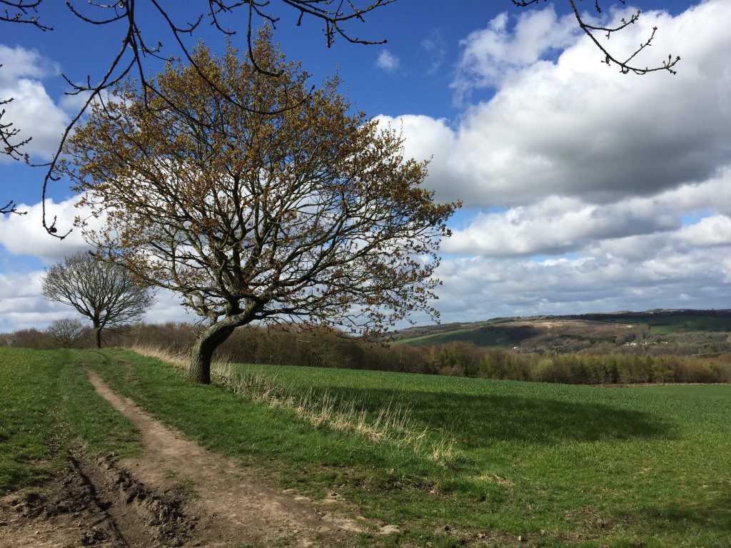
Turn left and immediately cross the road and pass by the side of a gate onto a track by the side of the property called Dalton Lees. Follow the track and note the bricks on the steep section, which have the words Dalton impressed in them. Just to the left are the remains of a quarry that used to make these as we are in the parish of Dalton. After the steep section look out for a stile on your left where there is a private sign just ahead on the continuation of the track. Cross into the field and head straight ahead in an easterly direction following a line of trees. The path bears slightly right and then heads through the trees and then bears slightly right again up to the top of a bank. Find the kissing gate and crossover a small footbridge on to a track and then after less than 100m look out for another stile on your right. Use this to cross into the adjacent field via another small footbridge and then head up the field to find another stile with a small footbridge in some more woods. Head up the up the slope and then turn right and then left, which brings you out on to another track.
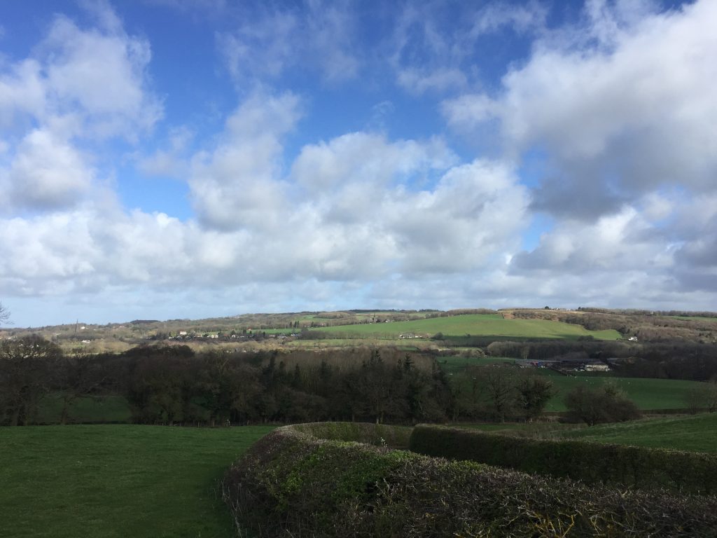
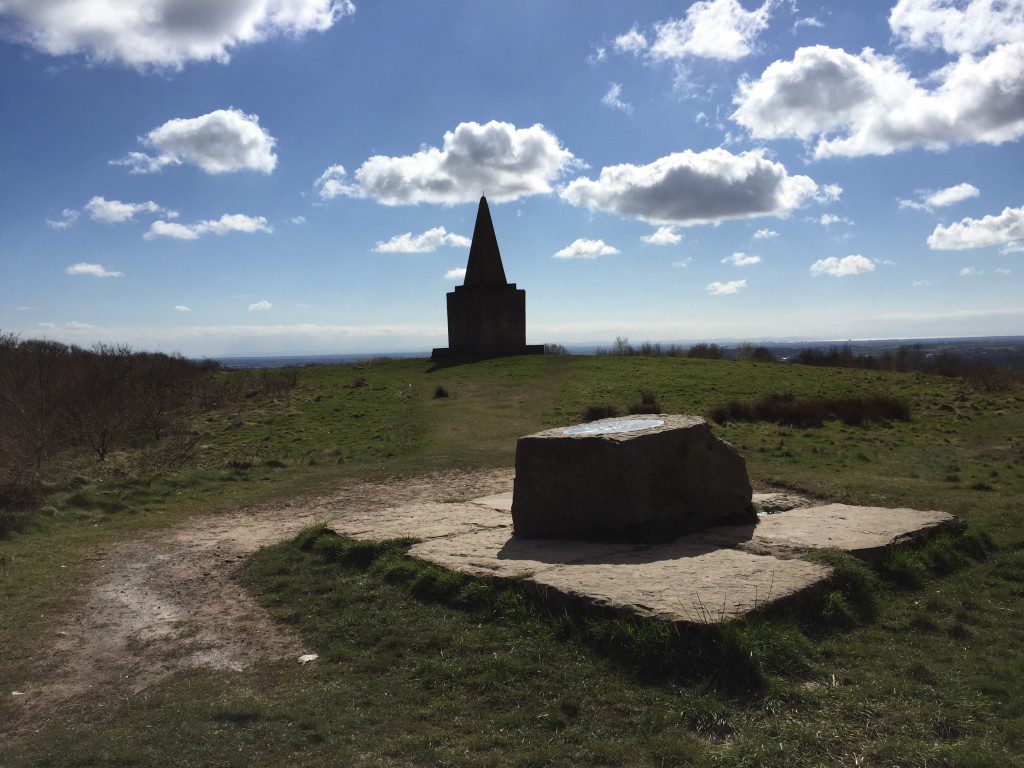
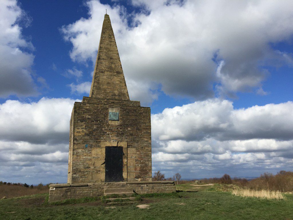
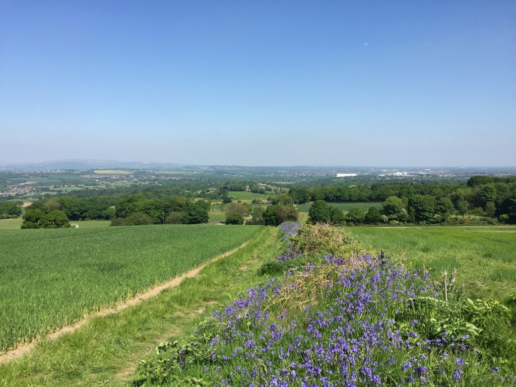
Head straight on along the track, which has great views down towards the Douglas Valley and beyond to the West Pennines with Appley Bridge and Standish in the foreground. Cross over a stile and then on to a road. Turn right and follow the steep road. Shortly after a few properties, and towards the end of the steep section of road, look for a path on both your left and right. Take the one on the right which is cut into a rock face. Follow this path around the edge of a field, over a footbridge, up the other side and then diagonally through a field to a gate and stile. Take the path to the right through the small wood and at the top of the slope you come out on top of the hill at a viewpoint with the stone Ashurst’s Beacon just further ahead.
The Beacon that originally stood here was one of a series of beacons, which stretch from Liverpool to Lancaster and date from the 16th century and whose purpose was an early warning signal in event of an invasion during the Anglo Spanish War of 1585. The current stone structure dates from the early 1800’s and was built by the local landowner Sir William Ashurst who felt the need for a permanent structure during the Napoleonic Wars.
From the Beacon take the path which runs south, until you come to the main road.
Turn left and pass the Pub/Sports Bar (now closed) and then take the first left where the rear of another pub can be found – The Price William )also now closed since Covid. After less than 100 metres look out for a path on your right, which then skirts a cricket pitch. Follow the path more or less straight on, in an easterly direction down the hill. At the bottom of the hill, join a track continuing in the same direction and then onto Farley Lane.
Follow Farley Lane down to a T junction in the centre of Roby Mill – a conservation area. Not unsurprisingly this small hamlet is named after a manorial corn mill, which is known to have been in existence in the reign of Elizabeth I. in 1653 it was held by Lord Derby who rented it to a Henry Roby. It would have been a substantial collection of buildings, with a number of other purposes including a kiln which as well as drying corn would probably have been used for brewing and baking. The mill continued to operate well into the 19th Century with the miller living at 28 Roby Mill. Unfortunately the corn mill was demolished in the early 20th Century but stood where a bungalow now stands at 32 Roby Mill. As well as the corn mill, the village had become quite industrial by the 19th Century with quarrymen and colliers recorded in the census of 1841. There are 25 historical buildings in this small village, which have been given statutory protection as listed buildings, all at Grade II.
Turn right and after 50 metres turn left into School Lane. On the corner is The Fox pub, which may be a good stop for food and sustenance. In the corner of the car park of the pub is Anthony – do have your photograph taken with him – sorry you will have to visit to understand who Anthony is!
Follow the tarmacked lane, straight on, down the hill. This then becomes a muddy track. After a short while the track splits into two. Take the left hand track and follow the track all the way to Dean Wood. Before getting to woods the track becomes more of a path, but follows a line of trees just after a small pond on your left.
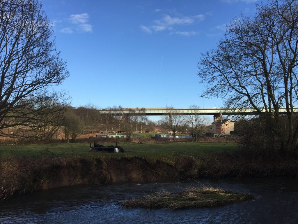
On entering Dean Wood take the left hand path, which then joins a more significant path. Turn left and then follow the valley northwards. On your right you can see the river running along the bottom of the valley. Where the path splits take the right hand path, which descends down to the river and then follows it further north. I must apologise but these paths can be very muddy! Eventually you will come to a footbridge with dark green metal railings. Cross the river using this and then shortly after this you are on a track, which follows the River Douglas underneath the M6 viaduct and then parallel to a railway line until you reach a main road.
Before heading out of the wood and onto the track look across the river for Dean Lock with the lock keeper’s House. Not only is there a lock on the canal itself but there was a lock and channel which connected the river to the canal. This was first used when the western stretch of the Parbold to Wigan canal was only partly completed and barges came off the uncompleted canal back onto the upper Douglas to continue on to Wigan. When the canal to Wigan was completed it was still used to access some of the wharfs, which remained on the river. The Douglas navigation was finally abandoned completely in 1801.
Ideally I would have liked to cross the river here to the canal so that you could see this fascinating history more clearly including, sluices, water overflows and remains of locks on the river, but unfortunately it is private land.
This is also an interesting section of this stage, with all forms of transport crossing the deep valley that the Douglas has created here. You should be able to see the iron railway bridge with its four stone supports, which allow it pass over the River Douglas and then the canal. This all takes place almost under the huge M6 viaduct. The railway was built in 1855 so the canal was the only means of transport to Liverpool, via the Douglas valley, for over 70 years.
Turn left under the railway bridge and follow the road until you reach the Leeds Liverpool canal again by the Baby Elephant Indian restaurant, formerly the Navigation pub because of its proximity to the Douglas and the Canal.
END OF STAGE 7
Overnight accommodation can be found at J27 on the M6 (Premier Inn) which is 2 miles north. Alternatively there is accommodation south in Orrell (another Premier Inn at J26 on the M6) or you can catch the train into Wigan – 5 minutes journey.
Click here to go straight to Stage 8
CIRCULAR/DAY WALKS
There are numerous options for circular walks beginning at Parbold Hill or back at the High Moor Restaurant towards the end of the previous Stage. Descend to the Leeds Liverpool Canal. For a short walk use the towpath to journey into Parbold. Walk through Parbold and take Stoney Lane back up to the High Moor. Return to Parbold Hill by the route at the end of Stage 6. Total distance 4.5 miles.
Alternatively, you can head east along the canal towpath to Appley Bridge. Follow the B5375 north and then west into the wooded area known as Fairy Glen. Return to Parbold Hill via the main road.
A longer alternative is to continue along on Stage 7 to Ashurst’s Beacon on the other side of the Douglas valley. Return to Parbold Hill by Dalton, Newburgh and Parbold. Use Wood Lane to avoid the main road up Parbold Hill.
The longest alternative is to complete Stage 7 ending in Gathurst and then return to Parbold Hill via the Leeds Liverpool canal. The total distance is just under 9 miles. Or you can return to Parbold or Appley Bridge by train to shorten the distance.

