STAGE 19 – MELLOR to WHALLEY
8.25 miles – 3 hours walk.
720 feet climbed – highest point 725 feet – Top of Ramsgreave
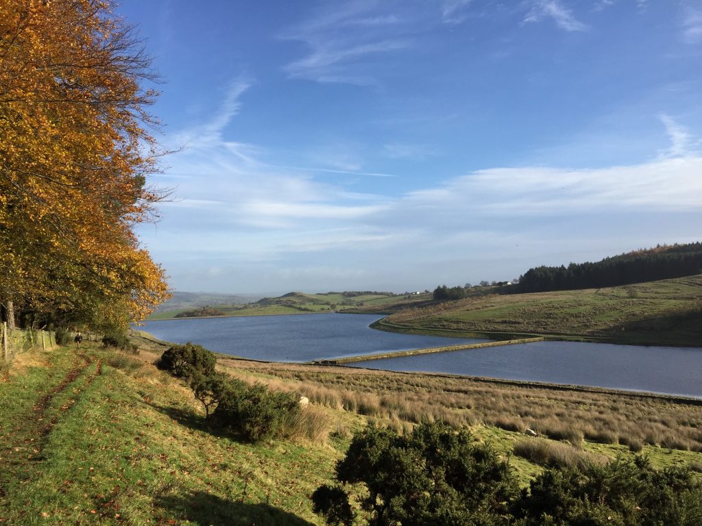
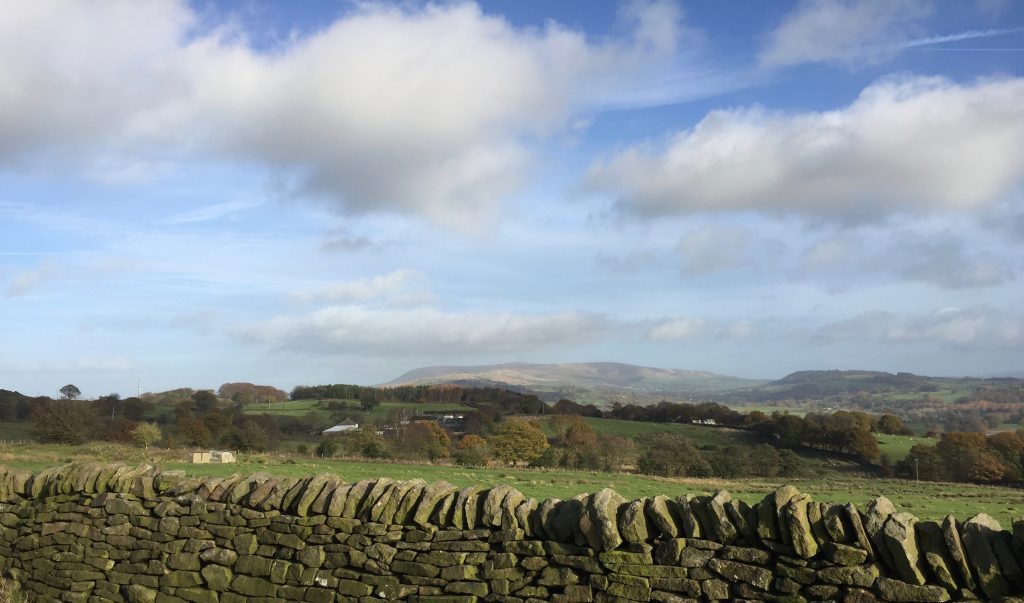
We initially head for Mellor Moor, with great views and much history. The next leg of this stage is not great as we skirt around the edge of Blackburn but soon after we start climbing along another ridge of hard sandstone with great views of Pendle Hill as it gets closer and closer. Beautiful reservoirs and then a final steep descent into Whalley and the remains of it Abbey and impressive railway viaduct.
A map of Stage 19 can be found below courtesy of Ordnance Survey maps. You can subscribe yourself using this link, https://osmaps.ordnancesurvey.co.uk, which will enable you to import the GPX file which can be downloaded below.
Download file for GPS
To download the GPX file for this Stage click on the link above.
ROUTE DESCRIPTION
Turn right and head up the hill past the many pretty cottages. Pass Mellor Methodist Church and the Traders Arms on your right. Mellor developed as an important center for handloom weaving in the 18th century in the many cottages and farmhouses in the village, and the name of the Traders Arms dates from that period when hawkers and traders would meet to discuss their business in the village inn. Much of Mellor’s past is displayed in this pub, where many old photographs of village life are displayed on the walls.
Continue and look out for Abbott Brow on your left. Turn into Abbott Brow and just after the initial bend look out for a gap in the wall and some steps, which take you around the back of a property. Pass over the stile into the field and continue straight on keeping the fence to your left. At the top is stile, which takes you through an electric fence and then you can head for the various concrete structures and the trig point, which make the top of Mellor Moor – 223 meters above sea level.
This is the site of an old Roman outpost, which overlooks the historic village of Ribchester in the valley to the north – See Stage 28. A Roman altar once found on the moor is now in the Ribchester museum, and the Ribchester-Manchester Roman Road lies just a mile to the east. However, the name of Mellor is an old Celtic name for a place on a rounded hilltop, suggesting a more ancient past and Neolithic artefacts have been found on the moor in the past. More recently it was the site of a Underground Nuclear Monitoring Post and hence the concrete structure.
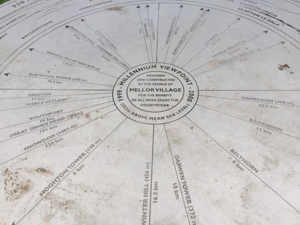
Nowadays, the moor-top is the site of the Millennium viewpoint, where on clear days fantastic views can be had of the Yorkshire Dales and West Pennine Moors, the Lake District, Furness, the whole of the Fylde coast, the Isle of Man and Snowdonia, as well as more local features such as the Bowland Fells, Ribble Valley, Pendle Hill, Blackpool Tower. Just below us to the NW is Samlesbury aerodrome, which now houses BAE Systems, which has developed the site hugely over recent years, with its large industrial sheds. The company, along with its sister site at Wharton on the Fylde coast manufacturer the Hawk and Typhoon jets and export all over the world.
From the Trig point take the stile over the electric fence and then carry straight on. Do not take the track on your right, which leads directly back to the road, as this is private land. Carry on a little further and then take the next track back to the road.
At this point I must explain the logic for my route, which simply takes the road – Mellor Lane to the Top of Ramsgreve where the Spread Eagle pub is and then continues along Higher Ramsgreve Road almost all of the way into Wilpshire. There are paths from the summit of Mellor Moor, which can take you across country via footpaths, but in my opinion this area is not especially pretty, and in wet conditions is often boggy under foot and adds time as you navigate through field and over stile. The Lancashire Trail does take such a route and of course by all means follow this and lets see if you agree with me when you have finished?
So turn left and follow the road to the summit. There is a footpath for most of the way and there are excellent views both to the north and Longridge Fell and south across to the outskirts of Blackburn. Continue straight past the Spread Eagle (or stop for a drink, rest and great views from the beer garden) and head down hill along the road.
Look out on your OS map for the line of the Roman road which heads north to the Roman fort at Ribchester. If you plot a straight line on your map you will see that this meets a cross road on the next ridge south which is called Four Lane Ends and you then follow further south it dissects the centre of Blackburn close to the Cathedral and then meets up with more stretches of straight roman roads marked on the map which make there way eventually into Manchester and what was the largest Roman centre in the NW.
After almost a km you will pass a row of cottage called Flashgate and then the road bends to the left and then to the right. Take the lane on your left at the second bend just before the road straightens. After about 50 m the road bears left but continue straight on infront of a property called Ramsgreave Hall Barn and then a short lane before crossing into an open field. Bear right and follow the boundary fence on your right down past the reservoirs. Just beyond the reservoirs you need to head away from the fence on your right and head to the left of the electricity pylon down hill in the direction of a renovated farmhouse – Jersey Farm. There is a stile at the right hand corner of the property and then turn left over the wall onto the drive of the farm. Turn right and follow the drive to the road – Knowsley Road in Wilsphire. Turn left and observe a pretty row of cottage – Daisy Terrace on your left and Primrose Terrace on your right. At the end of the latter you will see a footpath sign on the right. Turn right and follow this between various houses up the hill and then through the pedestrian tunnel underneath the railway line. Continue up the zigzag path to the main road – the A666 Whalley Road. Unfortunately we won’t be following this direct route but will make our way up the ridge on our right and then along its spine to Whalley.
Turn right. Just after a property called the Grange on the other side of the road you will see another footpath sign. Cross the road and take the steep path which heads diagonally up the hill between two properties. When you come out of the enclosed path take the path around to the right, which brings you on to a residential road. Turn left and then look to your right around the corner for the continuation of the footpath, which is clearly marked. It continues up the hill in a similar direction to that before. The path works its way between fence panels and then comes out on another residential road. Cross the road and carry straight on to the back of the residential development. take the stile into an overgrown area and follow the path to the field and then bear left and follow the boundary of the field to more houses. Cross behind the houses, which then exits onto Hollowhead Lane.
Look for the footpath sign slightly to your right on the other side of the road. Pass over the stile into the golf course. There is a tee here so please wait if golfers are present. Pass by the tee on your left and then head straight on following the many black and white square posts, which clearly mark the footpath. Initially the path heads on the right side the fairway and then veers slightly right past a green towards two small bridges. Then follow that fairway keeping some lovely conifers to your left and at the next set of conifers head slightly left so that this group is on your right. Pass the green on your right and then look out for the rough that is straight ahead, in which you should just be able to see more markers and a faint path which heads to wards a stile. Cross over the stile out of the golf course into a field.
The path is not clear so bear slightly left. Do not climb the spine of the hill but head around it in the direction of three wind turbines. Look out for a stile at the corner of a boundary fence and pass over into the next field. Continue straight on, over another stile keeping the fence to your left, which now houses newly planted trees. Another stile then takes you on to a very new stoned path, which continues in the same direction down into the farmyard of Little Snodworth. Carry straight past the farm buildings through the farmyard and then look out for the grassy lane on your right, which is signed as a footpath. Turn right follow the lane, cross the stile into a field, carry straight on and exit the field at the junction of two roads. Straight ahead across the two roads is a stile into another field. Go straight across the field in as direct a way as you can to the boundary wall opposite and you will find another stile/gate to the other side. You will see a NW Water sign advertising the reservoir ahead, which is called Dean Clough Reservoir. Turn left and follow the boundary wall towards and then along the eastern edge of a lovely wood just above the reservoir. Continue along this track in the same NE direction until you come to a gate with a wall that is parallel with the end of the reservoir.
The route can be a little messy here as there are a few footpaths. The simplest is to turn right towards the reservoir and pick up the bridleway on your left just before you get to the reservoir. This heads to a stile, which takes you into another field. Take the path which bears right up and around the contours to a gate into another field. There is a very prominent blue bridleway pointer, which encourages you to turn right but do the opposite, turn left and head towards and through the remains of a property. Take the stile over the wall into another field. Turn right and continue in a NE direction along the fence. Cross into another field and shortly afterwards the path splits. The right path makes its way to a stile in a stonewall but ignore this and take the higher track which heads towards and through a mass of gorse bushes. When you come out of the gorse there is a small wood on your right. Keep to the higher path, which gradually takes you slightly further up hill so that you pass the cottage below by some distance. Head towards another smaller thicket of gorse and when you come out of this head for the lone tree and a track and boundary wall behind the tree. Turn left and follow the boundary wall, which doglegs at one point and then continues in roughly the same direction as before.
Basically we are now heading for the end of the trees ahead so ignore the first stile on your right and continue straight on looking for the rickety stile ahead. Pass into the field ahead and than head for the stile which takes you into the woods opposite. After about 25m in the wood the path splits. The more prominent path bears left but we need to turn right almost by 90 degrees and head through the wood on an indistinct path but after a very short distance there is another stile which takes you into another small but different wood. Follow the path through this wood to the stile, which takes you out in to a field. Carry straight on and use the stile opposite to exit into Moor Lane. Before we carry on climb the stile on the other side of the road and take in the views of the Ribble Valley to the north with Longridge Fell beyond. You should also be able to see Stoneyhurst College, with its distinctive towers with Verdi gre tops, which we will visit later. Turn right and follow Moor Lane past a farm on your right and then through another one before we meet another road.
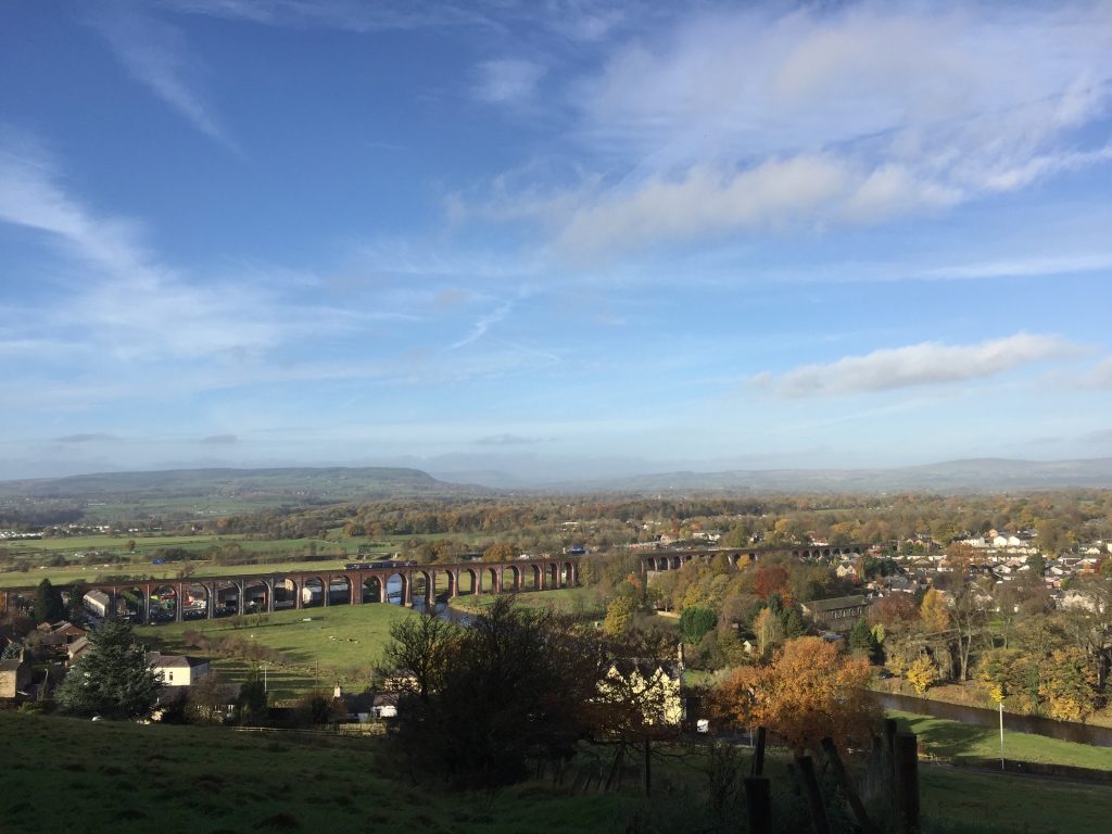
It is possible at this point to head east along footpaths and tracks to work your way around the east and northern slopes of the hill to the south of Whalley gap, where the river Calder has cut through the escarpment to make its way towards the River Ribble and then the Irish Sea. However, it is a fiddly route and by following the road down the steel hill into Whalley gives great views of the railway viaduct and the Abbey.
The railway viaduct was built between 1846 and 1850 by Terrence Wolfe Flannagan and carries the Railway from Bolton and Blackburn through to Clitheroe and up the Ribble valley to Settle where it joins the “main” line to Carlisle. It has 48 spans and carries the railway 620m over the valley of the River Calder at a height of up to 20m. It is a listed structure and was quite a fete of engineering with over seven million bricks used and considerable temporary wooden supports required to build the arches of brick. At one point two of the forty one then completed arches collapsed killing three people.
So turn left and follow the road down the steep hill until you reach Whalley Road again. Turn right and cross the bridge over the Calder into Whalley itself.
The River Calder is the second principal tributary of the Ribble and joins it just downstream from Whalley but unfortunately not accessible from our journey. It is just 15 miles long and begins near to Burnley not far from the Yorkshire Calder River and the River Irwell, which runs south to Manchester. It is thought that before the Ice Age the Calder flowed eastwards, but was diverted westwards by Ice, which occupied the Ribble valley and had to erode the “gap” in which the village of Whalley now sits.
Before we finish this stage we are going to explore Whalley a little and especially the Abbey and other buildings in that area. Unfortunately not much remains of the 14th Century Cistercian Abbey, which dates back to 1296, but you can enter the grounds (small entrance fee currently £2) which includes a conference centre and wedding venue and actually has a B&B service! After the dissolution of the Monastery in 1527 it was converted into an Elizabethan manor house.
Continue along the main street through Whalley. Look out for and turn left into Church Lane. You will see Whalley Parish Church – St Mary’s and All Saints – on your left . Follow the lane around to the left past the school and directly ahead of you is the entrance to the grounds of Whalley Abbey. You can continue left along The Sands, through the Abbey Gatehouse with its magnificent arches, and onto Ridding Lane to get a closer view of the viaduct. There are some pretty properties along the way. When you have finished exploring return to the Parish Church, which marks the end of the Stage.
END OF STAGE 19
The most obvious place to stay, if you are stopping overnight in Whalley, is the Swan Hotel, which is on King Street i.e. the main street more or less opposite Church Lane. Alternatives will require a taxi. There is the Foxfields Country House Hotel in Langho about 1.5 miles along Whalley Road in the direction of Blackburn or Mytton Fold Hotel and Golf Club just a little further on. Alternatively, a little further on again, there is Northcote Hotel if you really want to spoil yourself – Nigel Haworth, the chef, partly owns this! In the opposite direction is Mitton Hall.
Click here to go straight to Stage 20
CIRCULAR/DAY WALKS
Park at the railway station at Wilsphire at the bottom of Ramsgreave and walk Stage 19 to Whalley. Catch the train back to pick up your car experiencing the viaduct at first hand.
It is possible to walk both Stage 19 and Stage 20 from Mellor to Barley – a distance of 16 miles and then return by buses changing at Clitheroe.


