STAGE 1 – PRESTON
2 miles – a leisurely 1-2 hours walk.
187 feet climbed – highest point 102 feet – Chapel Street Preston
The start of the walk provides a brief introduction to the history of this important historic Lancashire town and in particular Avenham Park before exiting the city by following the River Ribble into its tidal estuary.
Map of Stage 1 can be found below courtesy of Ordnance Survey maps. You can subscribe yourself using this link https://osmaps.ordnancesurvey.co.uk, which will enable you to import the GPX file which can be downloaded below.
Download file for GPS
To download the GPX file for this stage click on the link above.
ROUTE DESCRIPTION
Part of the logic of starting in Preston was its excellent communications and I have assumed that you will arrive by rail at the impressive railway station. How many people in its history have alighted here or sat in transit whilst on their own particular journey and hopefully as equally fascinating as the one you are about to begin. The railway has always been important to Preston and at one point there were about five different companies all with their own track converging upon the station and some of these can still be seen when we do eventually begin our walk. The importance of the town as a railway town again relates to its position as a “portal” in the journey through England from North to South and in times gone by as a hub for transporting goods and raw materials – not only north and south but also into and out of Lancashire with the raw materials going in and the final products going out of region during the Industrial Revolution.
Before we begin our walk proper, I would like you to gain a small appreciation of the history of Preston before we begin our trek south. If you arrive on the day before you are to begin the walk, then you can always spend some of that day or the evening completing my initial ramblings through the streets and parks of the town thus enabling you to go straight to the River Ribble in the morning and stride out from there. Indeed, if you have more time, then head towards the impressive Harris Museum and ask for their “Preston History Walk” leaflet which will give you a more extensive introduction to the town and its history.
Exit the station on to Fishergate and turn right. Take the fourth right into Chapel Street. Call into the impressive St Wilfrid’s Church on the left, which was built by the Jesuits in 1792 and 1793. Chapel Street then opens out into beautiful Winckley Square. It was built around a field purchased by a William Cross in 1799 – he bought it from the daughter and heiress of a Thomas Winckley. On it, the wealthy and good of the town created a haven away from the dirt and noise of the main town centre. Unfortunately many of the original properties have been lost to modern office buildings particularly on the north side but the south side still includes many of the original houses. Preston was blighted more than most by the post war planning offensive when the old was replaced by monstrous concrete in the name of progress. Whilst continuing along the west-side look out for the Peel Monument on the opposite side of the park. This memorial statue of Sir Robert Peel MP was unveiled in 1852 shortly after his death. Over 400,000 people contributed to its cost in recognition of his work to abolish the Corn Laws which increased the price of grain imports and hence the price of bread for the working population.
Continue along the west side of the square and then leave the Square behind and continue into Ribblesdale Place where you will find the main entrance into the Avenham and Miller Parks. For those of you who explored these on your arrival yesterday proceed through the gates and follow the main Walk down underneath the Ivy Bridge along Derby Walk and then down to the Riverside Walk, which travels beneath the main Railway Bridge. For those of you who have not then please take this small detour with me to fully appreciate the Parks and the position of Preston as described above.
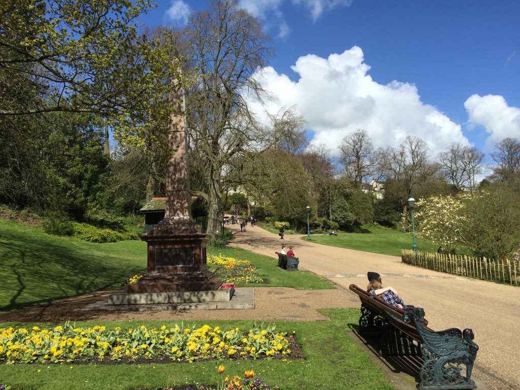
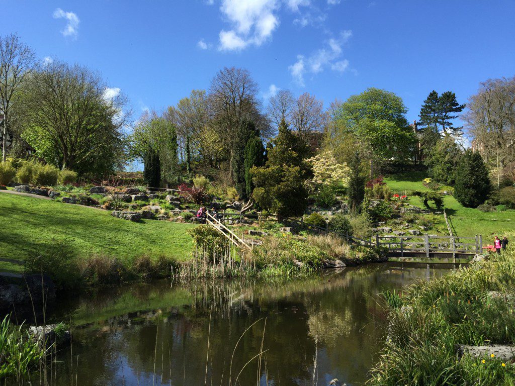
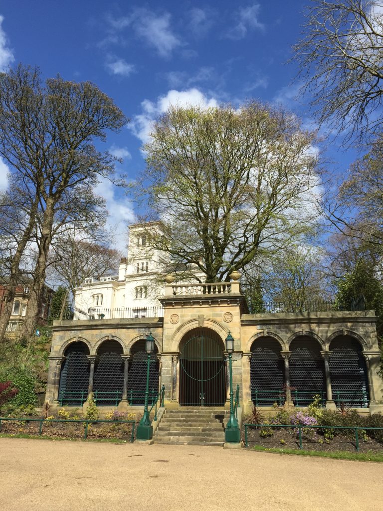
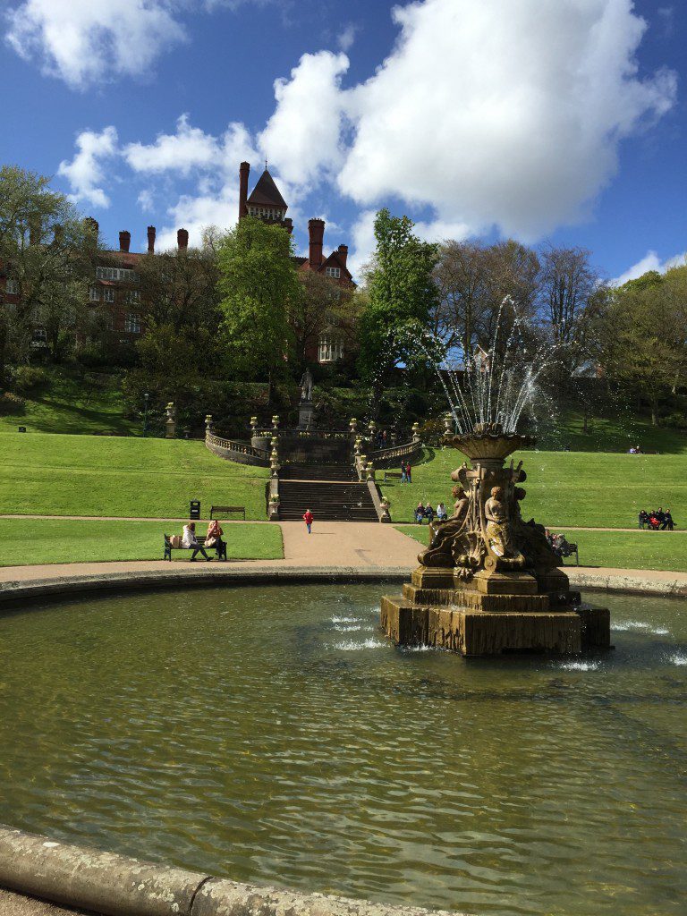
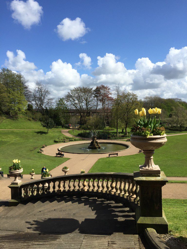
The Avenham and Miller Parks are wonderful examples of Victorian public parks. They occupy a natural amphitheatre on the southern edge of Preston town, sweeping down to the banks of the River Ribble and surrounded to the north by very pleasant historical buildings. Whilst it appears as one park there are in fact two. The first is the Avenham Park, which was started in 1846 when the local council acquired the land to create a park for local people. A local Mill owner, Thomas Miller, added further land to the west to create Miller Park, which is linked to Avenham Park through the disused railway arches and embankment, which was once occupied by the East Lancashire Railway. In the 1860s the council appointed a landscape artist, Edward Milner to enhance the two parks. The primary purpose of this was to provide temporary employment to many unemployed workers during the Cotton Famine. This period saw great unemployment when the cotton industry was depressed due to lack of supply of cotton from America caused by the American Civil War. There are many points of interest within the park including a statue of the 14th Earl of Derby, a famous family within Lancashire, which we will discover later in our travels. He was the MP of Preston until 1830 and prime minister of England three times. He remained well respected locally, particularly for his efforts to raise monies for the unemployed workers of Lancashire during the Cotton Famine. As a result the statue was partly paid for by public subscription, with each worker contributing 1d towards the total cost of some £2,500. It was completed, including the Terrace and Fountain, in 1873, four years after his death and the unveiling was attended by 40,000 people. In addition look out for the Boer War Memorial, the Belvedere, the Rock (Japanese) gardens, and the Swiss Chalet. More recently the Parks have benefited from a major restoration funded by a Heritage Lottery Bid and other organisations including the building of the new Pavilion, more or less in the centre of the two parks near to the riverbank. The park these days, besides being a haven for office workers during lunch in the summer, hosts a number of events including pop concerts and outdoor theatre.
On arriving at the end of Chapel Street turn left and walk along Ribblesdale Place ignoring the entrance to the Parks. Note the lovely buildings. After a short while the road bends to the left whilst to the right there is another terrace of houses and in front of these is the Avenham Walk – directly opposite the Harris Institute – a grand building in itself. The Walk dates back to 1696 and you can just imagine the great and the good of Preston promenading along the walk in their Sunday finery. The Walk gives you your first view of the Parks and the wonderful River Ribble, which sweeps away to the west.
Follow the Walk and at the end take the path, which turns back down into the park, and then look out for the stone building to your left – the Belvedere. Then follow the path down through the cutting in the rock down to the Tramway.
This part of the park I find fascinating as it is a relic of the Lancaster canal and a notice in front of the Belvedere will give further information. The aim was to connect Lancaster and Kendal to Preston and the coalfields of Wigan to the South so that these towns could participate fully in the Industrial revolution. In addition the expansion of Preston and its industrial base required more and more coal from the south. Transport by road was difficult and costly relative to the new canals. Prior to this coal was also brought from Wigan via the River Douglas and later a branch of the Liverpool and Leeds canal from Burscough to Tarleton, which was built in 1777 to 1781, which we will be following shortly, but this was affected by tides and river levels. The original intention had been to connect the Lancaster canal with the Leeds and Liverpool canal, which we will also visit shortly. However, the cost of building a series of locks and an aqueduct to traverse the flood plain of the Ribble and then climb back up into Preston was too costly and the plan was replaced by a tramway, which was completed in 1804. The bridge which crosses the Ribble here is unfortunately a replica of the original wooden structure and was built in the 1960’s from concrete. To the south of the river you can see the magnificent tree lined embankment along which the tramway was sited. Goods would be unloaded from the canal barges to the south of the Ribble at Walton Summit put on the tram which would make its way to the North end of the tramway, where the goods were unloaded again and then carried by horse up the steep incline and then through the town to the terminus of the Lancaster canal a few miles to the north west near to the Albert Docks further down the Ribble.
The Belvedere was originally sited where the Lord Derby statue is located now and replaced the old Steam House. The latter housed steam engines which helped pull cargo up the steep hill and apparently often failed causing loss and damage to cargo and animals. In the immediate distance is a white porticoed building, Avenham Villa, which was once the home of Edwin Booth, the founder of the local supermarket chain, Booths. With the advent of the railways in the middle of the 19th century the tramway and the canals would have been used less and less but did manage to survive until 1860 after almost sixty years of service.
Before crossing the Tramway Bridge linger a while to view the landscape. Note the flood plain of the Ribble and the steep valley sides, which have contributed to the position and development of Preston. If you look up the Ribble on a clear day you can see the hills to the north of Blackburn which hopefully you will pass over when you undertake the Northern Loop, whilst to the south east you should be able to see Winter Hill and Great Hill, which are a few days’ walk ahead. The former, in particular, with its TV masts will be a constant point of reference during the first half of our walk.
DETOUR. Unfortunately the Tramway is currently closed following safety concerns and will be so for sometime! So rather than crossing the Tramway turn right and follow the river down stream to the Pavilion.
ORIGINAL ROUTE – IGNORE. Cross the tramway to the other side of the river and then descend to the Riverside walk and head downstream to the next bridge, which is the East Lancashire Viaduct and separates the two Parks. This was built in 1850 and took the line on to Blackburn, East Lancashire and beyond. Take the path on your left immediately before the bridge, which takes you up to the top of the embankment. Then cross back over the river to the Parks. This higher bridge gives a great view of the Parks and many of its landmarks such of the terracing by the Derby statue and the pavilion.
Overlooking the western side of the park is the imposing red-bricked Park Hotel, which now houses part of Lancashire Council. Apart from its magnificent views over the park, the Ribble valley and beyond, just behind it and out of view is the Railway station, which in times of slower travel fed the hotel with many travellers including Queen Victoria. Apparently both are connected by an underground passage, enabling luggage of its esteemed visitors to be transferred quickly and securely. Next to the Park Hotel is modern concrete building, which again typifies the previous planners’ disregard for the heritage and beauty of the town.
Immediately after crossing the bridge take the steps to your right back down to the banks of the river.
PICKING UP THE ROUTE AGAIN – ignore the above directions after the word DETOUR.
At the bottom, opposite you, is the new Pavilion, a play area and toilets. Make your way behind the Pavilion and then towards the Japanese gardens, which occupy the hillside on your left. You can cut through the gardens but do make sure that you do not miss the Swiss Chalet and the Cenotaph, which are close to the main entrance to the park at the very top of the hill. There is an information board by the Chalet. Follow the main walk away from the entrance, under the Ivy Bridge to the Derby Walk. Look out for Lord Derby’s statue and the fountain to your left.
Continue to make your way west back to river and then exit the park. Turn right and go underneath the third bridge over this short stretch of the Ribble – the North Union Bridge, which marks the western end of the Park and carries the main West Coast railway line across the Ribble.
Beware of cyclists as you are now following part of the “Guild Wheel” – a 20 mile circular cycle route around Preston.
Continue along the road (Riverside) on the northern bank of the Ribble, following its course downstream. Before long you will come across the remains of another railway bridge – the West Lancashire Railway Ribble bridge, completed in 1882, consisting of six piers made from Sandstone from Longridge (Later!?), between which were five iron spans carrying the track. The railway was taken over by various competitors in its time and was eventually closed in 1965, when its own terminus on Fishergate Hill was also closed and demolished.
The Stage ends at the original Listed Old Penwortham bridge, which is just after the remains of the railway bridge. It is an old “pack horse” bridge spanning the Ribble, which dates back to the 16th century but was rebuilt in about 1759. Below it are some rocks (red Triassic sandstones) and presumably the site of an old ford to cross the river when the river levels were low and the tide out. The presence of bed rock in the flood plain of the Ribble and its existence not much below the surface of the docks, when excavated, have led some geographers and geologists to assume that the course of River Ribble was once to the north of Preston and now submerged below glacial deposits. More of this later!
I hope that our brief detour around the parks was worth it for both its beauty and historical interest. And now for the walk proper!
END OF STAGE 1
Preston has an abundance of accommodation options. This stage is short so no refreshments or provisions will be needed. However, if combining with subsequent stages consider buying provisions in Preston. There is currently a Tesco Express on Fishergate just after you turn into Chapel Street.
Click here to go directly to Stage 2
CIRCULAR/DAY WALKS
This short stage around Avenue and Miller Parks in Preston is an ideal short walk where you can retrace your steps at the end of the Stage back through the parks or along the River Ribble.

