STAGE 17 – PRESTON TO RILEY GREEN
10.5 miles – 4 hours walk.
1,050 feet climbed – highest point 572 feet – Hoghton Towers
This is the first leg of the Central Loop, with a slow start as we make our way out of Preston. But the scenery improves and ends with a walk up the drive to the impressive and historical Hoghton Towers.
A map of Stage 17 can be found below courtesy of Ordnance Survey maps. You can subscribe yourself using this link, https://osmaps.ordnancesurvey.co.uk, which will enable you to import the GPX file which can be downloaded below.
Download file for GPS
To download the GPX file for this Stage click on the link above.
For those of you who have not yet completed the Southern Loop it would be good to read through Stage 1 and the history of Avenham and Miller Parks and possibly start Stage 17 by undertaking Stage 1 if you feel you have the time and may never come back this way! I have tried not to repeat any of the information regarding the points of interest so again it will be worth familiarising yourself with this, even if you do not fully explore the Parks.
Exit Preston railway station on to Fishergate and turn right. Note the great Victorian buildings on Fishergate – the main road through Preston. Take the fourth right into Chapel Street. Pop into St Wilfrid’s Church – beautiful! Continue along passing through Winkley Square. At the end of Chapel Street ignore the entrance to Avenham Park and turn left into Ribblesdale Avenue and continue along.
Pass the Harris Institute on your left – this Grade II listed building dates back to 1849, when it was built to house the first Arts school within the town. Unfortunately it is now empty and has been for sale for some time now.
Turn right through the green bollards into Upper Avenham Walk, which predates the two Parks. It was built in the late 17th century and was acquired by the town of Preston in 1697 for £15. Descend the first set of steps at the end of the Upper Walk. These were built much later in around 1861 when the Walk was incorporated into Avenham Park, which can be seen to your right hugging the land which runs down to the River Ribble below.
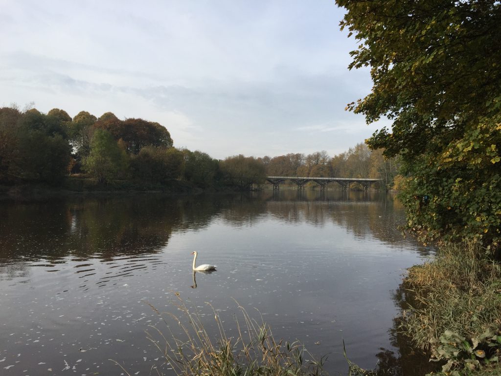
On the left is Avenham Villa, an imposing white house built in an Italian style. Descend another set of steps and look out for the two replica cannons from the Battle of Sebastopol – the Crimean war of 1850ish. Descend the final set of steps and then take the broad tarmacked path to your left, which follows the River Ribble upstream. Note the replica Tramway Bridge to the right, which we would have passed over as we completed the Southern Loop before it was closed.
Follow the river upstream – the path is accompanied by beautiful mature trees on either side. Beware though as this path is shared with the Guild Wheel – a 20 mile bike ride around Preston. Before long we reach houses on the “Boulevard” but continue to follow the path by the river. If you look at the water sometimes you may feel that the water is flowing inland/upstream – and you will be correct as the tide does reach this far inland at high tide.
After about 700m we reach Walton Bridge, which crosses the Ribble and is one of the oldest entries into Preston. The road is the A6 – or London Road – and is the direct route from the south. Climb up to the road, cross over and then head right in a SE direction along the main road. You will see the Capitol Centre Retail Park on your right, which occupies a site that is surrounded on three sides by rivers – the Ribble and the Darwen. This area is known as Walton-le Dale and was a major Roman settlement and more specifically a centre of industry for the Romans. It would certainly be easily defended and would have been a point at which the Ribble was crossed.
Continue along the main road keeping the river just to your left. At the White Bull pub, turn left and climb the hill to the top of the riverbank, with the Ribble now many feet below us to our left. Note St Leonard’s Church, with parts of it dating back to Norman times.
Continue along this road (the B6230), which has good views of the Ribble and its flood plain to the left. The road is initially paved but thereafter has a good grass verge in most places allowing you to step to one side to avoid oncoming traffic. After about a km you reach the M6 – but just before this there is a footpath, which we will not take, but it leads down to the bottom of the Ribble valley at Cuerdale Hall, which is where the Cuerdale Hoard was found in 1840 – a huge hoard of 8,600 pieces of Viking Age gold and silver artefacts, including both jewellery and ingots – which is now housed in the British Museum.
Cross over the M6 and look out for a footpath sign on your right with a gate and track. Follow the track and then cross over the stile on the left of a gate into the fields and then traverse diagonally across two fields via well signposted stiles. On exiting the last field you enter into a lane, which accesses a well-fortified “gas station”. Turn left and follow the lane to a tamacked lane – Potter Lane. Turn right and follow this for about 600m. At the bottom of a small incline the lane splits into two. Take the left hand track by the side of the property marked as Carver Fold on the OS maps. When you reach the river (the Darwen, which we will come across quite a lot over the next two stages) do not cross the new bridge but take the footpath on your left, which follows the river upstream. By a weir, the footpath departs from the river and crosses a stile into a field. Continue straight ahead towards a muddy-hedged lane, which is just to the right of some farm buildings. Take the lane, which passes to the right of a large barn and then rejoins the river. Keep the river immediately to your right and then pass into another field. The path is not very distinct but hugs the riverbank. After 200m the way along the riverbank is blocked by trees, which shield some cottages. Bear left around the trees and look out for the stile at the corner of the back yard of the first of the cottages. This takes you over into a drive, which backs on to the yards of the cottages with garages behind. Follow the drive to the main road at Roach Bridge.
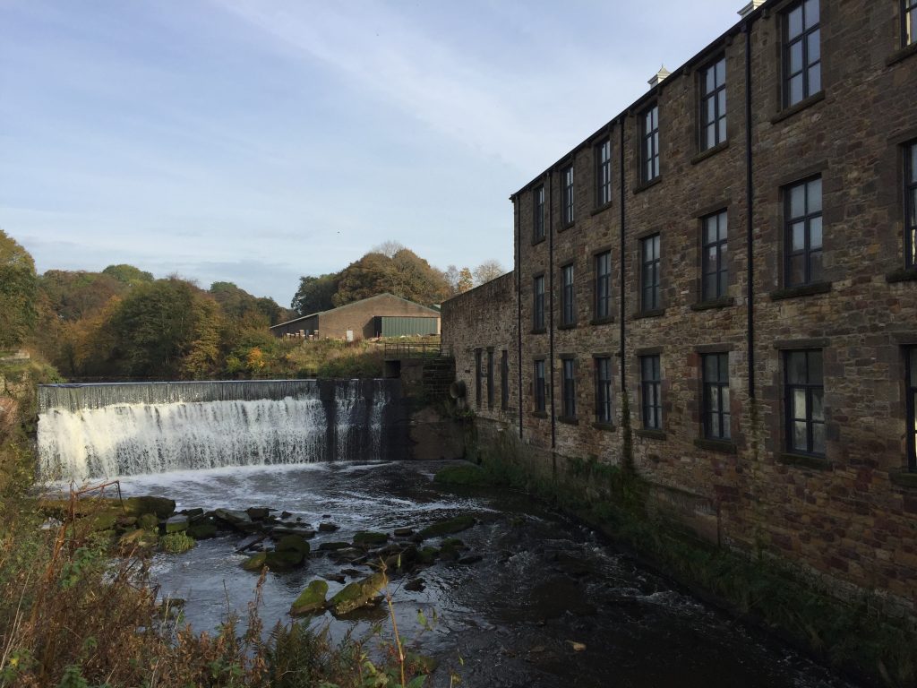
Roach Bridge is the site of what was once a large printing and paper mill. I believe that it is owned by the sculptor and artist, Charles Haddock. The mill belonged to his wife’s family and it still operates today from the far side of the site. It now produces specialized luxury tissue paper for the likes of Fortnum and Mason. The original mill by the river is now empty but the family have ambitious plans to renovate the site and include an exhibition area. By the mill is a weir, which is thought to date back to 1770 but still provides hydroelectric power to the mill.
Turn right, crossing the bridge over the river, past the mill, a small mill cottage and the entrance to the trading estate and the new mill. Then look out for a Bridleway sign on your left. Take this and after 50m or so bear right and look for the small metal gate. Do not be tempted to carry straight on. The gate takes you into a field. Follow the line of a ditch and trees – keeping these on your right. This then becomes a muddy track and takes you to Cardwell’s Farm. The track then becomes a tarmac road known as Green Lane. Follow this for almost a mile to a T-junction just above the hamlet of Samlesbury Bottoms.
Turn left and descend the steep hill. Before reaching the bottom look out for a gate and footpath sign on your right where the road bends to the left. Cross over the stile and turn left and follow the grassy track down the hill to the River Darwen, which is marked by a weir at this point. Follow the remains of the track along the river bank upstream. Just before the river bends to the right look, and although the way forward looks to be blocked, you will find a metal gate stile and footpath sign to your right. Cross the stile and follow the short path to a track. Turn right and follow the track up the hill away from the river. The track is steep and then bears left and then follows the boundary of a wooded area to your left. Continue bending around the Wood (Wild Bottom’s Wood!) and then follow the track across the field towards farm buildings known as Bolton Hall. If you look closely you can see the flag pole on the top of Houghton Tower directly ahead. On approaching the property cross through the gate on your right and circumvent the property. Then join the lane that accesses the buildings. Before long you will be confronted by an enormous metal gate that appears, from a distance, to block one’s progress. However, there is a gap to the left, which allows you to continue along the lane.
There are great views along this road particularly towards Darwen Tower slightly to your left in the distance – see Stage 14. After about 0.5km the track ends at main road opposite a terrace of cottages on Long Barn Row.
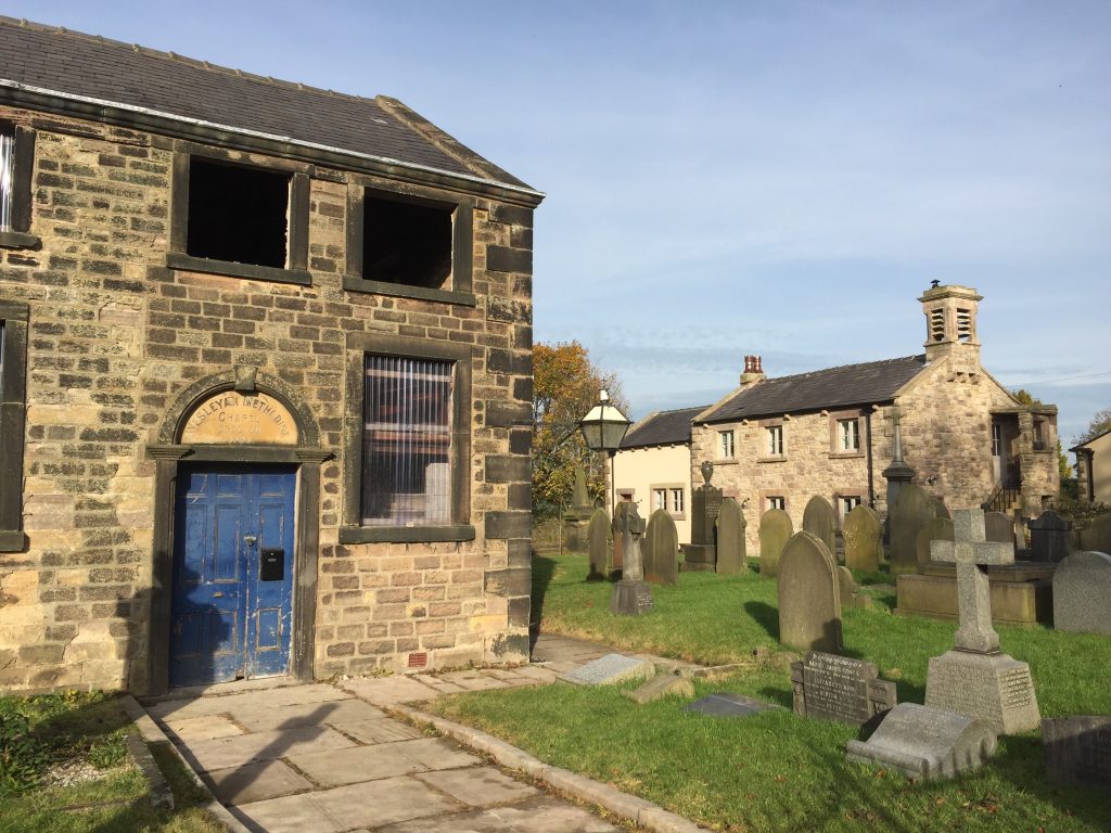
Turn right pass the cottages and the remains of a Chapel with a small graveyard. This is the oldest Wesleyan chapel in the North-West of England and was built in 1794 from local stone from the Tower quarry, and houses the pulpit taken from Clayton St Chapel in Blackburn, from which John Wesley preached during one of his visits to Blackburn.
Pass over the railway bridge and take the path immediately on your left at the end of the bridge. The path follows the line of the railway and then enters a wood. On entering the wood take the path to the right, which heads to a substantial wall. This is the perimeter wall of Hoghton Tower, which sits high on the rocky hill above. Take one last look at the railway, as we will see this again shortly in a very spectacular setting.
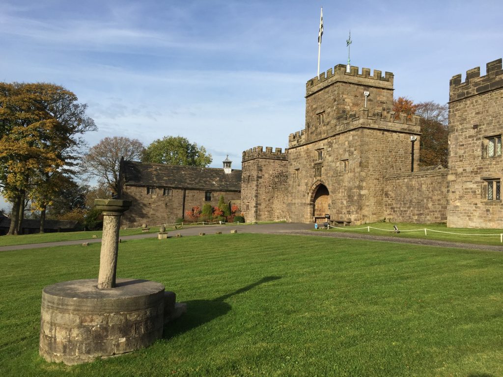
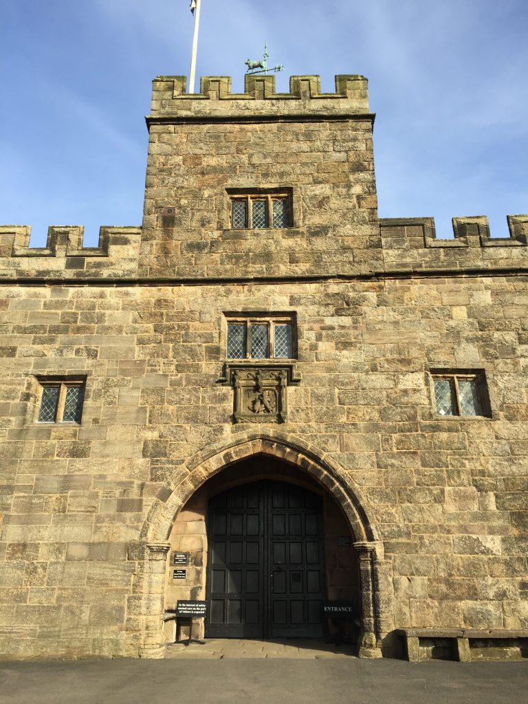
Turn right and follow the wall, out of the wood into a field. There are some good views ahead back to Preston. Continue along the edge of the wall, which eventually joins a small lane, which is flanked by various cottages belonging to Hoghton Tower. Continue until you meet the main drive up to the Tower, which can be seen in the distance at the top of the hill. Whilst the route continues straight across the drive, our route takes a detour up the drive to Hoghton Tower. Access to the building can be gained on Thursdays through to Sundays in the months of April to September but please check the website to confirm this. There is a cafe with toilets inside making it a great stop-off for refreshments. Even if you arrive when closed, it is certainly impressive close-up from the outside and there is also the Great Barn next door, which dates from 1692. There are also excellent views to the right across to Darwen Tower again – Stage 14 of the Southern Loop.
The official website of the Tower is www.hoghtontower.co.uk which gives more information, but below is a compilation of its history.
Hoghton Tower, a Grade I listed building, is the ancestral home of the de Hoghton family. The de Hoghtons are descended directly from Harvey de Walter, one of the companions of William the Conqueror, and through the female line from Lady Godiva of Coventry, wife of Leofric, Earl of Mercia.
The ancient, fortified, hilltop manor house occupies a commanding position, 650ft above sea level. The Tower lies mid-way between Preston and Blackburn, with magnificent views of Lancashire, the Lake District and North Wales. Hoghton Tower is the only true baronial hall in Lancashire.
The site was first occupied in 1109 but was re-created in 1565 by Thomas Hoghton. However, Thomas, who was a Catholic, stayed in it for only four years before fleeing to the Low Countries, where he died. Thomas’ nephew Richard enjoyed rather more politically correct views, and earned the favour of James I, who visited Hoghton in 1617. Sir Richard, who was hoping to convince the king to relieve him of his money-losing alum mines, laid out the red carpet for James’ visit – literally. Red carpeting was laid for the entire length of the half-mile avenue leading to the house! The King must have been impressed by the lavish welcome, and the feasting, which followed, as he did indeed buy the mines. An amusing but unsubstantiated tale has it that at the feast in the banqueting hall given in James’ honour, the King was so moved by the excellent loin of beef he was served that he took his sword and knighted it “Sir Loin”, giving us the term ‘sirloin’. Richard’s good fortune did not last long; only a few years later he was imprisoned in Fleet Prison for debt.
Richard’s son, Gilbert, fought for Charles I in the Civil War, though Gilbert’s own son (named Richard, like his grandfather), chose the Roundhead cause, and Hoghton Tower was besieged by Parliamentary troops in 1643. Eventually the defenders capitulated, but when the Roundheads entered the house the powder magazine, in the tower between the two courtyards, exploded with terrifying force, killing over 100 Parliamentary men. The tower was never rebuilt.
Following in Richard Hoghton’s footsteps, succeeding generations of Hoghtons were fervent Presbyterian Dissenters, and the banqueting hall was often used as a Dissenting chapel (quite a change from the gaiety of entertaining the royal court). Later generations of Hoghtons took a strong interest in parish affairs, and moved away from Hoghton Tower to be closer to the political action. Without them the house fell into disuse, and when Charles Dickens visited it in 1854 he found it in a depressing state of disrepair. The mood of the place prompted Dickens to write a story “George Silverman’s Explanation”, in which the house features prominently.
Shortly afterwards in 1862 the 9th Baronet inherited the estate and decided to restore the house. Work continued after is death and eventually in 1880 his brother the 10th Baronet took up residency. Further work was undertaken and the site is still the home of the family.
Over the centuries many royal guests have been welcomed and entertained here including James I, William III, George V & Queen Mary, and Prince Philip, Duke of Edinburgh. Other distinguished visitors include William Shakespeare in 1580 or so legend says, and JMW Turner.
More recently, the creation of the Hoghton Tower Preservation Trust has established the house as a destination for culture, education and entertainment, whilst ensuring that the fabric of this historic treasure is preserved for future generations.
When you have climbed to the top of the drive you must turn around and descend back to the cottages at the bottom. It is an impressive drive!! But no red carpet for us!
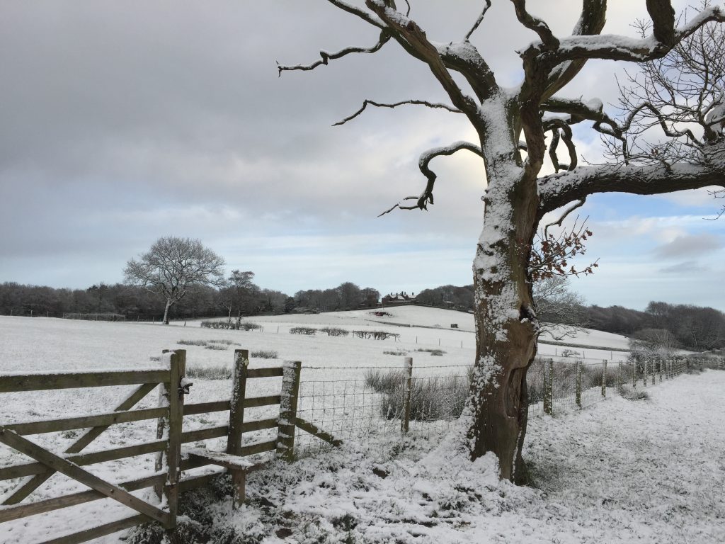
Turn left and enter the field and follow the track up the slope into and then out of a small wood. When exiting the wood carry straight on across the field directly ahead to a stile next to a gate and a very dead but haunting tree.
There are great views when descending down into Riley Green, with Darwen Moor and its Tower directly ahead, Winter Hill slightly to the right and the town of Blackburn lying in the valley to the left. Looking back you get another view of Hoghton Tower.
Continue straight ahead to Green Lane Farm. Join the lane and continue to the Royal Oak pub at Riley Green, which marks the end of the first Stage of the Central Loop.
END OF STAGE 17
There are buses here which run to Preston and Blackburn, both of which offer overnight accommodation. In addition if you follow the road opposite (A675) for a few 100 metres, you will find the Grill and Grain Inn/Boatyard Inn on the Leeds Liverpool canal, which offers rooms and food. NB Update – this may be closed due to a fire in the Spring of 2017 – please check in advance.
Click here to go straight to Stage 18
CIRCULAR/DAY WALKS
Park in the car park above Preston Bus Station. Walk the entire Stage. Catch a bus back to Preston from Riley Green – Bus Service 152 every 30 minutes. The bus stop is just a short walk from the Royal Oak pub in the direction of Preston. Total distance is 10.5 miles.
Alternatively continue and walk the first part of Stage 18 to Pleasington and catch the train back into Preston. Total distance is 14 miles.
Finally you can walk both Stage 17 and 18 in their entirety and then catch a bus back to Preston from Mellor. You have to walk either down to the Fielden Arms in Mellor Brook or back to the main road to catch a bus.

