STAGE 18 – RILEY GREEN to MELLOR
9 miles – 3.5 hours walk.
1,118 feet climbed – highest point 693 feet – near Billinge Hill
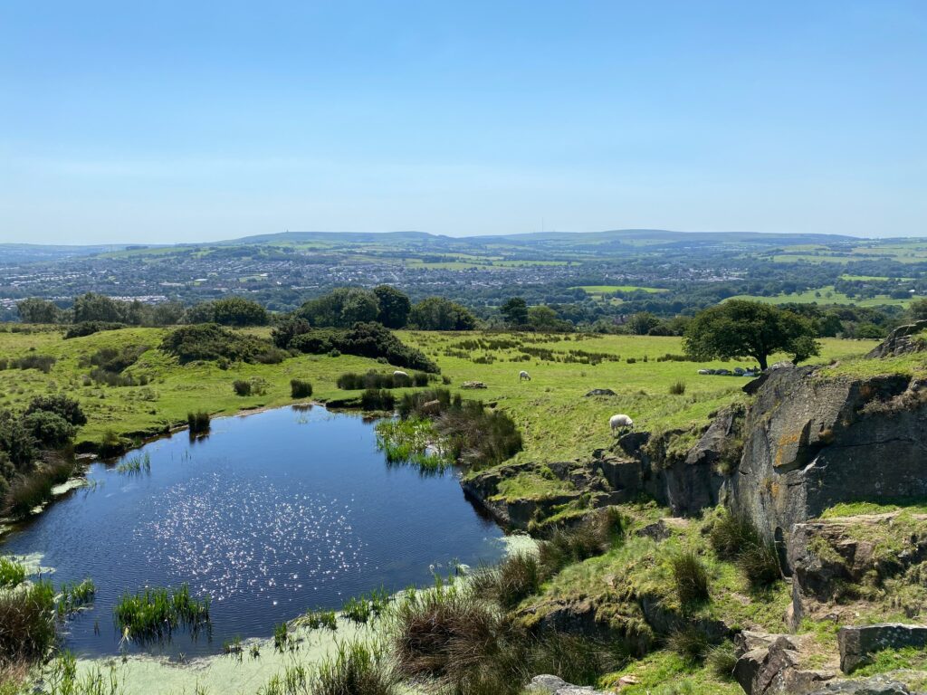
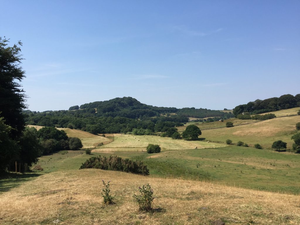
A spectacular and unexpected walk through a gorge created by the River Darwen at the end of the last Ice Age followed by great views from the ridge which becomes Billinge Hill. A little history as we pass Woodfold Park and Stanley House before finishing in the village of Mellor.
A map of Stage 18 can be found below courtesy of Ordnance Survey maps. You can subscribe yourself using this link, https://osmaps.ordnancesurvey.co.uk, which will enable you to import the GPX file which can be downloaded below.
Download file for GPS
To download the GPX file for this Stage click on the link above.
ROUTE DESCRIPTION
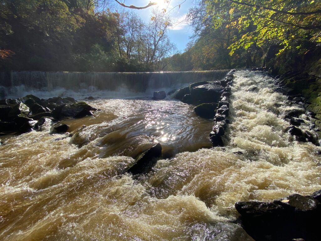
From the Royal Oak, turn left along the A6061. After about 300 meters take a track on your left, which is almost directly opposite a red bricked house on the other side of the road. Follow the track in an approximate northerly direction until it turns sharply left towards a hidden property. At this point go straight ahead through the gate and pick up another track, which runs down to the bottom of the valley in which the River Darwen runs. Find the path that runs downstream alongside the river and continue down the valley. Initially the river is quiet and sits in a flat valley but before long, we enter a steep sided gorge, with the river flowing fast, where it has cut through thick sandstones which form the hills on which Hoghton Tower stands and King’s Hill on the other side of the river.
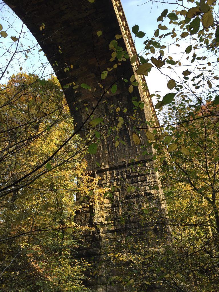
Then just as unexpectedly we reach a huge viaduct, which carries the railway high above us over the valley.
The railway line links Blackburn and Preston. Its construction started in August 1844 and was completed in June 1846 at a cost of £70,000. Hoghton viaduct retains the record of the tallest in England – it has three semicircular spans of 65 feet built out of local sandstone and the track is about 116 feet above the river bed. During the summer of 1924 some 200 trains passed along the line on one day. A 3rd class return from Blackburn to Preston cost just 1s 6d then!
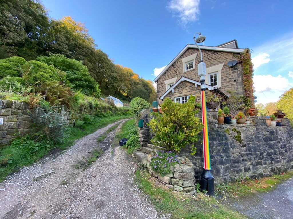
We then exit the gorge and come across houses and cottages in the valley which opens up before us.
Look out for the information point, which gives a brief but fascinating geological explanation of the gorges and the course of the River Darwen.
The river Darwen powered two mills by water-wheel and yarn was produced for the weavers working from their pretty cottages in Chapel Lane. The mills originally operated as cotton spinning mills, then were later used as weaving sheds, only closing down in 1971. Weaving was not the earliest industry in Hoghton, Alum Scar, Alum Wood and Alum House being reminders that the de Hoghton family had an alum mine, on licence from the King. The Tower quarry and the Duxon Hill quarry provided stone for buildings and local houses and roads; both quarries are now closed.
Continue along the road. When you come to the junction of another road just by Hoghton Hall turn right onto Valley Road and descend to another part of Hoghton Bottoms. At the end of a row of cottages continue to Bridge End Cottage and find the footbridge back over the River Darwen.
At this point you have a decision. The main Way takes a 4.25 mile detour through Pleasington and up to Billinge Hill, which should take just under 2 hours but if it is getting late and you don’t have time then continue as below to Close Farm.
QUICK ROUTE.
On the other side continue straight on through the gap in the wall next to the gate, which is signed Lower End Farm. Pass the empty farm and then pick up the small track, which runs north from around the far side of the building. We pick up the river again but then start to climb up the side of the valley edge away from the river. The path is largely distinct but always keep the fence to your left and do not be tempted by various tracks, which head away from the fence up the hill. After a short climb the fence turns 90 degrees right next to a padlocked gate. Follow the fence again in its new direction – there are numerous footpath signs here. Keeping the fence to your left carry on up the hill and then down into a small valley with a stream in it. On the opposite side are some stone steps. Climb these and then follow the path to the substantial stoned castellated wall. Pass through the wall by the gate into the field and then head straight on towards the roof and chimneys of a building, marked as Close Farm on the OS map. From this point pick up the main route again below.
MAIN WALK.
After crossing the footbridge turn right and follow the bank of the River Darwen back upstream. At the first bend in the river there is a lane, which makes its way away from the river up the side of the hill to Higher Park Farm. Ignore this and pass through the gate on your right and continue along the riverbank. After around 200m you will come to a track, which once crossed the river via a bridge but this is no longer here. The OS map actually shows a concessionary way which the Walk could have taken but for the lack of a bridge!
Turn left and follow the track to a stone wall behind which is one of most spectacular golf holes I know of – part of Pleasington Golf course. Before long a gap in the wall with a stile marked by the Witton Weavers footpath sign takes you over the wall into the golf course. Look back down the fairway to the green with the backdrop of some of the properties at Hoghton Bottoms and the huge hill on which Hoghton Tower is sited.
The path continues along the boundary wall through a small wood and eventually enters a field via a stile. Ahead of you is a Conduit, which I believe carries water across the valley. The valley, which is much too large for the small brook, which sits in the bottom is probably the original course of the River Darwen before it was diverted on its new course, which we have just seen. Keep looking behind for great views back to Hoghton.
Continue straight on which takes you along a fence climbing past a small group of trees and then eventually you cross over a stile by a large house with a thatched roof. Continue straight on along the lane to this house, which then enters a small modern housing development called Priory Close. Bear right and you exit onto the main road through Pleasington with the Butler Arms to your right.
Pleasington is a lovely village and dates back to the Anglo Saxon times and was known as Plesigtune in the Doomsday book – the place of Plessa!
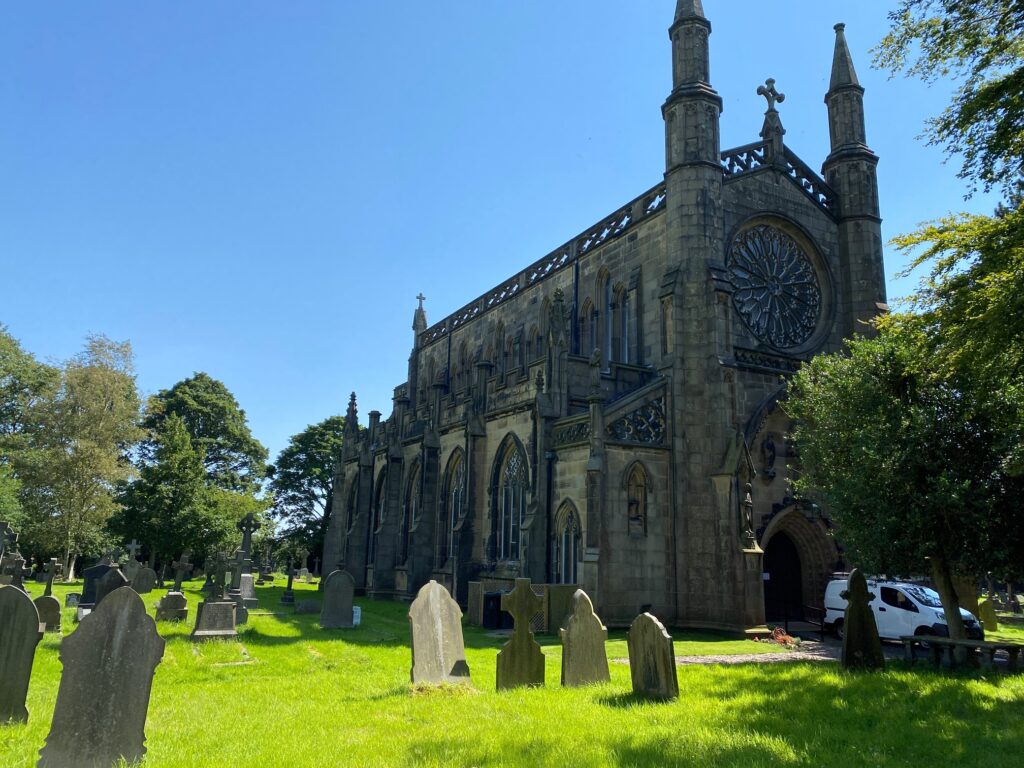
We are going to cross the road and carry straight on but first take a short detour to the left to look at Pleasington Priory – a Roman Catholic church.
The front facia of the Priory is quite beautiful with a spectacular large rose window. The design of the West doorway was copied from that of the chapter house at Whalley Abbey. Some observers have compared the Priory to chapels at Oxford and Cambridge universities.
Look out for the statue of John Butler in military uniform who provided funds between 1816 and 1819 totalling £23,000, to allow the Priory to be built. It is a Grade 1 listed building. Inside apparently are the remains of a Roman martyr, St Publianus, collected by John on his travels to Rome. Just beyond the Priory is the Lodge to Pleasington Hall, the house of John Butler. Unfortunately it no longer exists as it was demolished at the beginning of the 20th century when acquired by the local council as part of the nearby cemetery. The original Old Hall does still exits and dates back to 1587 and was built by the De Hoghtons.
Return along the road and take the road opposite to where we exited from Priory Close – Regents Close. Follow the boundary with the graveyard and then pick up the path, which is straight ahead. This then picks up a good stoned path which heads through a field and is fenced on either side of the path. The path enters a small wood and then exits by a football pitch. The OS Map suggests that the Witton Weavers Way goes straight across the pitch but I suggest that you turn left and pick up Tower Road.
To the left is the entrance to Pleasington Crematorium but we need to turn right and follow the road to the two bridges, which cross over the River Darwen. Cross the bridge which carries the road and then turn left and pass through the gap in the fence. Go around the cricket pitch and head for the footbridge. Use this to cross the River Darwen and then turn right and continue to the end of the last football pitch. Take the path through the undergrowth behind the pitch. Ignore the path that joins from the left but descend a short set of steps to a new metal kissing gate. Take the path on your left through the field which heads towards a wood. Enter the wood via another metal kissing gate and turn left and follow the path up through the wood alongside a stream to your right. After a short distance the path turns right and crosses over the stream via a crooked footbridge – more a series of sloping planks – beware in wet weather. Immediately after crossing, turn left and follow the path which makes its way up the hill through a small strip of woodland. Pass through the two gates on either side of the lane to Lower Fold Farm and continue as before through the strip of woodland, which begins to bend around to the right. After a view hundred metres this path meets a small road by the side of a property called Billinge Nook.
Just to your right in the wall opposite is a “tunnel” through the wall into Billinge Wood. You can make a detour to the top of the hill/wood but beware there are many paths in the wood and it is easy to get lost. There is a viewpoint marked on the OS map but it is largely overgrown and the views are largely concealed by young trees.
Follow the path and after about 100 metres turn left at a crossroad of paths. Follow this path, which keeps close to the western edge of the Wood, ignoring two paths which head off to the right, until you enter an old disused car park. Turn left and come out of the woods and enter into the adjacent field. There are excellent views here especially to the north with the Bowland Fells and Longridge Fell. Also try to spot the large golden building in the valley to the north which is Woodford Hall, of which more later.
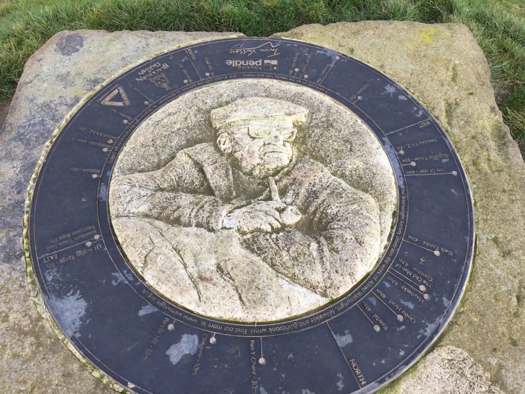
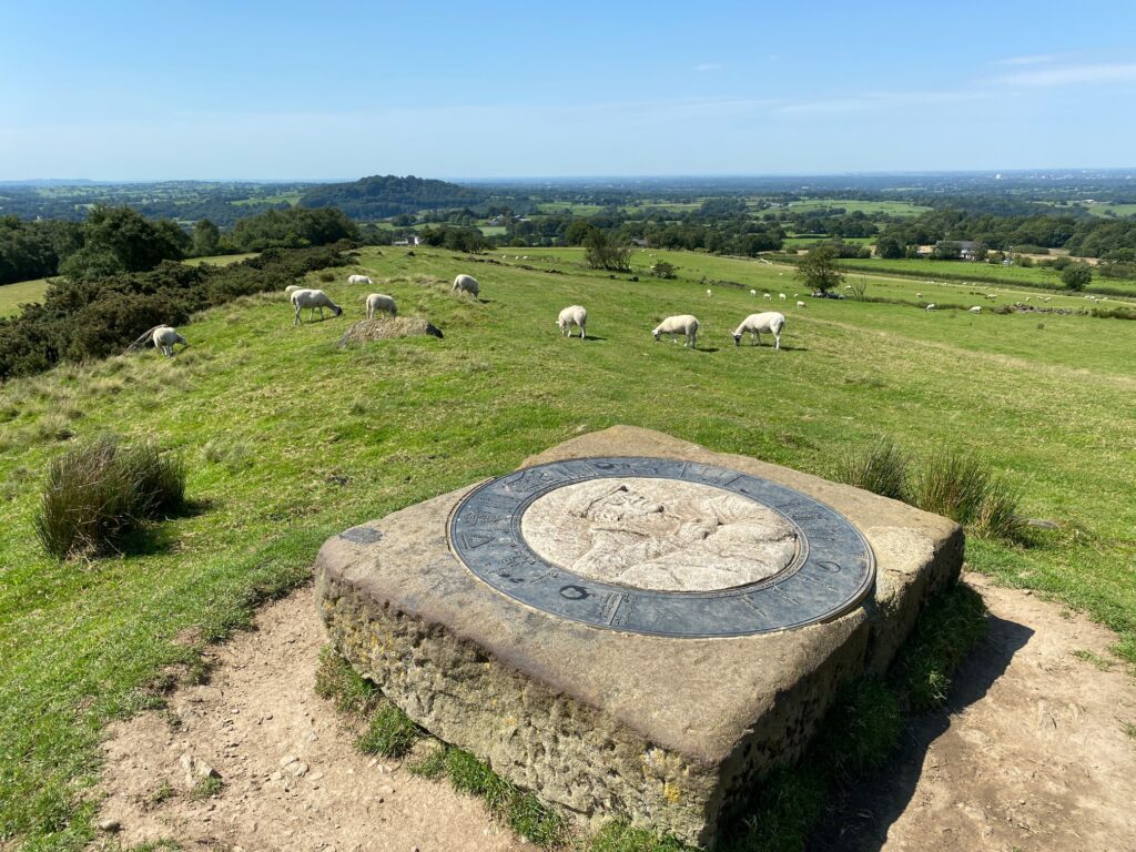
Head straight across the field in a WSW direction. Use the stile to pass into another field and then continue straight ahead climbing up a small hill. At the top there is a quarry to your left and this stretch has great views both south and north. Just beyond this look out for the viewpoint, which features a 3D image of Alfred Wainwright’s face in the centre. Please pay homage to Mr Wainwright, who was born and lived in Blackburn and worked for the local council before he gained promotion and moved to Kendal!!
Continue straight on down the other side of the small hill. Cross over a stile into another field and then use another stile just further on to enter some woods. After around 50m the path ends at a track. Turn left and then find the footpath on the opposite side of the track which enters the woods again. After about 50m take the less distinct path to your right and cross the stile into the field. Head straight across, keeping a line of old trees to your right. Pass through the gate and then continue straight on with the hedge about 15m to your right. Use the stile next to the gate to cross over onto a distinct track which then becomes the drive to Maiden House Farm. Continue straight on to the main road.
Cross over the road and pass through the gate directly opposite. Keep the hedge to your right and look out for a footpath sign just before Close Farm, which takes you through the hedge and around the side of the farm. Use the stile to pass over into the lane by the gates at the front of Close Farm.
Our 4 mile detour has ended and we can now continue as before.
From Close Farm turn right along the lane with the wall enclosing a large house called Alum Scar on your left. If you remember the Hoghton family had alum mines and this must be a vestige of the industry. Take the next left which is a drive to gates of the property of Alum Scar. However, just to the right of these is a gate, which allows access to a stoned wall lane. Follow the lane down into the valley bottom through Alum House Wood. At the bottom there is a substantial stone bridge, which takes you over Arley Brook. The bridge seems rather grand in this situation but it is associated with Woodfold Hall and the Park, which we will see shortly.
Follow the lane up and around the hill coming out of the woods. Shortly there is a gate, which allows access to a tarmac lane. Continue straight on until you reach the next farm on your left with the mobile telephone mast. Look for the footpath sign on your right and cross the stile into the field. [NB There are sometimes crops in this field so you may have to follow the edge of the field or alternatively continue along the road and then turn right at the T junction, which is Further Lane – see below.] The path is not distinct but makes its way diagonally through the field towards seven trees, which mark the boundary with the next field. The stile and gate to cross into the next field is just to the left of the last tree on the right. The path then heads along the side of the field hugging the wall that marks the boundary to Woodfold Hall. Ultimately the path passes to the right of some properties, which are at the top of the field on Further Lane.
There are views towards Woodfold Hall – as you cross the fields here. Unfortunately it looks quite modern these days but has a fascinating history.
Of all the grand houses in Blackburn’s affluent west end, Woodfold Hall was apparently the grandest, with over 20 rooms on the ground floor and a brewery and dairy in the grounds. Set in 400 acres of land it was surrounded by a 9 feet high wall, which was 4 miles long and although now in disrepair in some places, we will follow this wall for some time. It was built in 1798 for the cotton magnate Henry Sudell. It sounds as if Henry was quite a character. He travelled into Blackburn in a grand coach-and-four with uniformed postillions but he supported many of his fellow townsmen in lean times. He roasted an ox in the old market place every Christmas, founded St John’s church in Blackburn and St Mary’s in Mellor and helped recruitment to the Lancashire Fencibles.
When 6,000 handloom weavers marched on Woodfold from Blakey Moor in 1818, Henry acceded to their demand for a five per cent advance and even when his high living caught up with him in 1827, he left his butler with enough money to establish himself at the Fox and Grapes pub in Preston New Road.
Unfortunately he became spectacularly bankrupt in 1827. The Hall then became the home of John Fowden Hindle, High Sheriff of the County, before eventually becoming the property of the Thwaites family, in 1849. Thwaites is the local brewery based in Blackburn and still brews there over 200 years after being established in 1807. Unfortunately the brewing side of the business was sold to Marstons in 2015 so I am not sure what this means for the town of Blackburn as the company now concentrates upon its portfolio of pubs.
Woodfold was for many years home to Elma Yerburgh, daughter of Daniel Thwaites. Elma had taken control of the brewery’s affairs, when Daniel died in 1888. She was on her honeymoon tour when she received the news of her father’s death and was aged just 24 when she became proprietor of the Thwaites empire. Elma saw the brewery through the latter part of the 19th century, the dark days of WW1, the depression of the 1920’s & 1930’s and through WW2. She died, aged 82, in 1946.
The contents of Woodfold were auctioned off in 1949 in a huge 3 day event and the roof was taken off the hall soon after (it was a way of avoiding paying the rates and certain taxes). Derelict, it then deteriorated for the following five decades. In recent years, the shell of the hall has been completely refurbished and the hall has been turned into luxury apartments and from the outside, looks pretty much as it did in its prime.
Turn right on the road and follow Further Lane until you reach the gated entrances to Woodfold Hall and Woodfold Stud Farm. The road turns sharp left but we need to take the stile directly ahead and continue in the same direction adjacent to the drive on our right. The path passes the grand Woodfold Stud Farm and then reaches a white wooden gate and metal stile.
Bear slightly left keeping the scraggy hawthorn hedge to your right until you come to a gate, which allows access into the grounds of Stanley House.
Although it is difficult to see with all the development of a modern hotel and wedding and conference suite, the original house was a locally important manorial house dating from the 17th century. Its history is intimately linked with Woodfold Hall. It was originally the seat of the manor of Mellor but was bought by Henry Sudell in 1788. It was common for the new industrial rich to buy farms and small estates and to assemble these into large estates and then build a new country house. This is what happened with Stanley House for it was Henry Sudell that built Woodfold Hall just to the SW of Stanley House along with its landscaped park and lake and woodland. The house then became a tenanted farm and was until very recently in a parlous state with the main house derelict.
Turn left and follow the driveway away from the house. Just as the drive becomes much steeper look for the footpath sign on your right and follow a track down to the main road – A677 – Preston New Road connecting Preston and Blackburn. Cross the road carefully as the traffic can be quite fast here and then head up Mire Ash Brow, which takes you into the village of Mellor.
At the top of the hill turn left rather than carrying straight on. Pass St Mary’s Church. The manor of Mellor now belongs to the descendants of the Thwaites brewing family and the vaulted grave of Daniel Thwaites himself can be found in the village church graveyard of St Mary’s.
Continue to the T junction and on your right is the pub called the Millstone at Mellor, which marks the end of the second stage of the Central Loop.
END OF STAGE 18
The Millstone pub offers excellent accommodation and food and drink and is an ideal as an overnight stop, being right at the end of the stage. No marks for guessing who owns the Millstone! There is also a B&B at Old Dads Barn, which is just after returning to the road from the summit of Mellor Moor at the beginning of the next Stage.
Click here to go straight to Stage 19
CIRCULAR/DAY WALKS
Begin Stage 18 from Riley Green and follow to Billinge Hill and then down to Close Farm. At this point make your way back down to Samlesbury Bottoms by following the alternative quick route on Stage 2 in reverse. At Hoghton Hall turn right and follow the road up the steep hill. At the top you will come to Long Barn Row and the Wesleyan Chapel. From here follow Stage 17 to the end.
If you combined Stage 17 with walking to Pleasington part way through Stage 18, then start Stage 18 at Pleasington (parking available on the road). Complete Stage 18 to Mellor and then complete the first part of Stage 19 and end at Wilpshire. Catch the train back to Pleasington changing at Blackburn – journey time less than 30 minutes! The total distance is 9 miles. Or you could walk the whole of Stage 19 to Whalley and return by train – the total distance is 14 miles.

