STAGE 26 – CHIPPING to HURST GREEN
11.5 miles – 4-5 hours walk.
1,655 feet climbed – highest point 1,134 feet – Spire Hill, Longridge Fell
Out of Chipping and across the frequently soggy Loud valley before a steep climb up to Jeffrey Hill and then Spire Hill, the highest point on Longridge Fell at 350m. A descent through the forests and then down to the beautiful River Hodder. The final leg of the stage takes in Stonyhurst College before ending in the village of Hurst Green.
A map of Stage 26 can be found below courtesy of Ordnance Survey maps. You can subscribe yourself using this link, https://osmaps.ordnancesurvey.co.uk, which will enable you to import the GPX file which can be downloaded below.
Download file for GPS
To download the GPX file for this Stage click on the link above.
ROUTE DESCRIPTION
NB ROUTE DIVERSION ON LONGRIDGE FELL – See details below. The GPX file and map above still reflects the original route!
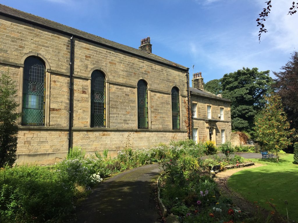
From St Bartholemew’s Parish Church turn right into Windy Street. There are some pretty cottages along this street including the old School House and make sure you take a quick detour into the grounds of St Mary’s RC church which is on the left after about 100 metres.
This Catholic church has an interesting history. By the beginning of the 19th century Catholics were able to openly attend a nearby chapel at Leagram. In the 1820s, George Weld, who was squire of Leagram, donated land in the village for the construction of a church, a school, a priest’s house and a cemetery. St Mary’s Church was built at a cost of £1,130 (equivalent to £80,000 in 2015).The day school, also built on the site, remained in use until 1967 when the new school was built. The old school is now a community centre for all the people of the village. In 1999 the church was fully redecorated and rearranged. The organ was reputedly bought from Stonyhurst College in 1872 and it has been dated by experts from Preston and District Organist Association to be early 18th century, by Bishop Ltd of Ipswich. It was originally hand blown and contains 650 pipes. In 1944, when electric light was installed, a plate confirming its builder was discovered. It was further renovated in 1952, when an electric blower was installed, and a further inscription was found clarifying the re-building of the organ in 1872 by Henry Ainscough.
As you exit the village the road is now Longridge Road and the road bears right at this point.
The official route takes footpath to Dobsons Hall but I have found this to be wet under foot at times – in fact the valley bottom in this region is wet with numerous ponds and probably attests to the hypothesis that the River Hodder or even the River Ribble used to run through this valley prior to the Ice Age. So there is a choice – you can follow the official route or continue along the road, which unfortunately is not paved in parts so beware of the traffic if you do opt for this.
ROAD ROUTE
On your right is the Chipping Showground. The road bears left and then a sharp right. At this point take the lane, which runs straight on to Dobson’s Hall. You never actually get as far as the Hall as you need to take a stile on your right and at this point pick up the official route.
FOOTPATH ROUTE
Cross the stone bridge over the stream and use the gate to enter the field. Bear right and cross the field diagonally to the far corner. Use the stile to enter the next field and then continue straight on with the boundary fence on your left. Pass through three fields in quick succession and then begin to bear left in the fourth field following a line of trees on your left towards Pale Farm. Exit this field by the stile to the right of the property. Turn immediately right and carry on around the back of the buildings on to the road at the front of the property.
Look out for the gate on your right with the Bridleway sign. Enter the field and follow the boundary on your left to a footbridge in the corner of the field. Straight ahead you will see a gate and a path fenced on either side which circumvents Dobson’s Hall. Use the stile to pass over on to the track that serves Dobson’s Hall.
Cross the stile on the other side of the track into a field and then head straight ahead to another stile and another field. Again straight ahead and cross over two stiles in quick succession into another field through which the River Loud runs.
There is a footbridge across the river but it can be very wet and marshy. If it is too wet then please take the road all the way to Thornley Hall.
Having crossed the footbridge carry straight on to a stile which takes you onto the track that serves Leach House. Turn left and follow the lane to the main road. Turn left again and after a few hundred metres look out for a footpath on your right which is after various farm buildings and opposite Thornley Hall.
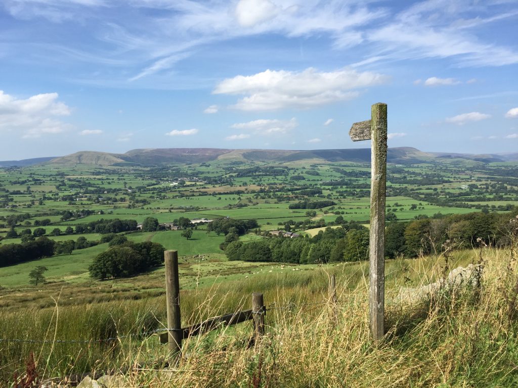
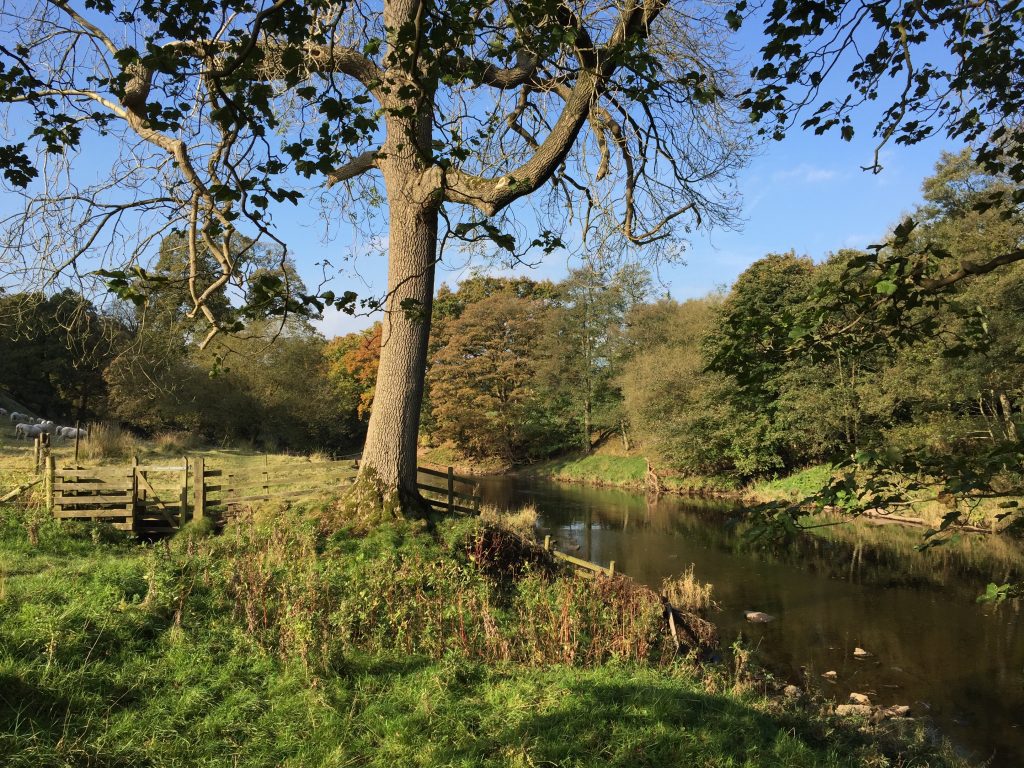
The path, which heads almost in a straight line in a south easterly direction to the top of Jeffrey Hill, is not always distinct. But if in doubt keep going straight up the hill perpendicular to the contours. Initially from the road bear right and then follow the fence on your left. At the end of the fence bear left and continue up the hill with a small coppice on your right. Find the stile at the top of coppice, which takes you into a separate less pastured field. Continue straight on to the very top of the hill to find another stile, which takes you over the wall on to the road. This stile is the location of the iconic picture across the Loud valley to the Bowland Fell, which you can see on the home page of lancashireway.com and above on this page. Turn right and then almost immediately left and look out for the small car park opposite Cardwell House.
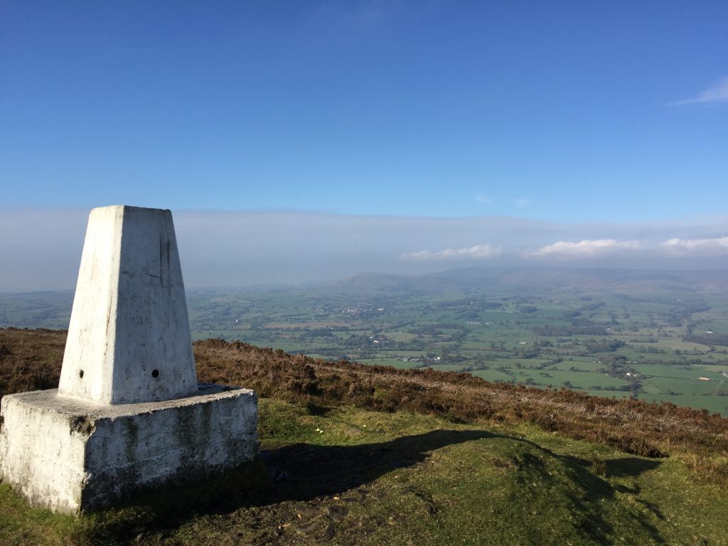
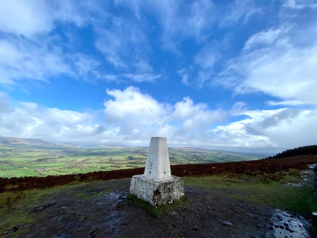
At the top of the car park is a gate, which gives access to the heathered slopes of Longridge Fell. Follow the path from the gate, initially to a cairn circle. From here carry straight on across a boggy area onto the footpath marked on the OS map which climbs up the fell from the west. Bear right and follow this path, which takes you to the spine of the fell along which runs a very straight boundary wall. Turn left and follow the wall in a NE direction and you will eventually reach the trig point at the summit of Spire Hill – the highest point of Longridge Fell at 350 meters.
There are great views – some of the best in Lancashire.
Continue along the boundary wall keeping it to your right. When you come to the edge of the forest climb over the wall using the stone stile set within the wall. On the other side follow the path into the woods through the “coniferous curtains”.
DIVERSION
During the winter of 2021/22 the many storms wreaked havoc in the forest on Longridge Fell. As a result parts of the routes are blocked by fallen trees making parts almost impassible. Hence the route requires a detour and rather than using the path which follows the edge of the ridge, which took the brunt of the storms, we will use the main track instead, which is largely clear. It does not have the views but is clear!
The path on entering the forest is dark initially and can be a little boggy in parts or is clothed in brown needles from the trees around. Pass the “magic deciduous tree” and shortly afterwards the path bears right and then comes out on to a track. (NB There are fallen trees on this last section but you can bypass these). Turn left and follow the track – do not take any of the footpaths around here. There is a section on the track which is blocked by trees (now clear) but you can carry on by passing through the young trees on your right. After the gentle descent from Hare Hill the main track turns right.
ORIGINAL ROUTE – take the path that continues straight on. From time to time there is an opening in the forest, which gives more great views across the Hodder valley below to the north. After a short while we come out of the old forest into a relatively newly planted part of the wood, which is almost maze like. The path then starts to bear SE and there is another clearing with views of Chaigley Manor and the huge farm called Darwens. At this point we will leave the path and head back into the forest to pick up main track again through the forest. Turn left on to this and descend to the road below via the zig-zagging track.
DIVERTED ROUTE – After passing Hare Hill follow the main track, by turning right. After about 150m you will come to another track. Turn left and follow this initially east and then it bears round in to a SE direction and then zig zags down the hill to the main road. This joins the original route just before the zig zag section.
Turn left and follow the road via Birdy Brow to the floor of the valley where the road meets the main road. Turn right and look out for the path on your right immediately before the Higher Hodder Bridge, which crossed the River Hodder here. The path circumvents a property and then passes over a footbridge. Shortly after this the path splits into two. Take the left hand path which hugs the riverbank although a few feet above the river within the wood. Unfortunately the trees do block out much of the river but I found this stretch very tranquil. Continue along the path, which then turns through 90 degrees as it follows a large bend in the river. Look out for the beds of rock exposed in the river and its banks – dark grey Lower Carboniferous limestones, which are inclined and folded in parts – evidence of the Pendle Anticline (geological feature explained previously).
After this straight stretch of river the path moves away from the river and ascends into the woods and then follows the contours around with the river now well below us to our left. On this stretch there is stone cross but no words to give a clue as to its origin! Shortly afterwards there is a crossing of paths. Take the left path, which descends the hill via a wooden staircase. At the bottom cross over the stone bridge and continue straight on up the slope. There is small path to the left but this is a dead end but does take you to the water’s edge. At the top of the slope you will pass the huge building known as Hodder Place, with its unusual architecture. The path then descends back to the edge of the riverbank and then follows a stoned track along the riverbank for a kilometre or so until we reach the Lower Hodder Bridge.
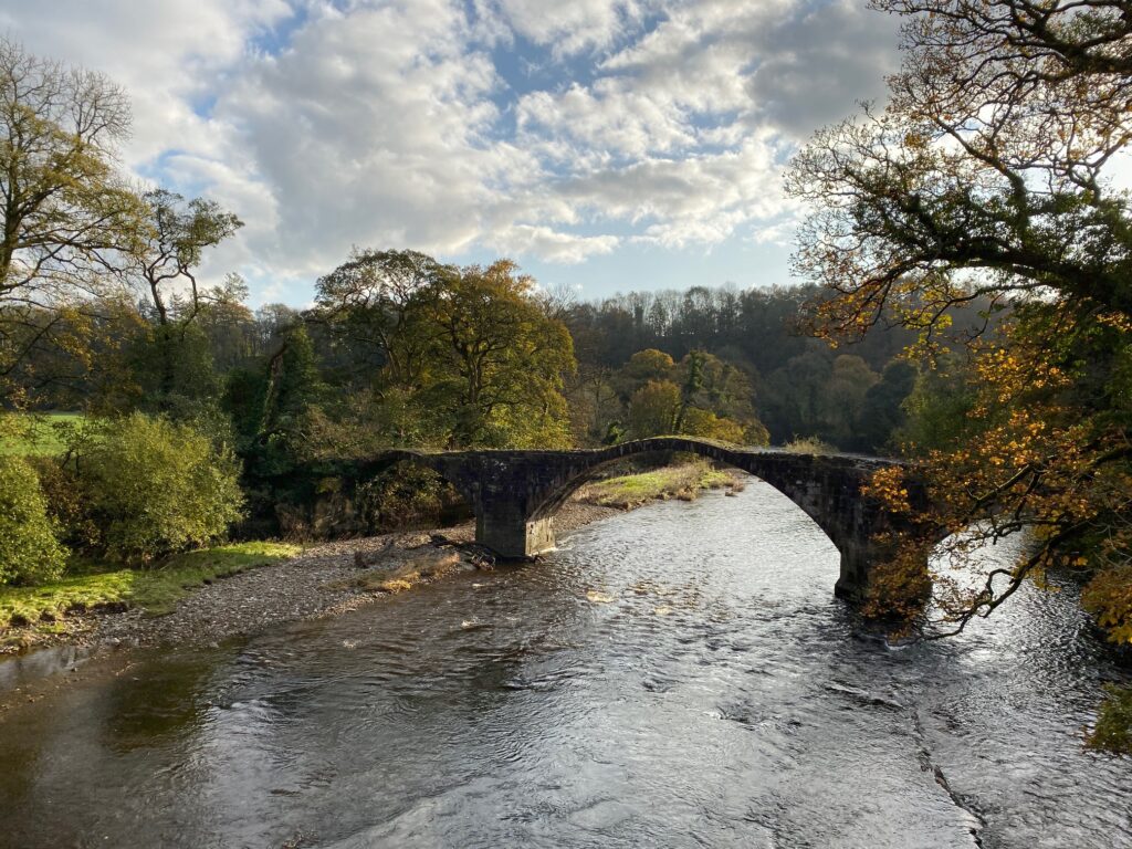
We will be turning right here and following the road up the hill but before we do this turn left and take a view downstream from the bridge. Just a 100 metres away is the Old Bridge which was once used to cross the river. This is also known as Cromwell’s Bridge so named as it was apparently used by Cromwell in his march upon Preston in August 1648.
On the Lower Hodder bridge carved into the stone you will see that the Hodder once represented the county boundary between Lancashire and Yorkshire and crossing the bridge would have taken us into Yorkshire. However, you will be relieved to know that the boundaries have long since been reset and Yorkshire has retreated much further up the Ribble valley (Just north of Newsholme).
Follow the B6243 west up the hill away from the Hodder and look out for a footpath sign on your right , which takes you up through a field which avoids following the roads for a very short while. NB This path is now very overgrown so you may just want to continue along the road. Keep to the right of the stream and trees in the middle of the field and exit by the stile back on to the road at the top of the field.
Turn right and follow the road until you come to a track on your left, which takes you towards Hall Barn Farm and the first real sighting of Stonyhurst College and some of its many rugby pitches. To the right you can see the impressive St Mary’s Hall, which now houses the preparatory school. Until the 1920’s this was used in training of Jesuits priests but was closed with the fall in demand after the First World War. Whilst the Jesuit philosophy remains, the only Jesuits remaining on site are those that lead the school chaplaincy team.
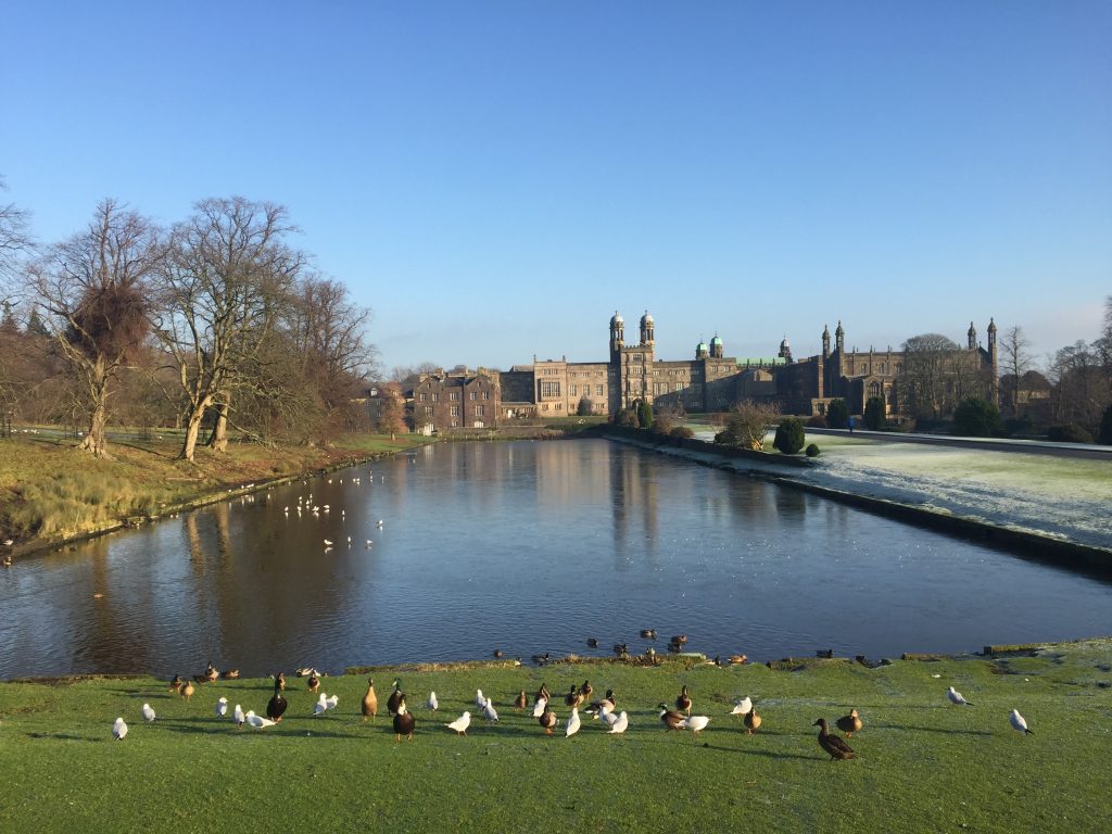
Continue to follow the track past the farm on your left. At the end of the farm buildings take the turn right and follow the wall, which is the boundary to the College. You will then pass the Observatory at which point you will turn right again. Note the old bobbin mill on your left. Walk past the Chapel – St Peter’s Catholic church – which is open to the public and is the church for local Catholic worshippers and on to the very front entrance of the college, with its magnificent avenue to your left.
Stonyhurst College is a Roman Catholic independent school, following the Jesuit tradition and occupies a Grade I listed building. The school has been fully co-educational since 1999.The college was founded in 1593 by a Father Robert Persons under the patronage of King Phillip II of Spain just across the English Channel at St Omer in France to educate English Catholics, at a time when penal laws prohibited Catholic education in England. After moving to Bruges in 1762 when the King of France expelled them and Liege in 1773, the college moved to England and located at Stonyhurst Hall in 1794. Today it provides boarding and day education to approximately 450 boys and girls aged 13–18. On an adjacent site, its preparatory school, St Mary’s Hall, provides education for boys and girls aged 3–13. Fees are apparently in the region of £27,000 pa – probably out of date now.
Under the motto Quant Je Puis, “All that I can”, the school combines an academic curriculum with extra-curricular pursuits. Roman Catholicism plays a central role in college life, with emphasis on both prayer and service, according to the Jesuit philosophy of creating “Men and Women for Others”. It has a strong sporting tradition which you can observe on the next leg of the walk by the vast number of Rugby pitches and its sporting alumni. It also has an observatory which dates back to 1866. The original telescope was sold shortly after the Second World War but it was repurchased and is now back in situ and used.
The school’s alumni include three Saints, twelve Beati, seven archbishops, seven Victoria Cross winners, a Peruvian President and prime minister, a New Zealand Prime Minister, a signatory of the American Declaration of Independence and a number of writers, sportsmen, and politicians. JRR Tolkein’s sons attended the school and apparently inspired the Lord of the Rings Trilogy. Arthur Conan Doyle was also a student here and it is believed the school and setting inspired the story of the Hound of the Baskervilles!
Unfortunately the avenue is not a footpath or public road for the first part so we have to take a small circular detour using the public footpath and local public roads. Carry straight on past the entrance and up another driveway which heads in NW direction. This brings you to a main road. Turn left and then left again at the next junction, which takes us backs back around to the Avenue some several hundred metres from the building. Here you can see the “Private” signs and the fact that the continuation of the road to the College is not a public footpath. Turn right and continue along the Avenue away from the College, flanked by several more rugby pitches, all with their own name.
At the end of the avenue to Stoneyhurst College the road takes a ninety degree turn left. Note the Lady statue at the top of the Avenue, dating back to 1882 and take one last look back at the impressive and quite majestic college.
Continue along the road past the overgrown churchyard on your left and then through the stone pillars which marks the start of the village of Hurst Green. Continue along the road past lovely cottages, Almshouses, the Bayley Arms and then finally St Peter’s Guild Club on your left. Finally the stage ends at the War Memorial, which occupies a small triangle of land by the main Longridge to Clitheroe Road.
More details of the village can be found at the beginning of Stage 27.
END OF STAGE 26
There are two places to stay in Hurst Green – The Bayley Arms on Avenue Road just after the Alms houses and the Shireburn Arms Hotel on the main Whalley Road opposite the War Memorial at the end of the Stage.
Click here to go straight to Stage 27
Click here to go to the Fifty Mile Route
CIRCULAR/DAY WALKS
This stage is 11.5 miles long so really needs to be split into two to complete the whole of the Stage with two day walks. Ideally adopt the car share option. You can then potentially add on Stage 27 making the total day 15.5 miles long. Then return to Chipping from Ribchester using the spare car.
The first half should be completed as far as the car park at Jeffrey Hill. There is no obvious alternative return route. Many of the paths are little used. You can use the roads but these can be busy. I would just retrace the route in reverse – it can look different walking in the opposite direction.
For the second half park at the car park at Jeffrey Hill a couple of miles into this Stage – GR 639 402. Complete Stage 26 ending in Hurst Green. Pick up the bridleway, which runs NW initially up Dean Brook and then heads to Greengore and Crawshaw House. Go onto the main road. Turn left. The easiest way back to Jeffrey Hill is to take the track on your right, which winds its way through the forest on Longridge Fell. At the point where the track splits take a left turn. This track becomes a path at the end and exits on the summit of Longridge Fell not far from the trig point at Spire Hill. Turn left and head down to the car park retracing your first steps of the day.

