STAGE 28 – RIBCHESTER TO PRESTON
11.5 miles – 4 hours walk.
748 feet climbed – highest point 235 feet – Near to Lower Yew Tree Farm off Alston Lane
Although we follow the River Ribble down its valley all the way to Preston, for much of the first half of the walk we only see fleeting glimpses of this impressive river. However, this is compensated for by lush verdant pastures, rolling hills and great views across the Ribble to the south, taking in Pendle Hill, Mellor, Billinge Hill, Darwen Moor and its Tower and Winter Hill – all of which we have visited in earlier stages of the Way. Ancient woodlands and the Brockholes Nature Reserve provide interest before following the banks of the Ribble for several miles back into the centre of Preston. For most of the day we follow the Ribble Way, with its many and distinct marker posts.
NB THE SECTION THROUGH TUN BROOK WOODS IS CURRENTLY CLOSED – FOOTBRIDGE BEYOND REPAIR. PLEASE SEE DETAILS OF ALTERNATIVE ROUTE IN THE NARRATIVE BELOW. NB It now appears that the alternative route is also unpassable – see below for more details.
A map of Stage 28 can be found below courtesy of Ordnance Survey maps. You can subscribe yourself using this link, https://osmaps.ordnancesurvey.co.uk, which will enable you to import the GPX file which can be downloaded below.
Download file for GPS
To download the GPX file for this Stage click on the link above.
ROUTE DESCRIPTION
We begin at the Roman Museum of Ribchester. Do please visit. Whilst it just a small museum in keeping with the village itself, it is extremely well done. It is run by a charitable trust – the Ribchester Museum Trust, whose website provides an interesting and thorough overview of the history of the location – see www.ribchesterromanmuseum.org.
The Museum celebrated its 100th anniversary in 2015! It was established originally by a Margaret Greenhall, of the famous brewing family, occupying just one room. Its aim was to stop the flow of artefacts out of the village, which had been going on for centuries. After many years of National Trust ownership the new Trust has transformed the museum adding a new two-storey extension, and incorporating the adjacent cottage, which was once the curator’s dwelling. Perhaps the most famous of all the many artefacts found in the village is the Ribchester Helmet, held in the British Museum since 1816. This elaborate cavalry helmet was discovered as part of the Ribchester Hoard, in 1796, by the son of a local clogmaker! Made of a copper alloy it had a lifting face visor and was decorated with the scene of a battle between cavalry and infantrymen. It was probably largely used in ceremonies rather than battle itself.
The Roman site at Ribchester was called Bremetennacum Veteranorum and consisted of a fort and civilian settlement or vicus. The earliest Roman fort in Ribchester was established in the early 70s AD as part of a network of defensive forts across northern Britain.
It is the centre of a network of roads in this part of Roman Britain. There was the main road from the south from Manchester, which passed through Blackburn and then crossed over Ramsgreave, near Mellor before heading into Ribchester. The road to the east went ultimately to York, via forts at Elslack, and which we crossed above Downham. To the west there was a road to a seaport at Kirkham, which would have connected with another road running north south from Chester to Lancaster. This would have provided the link to the industrial settlement at Walton-le-Dale, just south of Preston. We will see this again today later in the Stage and for parts of walk we will be following this particular Roman road, although there is little evidence of it today. To the north, roads went NW to pick up the main route north to Lancaster and more importantly to Carlisle via Slaidburn and Croasdale Fell.
The fort accommodated a garrison of cavalry troops whose purpose it was to patrol the surrounding area and keep the local inhabitants under control. You can see why this purpose developed with its central location across the road network and probably to patrol the wilder regions to the north and east – a sort of rapid deployment force! The first unit of cavalry originated from Spain – the second Asturian cavalry unit. Towards the end of the second century AD they were replaced by an ala of horsemen from Eastern Europe, a Sarmatian cavalry unit. The settlement then took unusual veteran status indicating that a high level of importance was attached to the site. At this point, if it had not already, Bremetennacum became the focal point for governance of the area.
Originally of turf and timber construction, the fort was rebuilt in stone in the mid first century AD. The civilian site outside the fort was extensive and covered an area more or less corresponding to that of the modern village. The vicus was also the site of the baths, the most substantial stone-built construction outside the fort, and at least two temples, fulfilling important social and religious functions. Narrow plots were occupied perpendicular to the main Roman roads. Excavations have revealed rectangular wooden buildings used as workshops and dwellings. Craftsmen plied their trades in the vicus providing essential goods for both civilians and military personnel alike. Metalworkers and leather workers were particularly abundant, supplying all kinds of military and cavalry equipment.
The fort was occupied until the fourth century AD but little development took place after the second century.
Having finished our tour of the museum, onward we must go – on two legs rather than four!
From the Museum continue down Church Street, which follows the river downstream. The road then passes between a number of properties including the Riverside Barn B&B on your left. Continue straight on passing various farm buildings on your left before joining a tarmacked lane.
The view to the left, is dominated by a large farm, with an ancient house to the left of it. This is Osbaldeston Hall, which is actually on the other side of the river. It is a Grade II listed building dating back to 1529 and is one of several Hall’s from this period, which occupy the Ribble valley.
Carry straight on past Lower Barn Farm and then the Boat House. By now the road is a stony track. Enter the field and continue straight on with the riverbank on your left. Cross over a stile into the next field with a small wooded area on your left, which hugs the steeper bank of the river. The path makes its way up the slope just inside the edge of the wood. At the top of the slope make your way down out of the wood and look for a metal gate with a substantial stile by its side on the right-hand side of the field. Cross over the stile into a fenced grassy track. Turn left and head down the track towards Hothersall Hall. Pass through two gates, which brings you on to a tarmacked lane which heads away from the hall. Follow the lane in a westerly direction.
Shortly afterwards you will pass Hothersall Lodge on your left, which consists of numerous buildings belonging to Lancashire County Council. This is a Field Study and Outdoor Educational Centre with its own climbing wall! The road bends to the right then climbs steeply out of the flood plain of the Ribble. At the top of the slope the road turns right but we need to turn left down a concrete track by the side of Tower House.
We are now following the line of the old Roman road and will do so for a few hundred meters. The concrete track becomes a gravel drive belonging to Stubbin’s Farm. Carry straight on to the grass ahead and find the two stiles, which take you into a field. There are good views here to the south including Winter Hill and Darwen Tower.
The next stretch takes us through field after field, stile after stile some of which can be a little awkward to spot. Essentially we carry straight on but below I have tried to make the detail as comprehensive as possible to make this as easy as possible. There are also a number of Ribble Way markers, which confirm that you are still heading in the right direction.
Carry straight on through the field over a stile into the next field, straight on past a fenced pond on your left to another stile. Cross the stile, and then another, which brings you into another field. This field descends steeply down to a small stream below. Keep left and find the stile and footbridge in the right-hand corner of the bottom of the field. Cross the stream, head straight up the slope ahead, through the remains of a fence and then find the small footbridge and stile straight ahead. Cross the track and continue straight ahead in the same direction towards a wood. Bear slightly right and find the stile over a trickle of a stream into the next field.
During this section you may from time to time see a rounded roof, which is part of an Observatory at the Grade II listed Alston Hall. The hall, which you cannot really see, was built in a gothic style with ornate decoration in 1876 for a colliery owner, John Mercer. From 1949 it has been used as a college of further education but was closed by Lancashire County Council in 2015, as part of its budget cutbacks. It sad demise does not stop there. Whilst it was bought in late 2016 by private individuals, there was a significant fire at the property in March 2017. The full extent of the damage is not known.
Bear slightly right and find another footbridge and stile over into another field. Carry straight on and then bear right and follow the electricity poles through the next field, which head to the right of a group of properties ahead. Cross over the stile onto a road. Turn left and then immediately right, following the lane past the side of Yew Tree Cottage. There is a Ribble Way sign to guide you.
Head straight on through a stile by a gate into a field. Continue straight on keeping the boundary fence just to your right. When the field opens out then, head slightly right keeping a pond in the middle of the field just to your left and then continue to the far boundary of the field. Find and cross the footbridge and stile into the next field. Continue straight on in the next field with the boundary fence just to your right and then exit the field via a stone stile onto a track. Turn left (ignore the stile straight ahead and signs, which encourage you to take this route but all it does is cross the corner of that field then takes another stile back on to the track just around the corner!!) and follow the track around then straight past March House. The track is then a stony one and takes you to a road – Elston Lane.
DETOUR
The route then turns left and follows Elston Lane south. However, on last walking this section, the route through Tun Brook Wood was advised as being closed. The significant footbridge in the bottom of the valley was blocked and the exit off the bridge required a climb due to landslips. I advise that you check online as to the status of the route before attempting. There is an alternative route, which involves turning right and then taking the first footpath on the left. This also takes you through Tun Brook Wood, but further north and then, when it reaches the Red Scar Industrial Estate, turns south to rejoin the route shortly afterwards.
NB THis alternative route is also currently impassable so the best alternative is to follow Elston Lane into Grimsargh. Turn left and follow the main road. This bears left and then crosses an old railway line. Continue on passing the war memorial on your right and then take the path on the left, just after a row of houses, which brings you back to the footpath on the second alternative route. Continue straight on to reach the original route.
So if the route is open, turn left and follow the lane south for about half a kilometre. Where the road forks, turn right and when the road turns sharp left take the stile over into the field. Bear slightly right passing a lone tree on your left. Find the stile and cross this into the Wood – Tun Brook Wood. There is a good path down into the steep valley with steps in many places to help. Cross the footbridge and climb the steep slope out of the valley.
Use the stile to exit the woods. There is an information Board here that gives details about the Wood – one of the oldest in Lancashire. Take the fenced path left and then cross another stile on your left into a field. The path then follows the edge of the woods through a number of fields.
We then follow a fenced path and to the left is a huge meander in the Ribble below to the left. Unfortunately, it is largely obscured by trees. There is a crematorium on the right and then an information board points out the site of Red Scar Manor, an old Elizabethan manor house. You can also begin to hear the roar of the M6 motorway, which we will pass under soon.
Keep on the path – the tarmacked path to the right is the route of the Guild Wheel cycle route. Another information board points out the site of an old Courtaulds textile factory. When it closed in 1980, 2600 people lost their jobs!
We now have to join the stony track that is now the Guild Wheel. The route then splits, where a significant signpost marks the beginning of Pope Lane. Bear left and continue to follow the edge of the wood. Enter the woods and note the warning signage – mainly for cyclists who underestimate the steepness of the slope, which takes us down onto the flood plain of the Ribble. So please watch behind for cyclists!
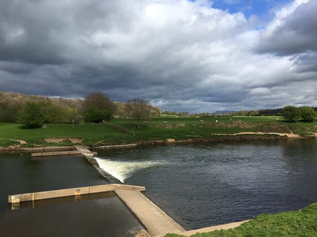
Exit the wood. Ahead you can see the lakes belonging to the nature reserve, which we will visit shortly. Turn left along the stony track. At the point that the track curves around right through ninety degrees we will take a detour along the grass ahead to the Ribble itself. This is one of the first proper views of the river since just outside of Ribchester. Here there is a weir with good views upstream with the woods, which we have been following, curving around the impressive meander in the river. Downstream the river opens up a little. Straight ahead in the distance is Pendle Hill and frequently you will see a lone heron here fishing on the weir.
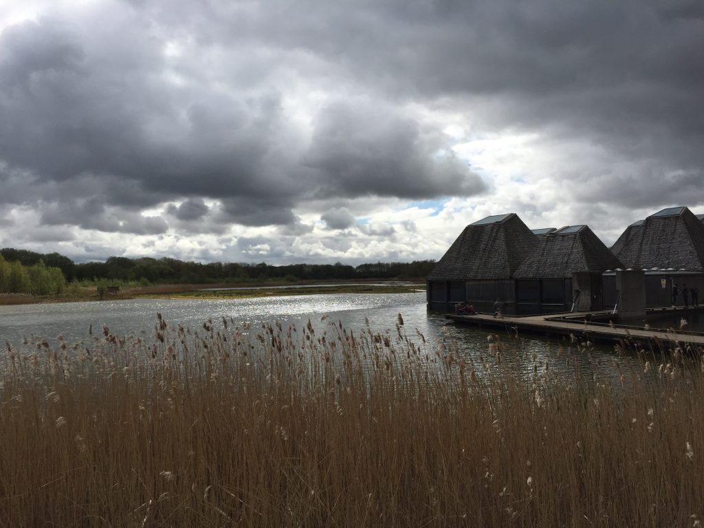
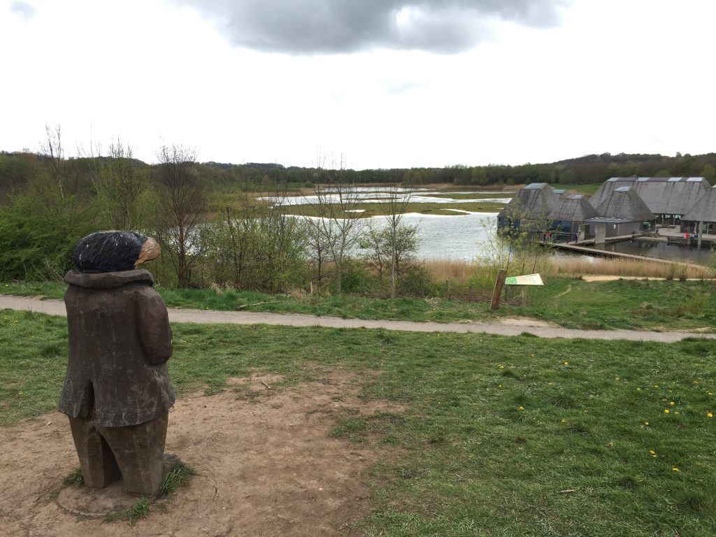
Retrace your steps to the stony track and continue south. On your left you may notice or hear children, who are playing on the activity area in the Reserve. When you come to the Brockholes Visitor Village sign please make another detour. Turn left and follow the path past the play area to the car park. Then head towards the far-right corner of the car park, just to the left of a maintenance depot. Here you will find the walkway down to the visitor centre, which comprises of a number of “eco” buildings sitting on stilts in one of the lakes, surrounded by reeds. You can buy refreshments, a meal or souvenirs here. Look out across the water for various wild fowl.
The site has been developed by the Wildlife Trusts charity from the remains of a large gravel pits, where the sands and gravels deposited by the Ribble over thousands of years were excavated. The charity first contested the redevelopment of the site 25 years ago in 1992 and finally purchased the land in 2007, with help from the NW Regional Development Agency.
For more information on the site please see www.brockholes.org
Retrace your steps back to the stony track. Continue to follow this south making detours to two hides, which look over more lakes. Ignore the cycleway sign. The path curves right and then turns left and passes through two substantial metal barriers and then ends at road. Turn right and follow the road under three large road bridges, the middle being eight lanes of the M6, which crosses the Ribble at this point.
This part of the M6 was actually Britain’s first stretch of motorway. It was just eight miles long from Bamber Bridge in the south to Broughton in the north and just two lanes in either direction. It was opened in December 1958 by the then Prime Minister Mr Harold McMillan. It was always to be part of a major motorway, which would link north and south but was started first to alleviate the extreme traffic pressure in Preston. The A6 north ran directly through the town to Blackpool, the Lake District and Scotland. The traffic was particularly bad during the holiday season and the Blackpool illuminations. The junction of the motorway with the A59, whilst much changed, was a significant part of the new design of roads that motorways brought. A great read is the initial booklet accompanying the opening – find it as a pdf document at www.cbrd.co.uk/articles/opening-booklets
Just after the third bridge pick up the tarmcked path, which continues to follow the line of the river and then bends around to another bridge, which allows the A59 to cross the river – a much older crossing and made of stone! The original bridge was built in the 1820’s as a single-track toll bridge, known as the Halfpenny Bridge. It was widened in 1937.
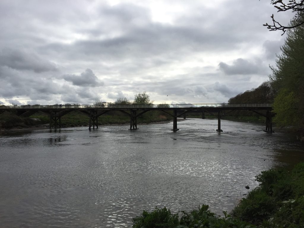
At the end of the track turn left and use the pedestrian tunnel to pass under the bridge. The next part of the Way is quite simple. Carry along the riverbank, which firstly uses the tarmacked track that is the Guild Wheel. At the first bend you can see Cuerdale Hall on the other bank, which is close to where the Cuerdale Hoard was found – see Stage 17. The Guild Wheel then turns abruptly right and heads towards Mete House. However, we will continue to follow the Ribble Way, which continues along the northern bank of the Ribble in one large meander making its way in an arc towards the right. There are a couple of stiles into separate fields but essentially continue along the bank of the river until you come to another stile, which crosses on to a road. Turn left, pass the car park on your left, walk around the side of the Shawes Arms (now closed!) and climb up onto the main road – the A6/London Road into Preston. This was the route north before the M6. The bridge – the Walton Bridge – dates back to 1712 and follows the site of a Roman ford.
You may remember this as the beginning of Stage 17 – the start of the Central Loop, almost one hundred miles ago! Cross the road – carefully – and enter Ashworth Grove on the opposite side of the road, which continues along the northern bank of the river. This then becomes the “Boulevard”. Shortly afterwards if you look left you will see the River Darwen entering the Ribble on the opposite bank. Hopefully you will have fond memories of this smaller river from Stages 17 and 18. Look on the map to see how the river produces the perfect defensive position that was used by the Romans.
Continue along the path by the riverbank, which then enters Avenham Park again, with the replica Tramway on your left. You should know your way around this park so choose your favourite route back to Ribblesdale Terrace – whether by the Sebastopol cannons and the Avenham Walk, or through the park itself to the main entrance near the Cenotaph and the Japanese gardens. If you have time treat yourself to a well-deserved drink in the Pavilion.
Exit the park and walk straight ahead past Winkley Square to Fishergate. Turn left and follow Fishergate until you come to the road that leads to Preston Railway Station on your left.
WELL DONE – END OF STAGE 28 and the CENTRAL LOOP.
There is much and varied accommodation in Preston.
Click here to go straight to Stage 29 – the first stage of the Northern Loop
CIRCULAR/DAY WALKS
Park in Preston. Take the train to Blackburn and experience parts of Stage 17 and 18 including the railway viaduct at Pleasington/Hoghton Towers. Catch the bus from Blackburn bus station to Ribchester – currently Service number 35 – see www.lancashire.gov.uk for timetables. It takes approximately 30 minutes. Get off at the bus stop near the Black Bull in Ribchester and head down Church Street to the Roman Museum, which is the start of Stage 28. Complete Stage 28 ending in Preston. Note the Roman columns at the front entrance to the White Bull pub on Church Street.
Alternatively you can travel to Ribchester from Preston via Longridge. There are very regular buses from Preston to Longridge – Service 1, which are every 10 minutes. Then take Service 35 the short distance to Ribchester.


