STAGE 45 – BARROWFORD TO BARNOLDSWICK
9 miles – 3.5 hours walk.
1,124 feet climbed – highest point 1,297 feet – Weets Hill
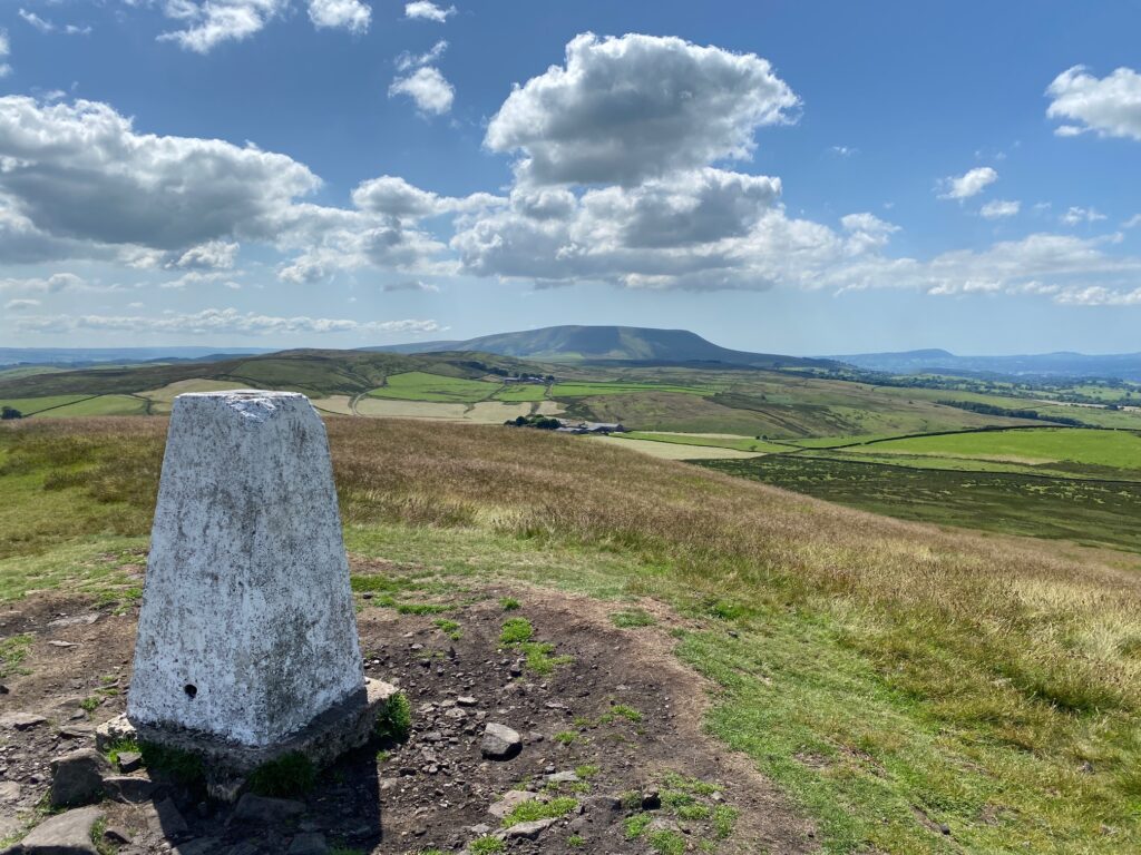
This Stage is lovely and initially meanders its way through pleasant countryside using the Leeds and Liverpool canal and then climbs to the top of Weets Hill. This great view point with trig and bench has great views over the Ribble Valley to the North and South. We end in Barnoldswick, which has more to it than you might think!
The map of Stage 45 can be found below courtesy of Ordnance Survey maps. You can subscribe yourself using this link, https://osmaps.ordnancesurvey.co.uk, which will enable you to import the GPX file which can be downloaded below. There is a small annual charge of around £30.
Download file for GPS
To download the GPX file for this stage click on the link above.
The route follows the Pendle Way at the very beginning of the Stage and picks it up again at the top of Weets Hill but leaves it as we enter Barnoldswick. I was originally going to follow the Pendle Way for the whole stage, only making a detour on entering Barnoldswick, where the Pendle Way makes a very circuitous route around the town. The Lancashire Way is more direct at the end of this stage and walks through the town. However, I prefer my overall route, which takes in more of the Leeds Liverpool canal including Foulridge with its Wharf, Tunnel and Reservoirs. The climb up to Weets Hill is better giving excellent views across the valley and the chance to visit some fascinating pieces of outdoor sculpture. So apologies to the Pendle Way!
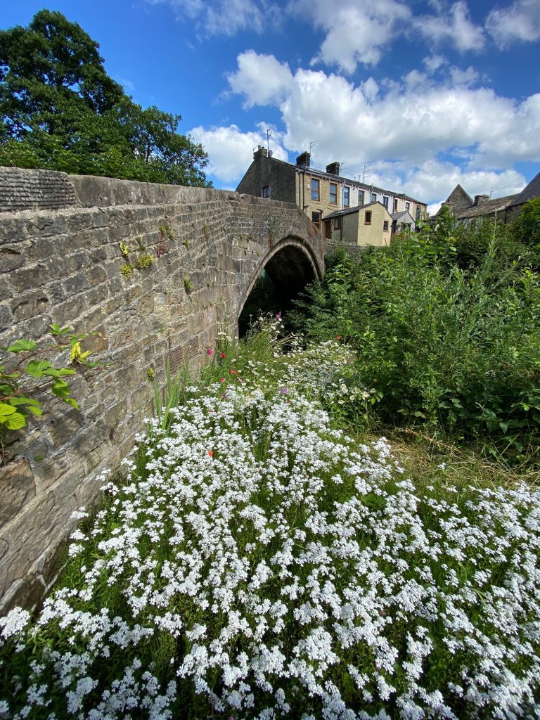
Exit the Heritage Centre and cross the road and enter the car park opposite. Find the path by the riverside on your left and follow to the next road. Cross the road, turn left, cross the bridge and then turn right into the road on the other side of the river. Turn right and cross over the old Higherford Bridge.
The Higherford Old Bridge is a Grade II listed pack horse bridge dating from the 16-17 Centuries and crosses the river called Pendle Water, which we have been following. It has a single span of 12m. It was also used by “Lime Girls from Lothersdale bringing lime into the district” — ‘Girls’ is a corruption of ‘gals’, itself an abbreviation of ‘Galloways’, a breed of horse particularly suited to packhorse work due to their stamina but now extinct in Britain. Methodist John Wesley preached from this bridge in 1774, but the crowd was hostile and he took refuge in what is now the White Bear Inn.
Follow the street onto the main road again. This was just a small circular detour to see the Higherford Bridge. Cross the road and turn left and follow the main road up the hill. When the road forks, bear right taking the Barnoldswick Road. Almost immediately come off this road by turning right into Francis Avenue. Continue straight on along Francis Avenue ignoring Grange Avenue on your left – it does appear that you are entering a private drive but persevere and pick up the path at the end. Use the metal gate to enter the field beyond.
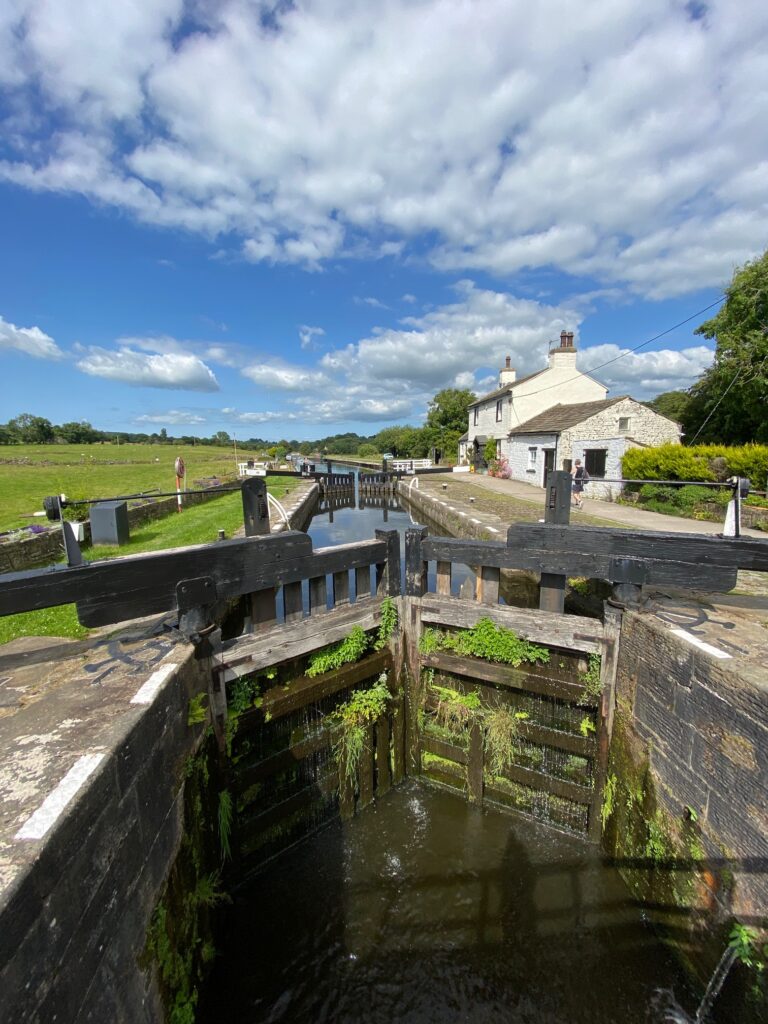
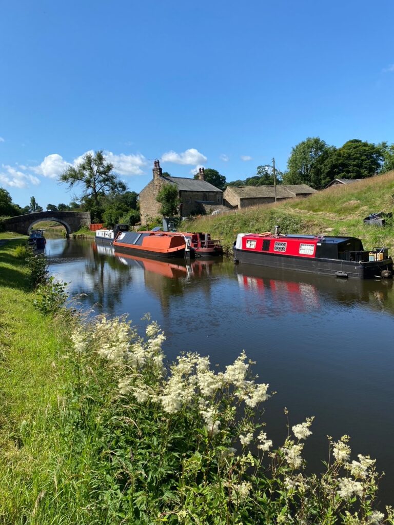
Bear left and follow the path down to the lock on the Leeds Liverpool canal with an old canal property on the other side of the canal. Pass through the white wooden gate at the base of the lock and use the footbridge over the lock to cross the canal. Turn left and follow the tarmac towpath in a northerly direction.
At Bridge 145 look out for Greenwood’s cafe and treat yourself to an ice cream!
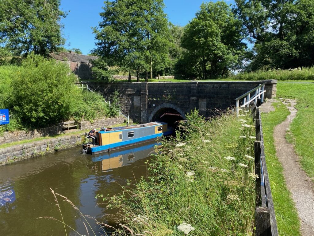
Shortly afterwards bear left at the Liverpool 81 miles marker and follow the path directly alongside the canal, rather than the tarmac track. After a few minutes you come to the entrance of the Foulridge tunnel.
The work on Foulridge “Mile” Tunnel started in the late 1780s, opened in 1796 and was a major construction achievement. With no towpath in the tunnel, the tow-horses were unharnessed at one end and walked along Reedymore Lane whilst the boats were ‘legged’ through. Men lay on boards at either side of the vessel and pushed with their legs against the tunnel walls, literally walking the barges through. Legging ceased in the early 1880s after the death of a legger by suffocation. Then, the Foulridge tunnel steam tug came into being which pulled the barges through to the other end.
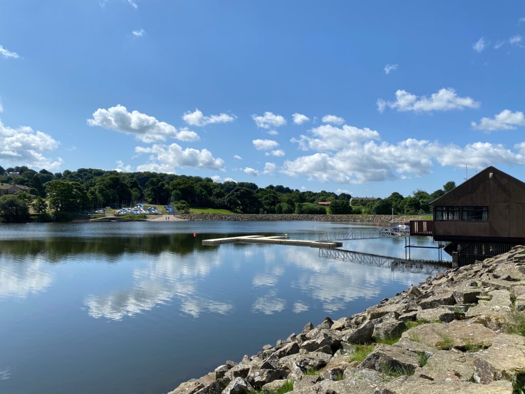
Climb up to the tarmac track and cross over the tunnel and then bear right and continue to a road. Turn right and take the second path on the left after 50m – a National Cycleway. Follow it to another road. Turn left and then almost immediately right using a stone stile to enter into a car park on your right. Bear left and ascend to the sailing club building and then follow the path around the reservoir. There are excellent views of the Boulsworth ridge, which we will climb soon, in the distance to the east and the distinctive Nonya Hill. The path then bears right and enters an area with trees. After about 200m take the wooden steps on your left and head straight on up the slope to left of a tree and on to a wall and then follow the fence down to the corner of the field. Be sure to look behind you on this stretch to get good views of the Lower Foulridge Reservoir and Pendle in the distance.
Find the wall stile at end of houses in the corner of the field. Cross this and bear right along an enclosed path and then onto grass and then cobbles. Look for a metal gate on your right and exit the property. After 20m turn left and follow a gravel track to a road. Turn right and then left into Warehouse Lane when the road turns right. Follow the road, ignoring Station Road on your left on to the Wharf and canal at the other end of the tunnel.
Foulridge Wharf was completed by 1796 in time for the official opening of the Foulridge Tunnel and the warehouse was built in 1815, a year before the canal opened in its entirety. In its heyday, the Wharf bustled with barges loading and unloading cargo. Cotton from America would be brought into to the North West via Liverpool docks. Canal barges from Liverpool would carry the cotton to Foulridge, where it was unloaded and stored in the warehouse, for redistribution to the local cotton mills. Canal horses used to pull the boats and were also stabled at the wharf. Later, when steam powered barges plied the route to Liverpool, horses were still used to take goods onward out to Yorkshire. A canal company man called a ‘horse marine’ would lead a horse and barge eastwards for the rest of the cargo’s journey. The building is now occupied by the Cargo cafe.
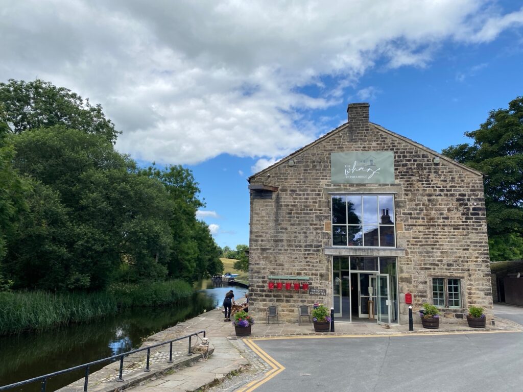
The old Wharf – this used to be the Cargo Cafe providing a welcome refreshment but is now an Italian Restaurant
Follow the tow path north to Bridge 149. Come off the canal here and use the bridge to cross the canal. Follow the track. After 75m the track bears left. At this point take the large metal gate to your right entering into a field and then use a second gate to exit onto the road by a mill. Carry on up the road past the front of the mill and onto road servicing the mill. After 100m the road turns left. Look out for a footpath on your right with a marker post. Follow the path down to a stream and use the lovely old footbridge to cross over the stream.
We will now continue in an approximately northerly direction for about 0.5km to close by Booth House Farm. From the footbridge go straight on up the slope and follow the fence line on the left to a stile gate. Bear left to a stone stile and then carry straight on through two gates, a stile and another gate at front of some properties. Look right to the village of Kelbrook and our route south on the opposite side of valley. Carry straight on past a quarry on your left to a gate stile which takes you onto a tarmac drive. Cross the drive and carry straight on across the field. Then follow a wall on your right to telegraph post and marker post near Booth House Farm. Turn left and head straight up the field to a wall stile and cross onto a road. Turn right.
After Lanehead Cottage take the stony track on your left and follow uphill. When you reach a farm on the right carry straight on through a gate onto grassy track to a second gate. Bear right but slightly away from the wall on the right to find a gate at the top of field. Go through the gate and continue to follow the path to a gate onto track, which is the Pennine Bridleway. Turn right and the follow stony track to a large finger signpost on your right with a track turning off to the left. Turn left and follow this track over a cattle grid. At a second cattle grid bear left across field towards the left-hand side of a group of trees to pick up the track again i.e. cut the corner. Turn left and follow the track to Duck Pond Farm. Pass the front of the buildings and take the gate past the last building into a field.
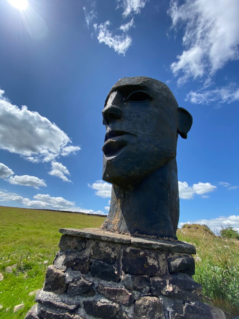
You will now pass two statues. The first you pass directly and looks like an Easter Island figure – the face of a man with a very prominent nose. Behind the wall in the grounds of a farm is another. I believe that these were created by an art teacher, who might now live at the farm.
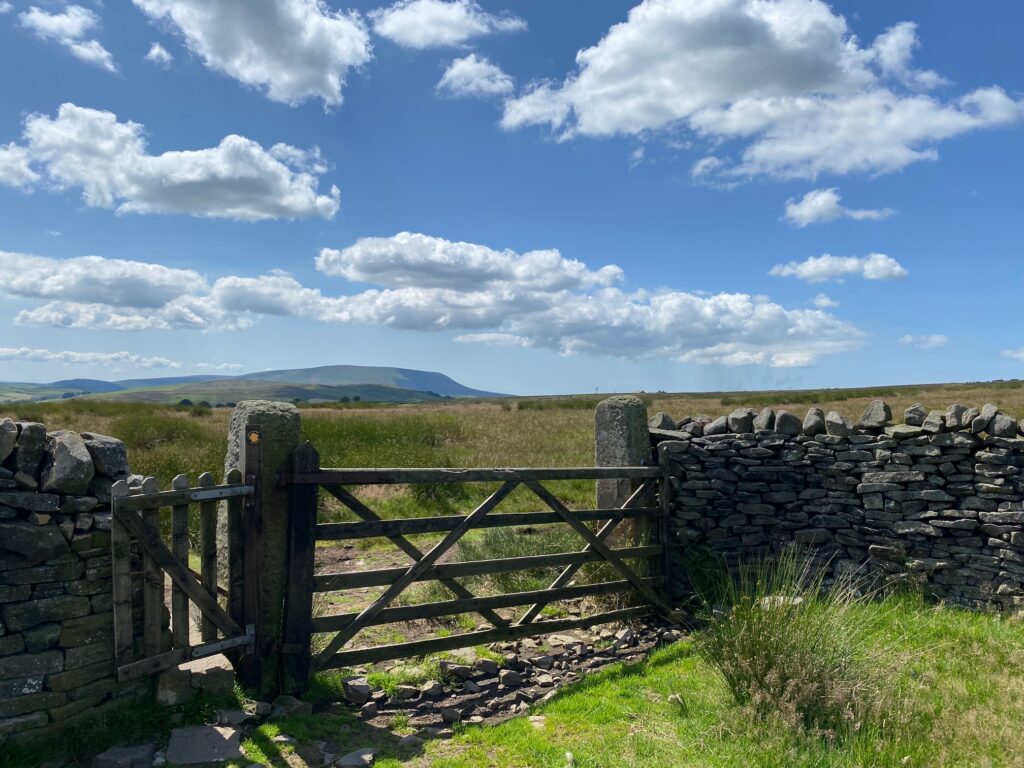
Pass the statue and carry straight on to a gate. Turn right and follow a good path, which is not marked on the OS map. When you come to a fence, use the small stile to cross over and then pass through the remains of a wall. Straight ahead you should be able to see a cairn. Proceed to this and then you will be able to see the trig point, which marks the top of Weets Hills at 397m.
A short distance away is a bench around which are various stones in memory of people who presumably loved this spot – and rightly so. It gives such great views up and down the Ribble Valley. To the south you can see firstly the distinctive big end of Pendle Hill, then Longridge Fell and even Beacon Fell on a good day. To the west are the Bowland Fells and then to the north are the Yorkshire Dales with both Ingleborough and Pen-y-Ghent being visible on many days.
Return to the wall and then follow the wall down along the ridge of the hill north to Barnoldswick. Keep on this side of wall passing two properties on the other side and then use a gate to access the lane. Continue along the lane down the hill in same direction, around a zig zag bend and then past various properties and then finally coming to a T junction in Barnoldswick. We had re-joined the Pendle Way at Weets Hill but left it again a little further back before the T junction.
Turn right and then look out for a footpath sign on your left just before the Bancroft Museum a little further on, on the right.
The Bancroft Mill Engine House and Museum is all that remains of a large mill built in 1914, but which only became operational in 1920. The weaving shed was demolished in 1978, but the engine house, boiler house and chimney survived and are now the Bancroft Mill Museum. The engine’s high and low pressure cylinders are named ‘James’ and ‘Mary Jane’, after James Nutter, who owned the mill, and his wife. The engine has been run using steam since 1982 to the present time. The museum is open for viewing every Saturday and is free.
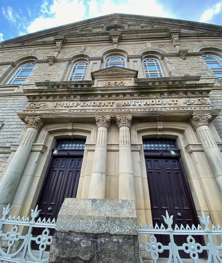
Turn left into the cobbled ginnel called the Forty Steps. Turn left at the bottom of the steps. We are now briefly joining the Stream and Steam Heritage Trail – please see the information board at the bottom of the steps – http://www.visitpendle.com/dbimgs/Stream_and_Steam_Leaflet.pdf. Follow the path to the road. Turn right, passing the Independent Methodist Chapel dating from 1892 and at the next T junction with Manchester Road turn left. At what was Barclays Bank, which is just after the ‘One-Stop’ store turn right into Newtown and then take the first left into Albert Rd. The Stage ends in the small square, which is surrounded by shops and cafes – the centre of Barnoldswick.
END OF STAGE 46
Click here to go straight to Stage 46 (E4)
CIRCULAR/DAY WALKS
Follow the Stage as far as Weets Hill and then return to Barrowford via the Pendle Way.

