STAGE 48 – LANESHAW BRIDGE TO THURSDEN
8 miles – 4.0 hours walk.
1,689 feet climbed – highest point 1,713 feet – Lad Law, Boulsworth Hill
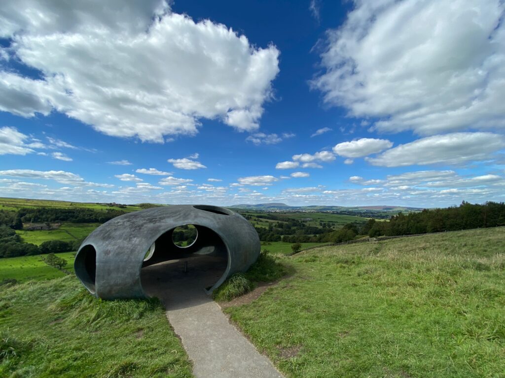
This Stage is one of the best, if not the best, on the Eastern Loop. We visit the lovely village of Wycoller, my fourth best village in Lancashire, the unique panopticon called the Atom, and then there is the climb to the summit called Lad Law, which at 517m is the sixth highest peak in Lancashire.
The map of Stage 48 can be found below courtesy of Ordnance Survey maps. You can subscribe yourself using this link, https://osmaps.ordnancesurvey.co.uk, which will enable you to import the GPX file which can be downloaded below. There is a small annual charge of around £30.
Download file for GPS
To download the GPX file for this stage click on the link above.
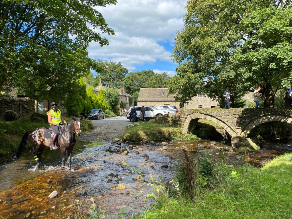
Turn right at the main road, cross the road and then turn left into School Lane. Just after the bridge turn right into Carrier’s Row. After the row of cottages turn left and we will now follow the Pendle Way into Wycoller. The path is obvious and follows Wycoller Beck. When you come to a flagged path turn right and then carry straight on until to a house with a large water tank. Exit the path onto a track. Carry straight on until you reach a drive with houses. Pass these now with the river on your left. You then come out on to the main road serving Wycoller. Turn left, cross over the river and then follow the road as it turns right and carries on into the centre of the village. Pass the tea rooms and then onto the ford and old pack horse bridge. Use this to cross the river and on to the remains of Wycoller Hall.
Wycoller is probably most famous for its Bronte connection. Today Wycoller Hall stands in ruins but this 16th century hall is believed to have been the inspiration for Ferndean Manor in Charlotte Bronte’s novel, ‘Jane Eyre’. The Brontes lived at Haworth, not far from Wycoller, and Charlotte would have passed through here on her way to Gawthorpe Hall when she went to stay with the Kay-Shuttleworths. Charlotte’s description of Ferndean Manor when approached from the old coach road fits Wycoller Hall perfectly.
Originally owned by the Hartley family, the hall was extended in the late 18th century by its last owner, Squire Cunliffe. A keen gambler, Cunliffe also borrowed money against Wycoller Hall to fund the building work. He died heavily in debt in 1818. After his death, stones from the Hall were plundered to build nearby houses and other structures. The hall subsequently fell into ruin.
The atmospheric ruins of the hall lie by Wycoller Beck which flows through the village. The beck is crossed by no less than seven bridges, the oldest of which is Clam Bridge. Possibly more than 1000 years old, the bridge is listed as an Ancient Monument. It is a simple bridge, just a single slab laid across the beck. It may also have once had a handrail.
Close to the ruins of Wycoller Hall is the late 18th / early 19th century Clapper Bridge. Grooves in the bridge formed by the weavers’ clogs were apparently chiselled flat by a farmer whose daughter fell and was fatally injured on the bridge.
The 15th century Pack-Horse Bridge (below, behind Clapper Bridge) is a substantial twin arched bridge. It is also sometimes referred to as Sally’s Bridge after Sally Owen, mother of Wycoller’s last squire.
Fans of the film, ‘The Railway Children’ starring Jenny Agutter may recognise this bridge. In a sequence from the film, Bobbie (Jenny Agutter) is seen sitting on the bridge, talking to Dr Forrest who is driving his pony and trap through the ford.
Finds of flint tools and axe heads at Wycoller indicate that there was a community here from as early as the Stone Age. A small sheep farming community in the 17th century, by the late 18th century the village was booming. Weaving had come to Wycoller. Weaving with a hand loom was now the main occupation of the vast majority of households in the village. However this period of relative affluence was not to last.
The invention of power looms in the 19th century led to the village’s decline. Weavers had to move to nearby towns to find work in the developing mills. Over 35 houses were abandoned and fell into ruin. By 1896 the majority of people had moved away from the village and it was virtually deserted.
Take time to explore the Hall and the Clappergate bridge.
We now LEAVE the PENDLE WAY for a short while to take in the Atom, which was built in 2006 after the PW (1987) .
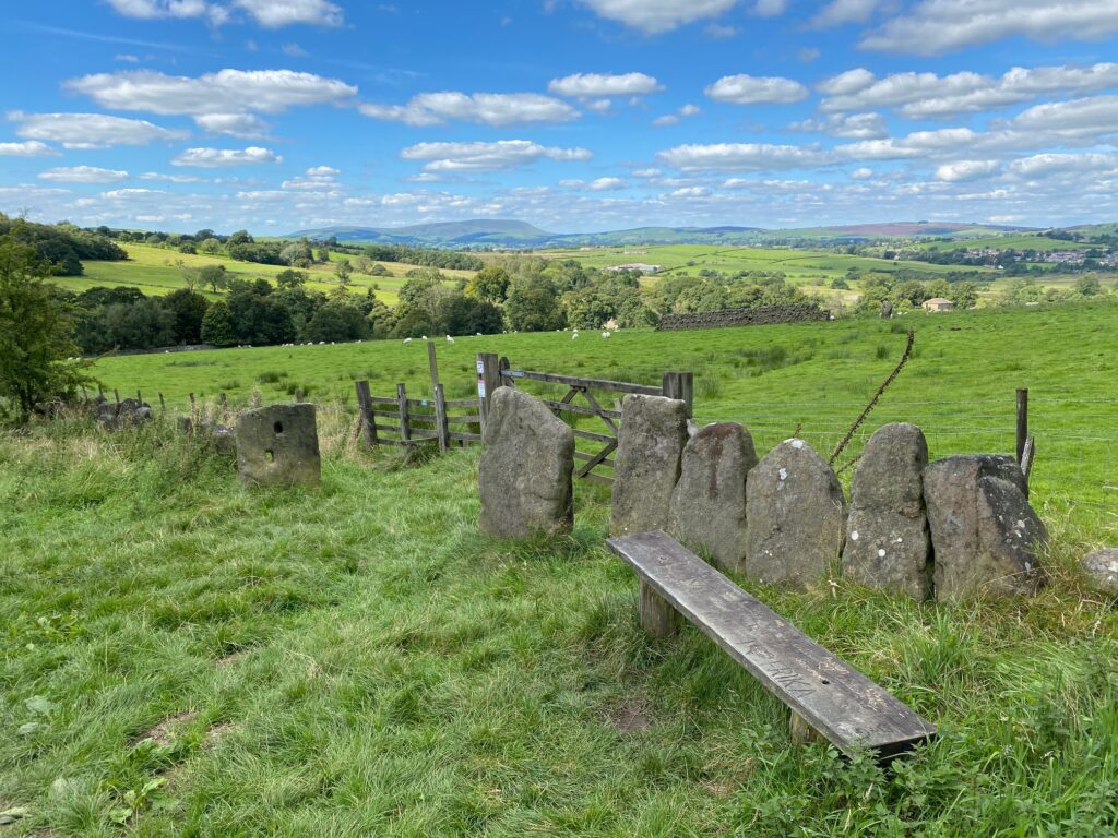
Pass the Hall on your right and find the steps behind which take you up to two stone gate post. Pass through these and carry straight on up a track.
Note the medieval stone walls, called vaccaries, as they were used to fence in cattle – the French for cow is “vache”!
Ignore various paths off to the left and right. Our track then bears around to the right and then reaches a stile gate, which takes us through up to the Atom.
Panopticon is a structure, space or device providing a comprehensive or panoramic view.
Quote “Lancashire’s Panopticons are a unique series of twenty-first century landmarks, designed to attract visitors into the countryside to enjoy the stunning landscapes and wealth of attractions that this delightful area has to offer”.
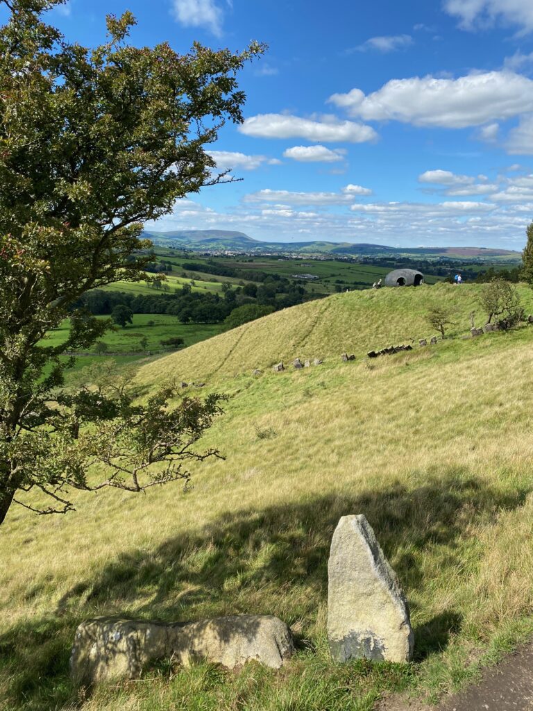
The position of the Atom on the hillside above Wycoller with of course Pendle Hill in the background
In addition to the Atom, nestling on the hillside above Wycoller village, there are three more Panopticons, each commanding spectacular views. From Colourfields, in Blackburn’s Corporation Park, you can enjoy a widespread panorama of the Park below, with the town beyond and distant views out towards Lytham, Southport and Fleetwood. From the Singing Ringing Tree, on Crown Point above Burnley, there is a superb view of Pendle Hill to the north and you can glimpse the Cliviger wind turbines on the Yorkshire border to the east. In between there is a panoramic overview of the town of Burnley, with the famous Turf Moor football stadium at its centre. On a clear day you can see the Bowland Fells, Pendle, Ingleborough, Pen-y-Ghent and Great Whernside. From the Halo, the centrepiece of a former landfill site on Top o’ Slate, now re-landscaped and returned to public use, visitors can enjoy wonderful views of the Rossendale valley, Greater Manchester and parts of Pennine Lancashire, which were formerly inaccessible.”
The Atom certainly is a view point with great views to both Pendle Hill and Boulsworth Hill, which we will climb shortly. It also acts as a shelter and is made from reinforced concrete and painted with a metal based paint. The interior used to hold a polished steel ball but this was stolen and has never been replaced.
From the Atom head towards the car park behind it but turn right before you get there and follow a path towards some trees skirting along the edge of the hill slope. At the way marker bear right and descend the slope to a kissing gate in a wall. Bear right towards two properties ahead – Foster’s Leap and Foster’s Leap Farm. Pass through two further kissing gates with the later taking you into the garden of the first property. Carry straight on to the drive and then past the next property and pass through a large metal gate. NB There is now concessionary footpath which avoids walking through the two properties – please take this.
Then bear left through two further gates. After 20m bear right across the marshy field. If you look carefully you can see marker posts but the path is a little indistinct. You are also heading in the direction of farm in the distance – Parson Lee Farm. At the end of the field head down to the stream, through a gate, across a foot bridge and up to a good stony track. We are now back on both the PW and PBW.
Turn left and follow the track for about 600m to the top of the valley. Cross through a gate onto a concrete track. Turn right and after 75m bear right off the track. Follow the PBW and PW, picking up the Bronte Way as well to the large bridge over the stream called Turnhole Clough. Follow the track up the other side of the valley and then around to the right before heading in a SW direction as far as Lumb Laith Farm, with a covered reservoir off to the left. The farm is the first that we encounter since Turnhole Clough and is shortly after the route becomes a made up track. This then turns left up to the reservoir just in front of two stone gate posts.
At this point you have a choice. You can either continue along the PWB/PW or head to the summit of Lad Law. The climb to the summit is an option – if you have a long day ahead then you have my permission to miss this out!
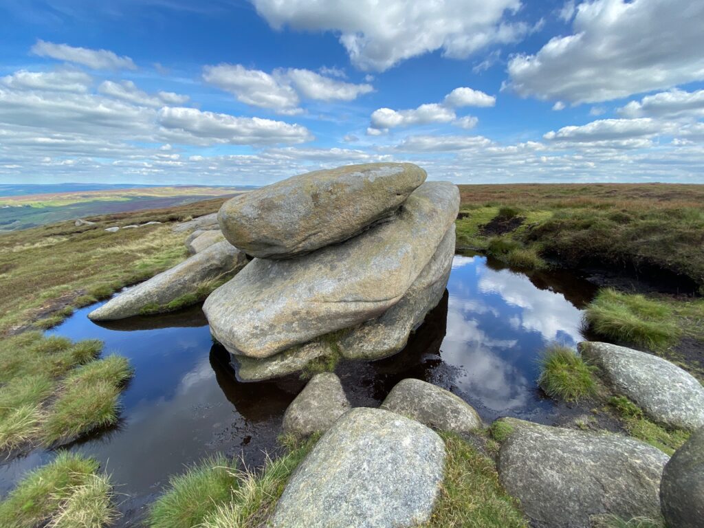
For the latter turn left off the PW/PBW following the track to the entrance of the reservoir. When you come to the entrance bear left past the boundary fence to the reservoir. From here the route then heads almost straight on in the same direction straight up Boulsworth Hill in a SE direction. After a hard but short climb of about 1km you come to some large grit stones known as “Little Chair Stones”.
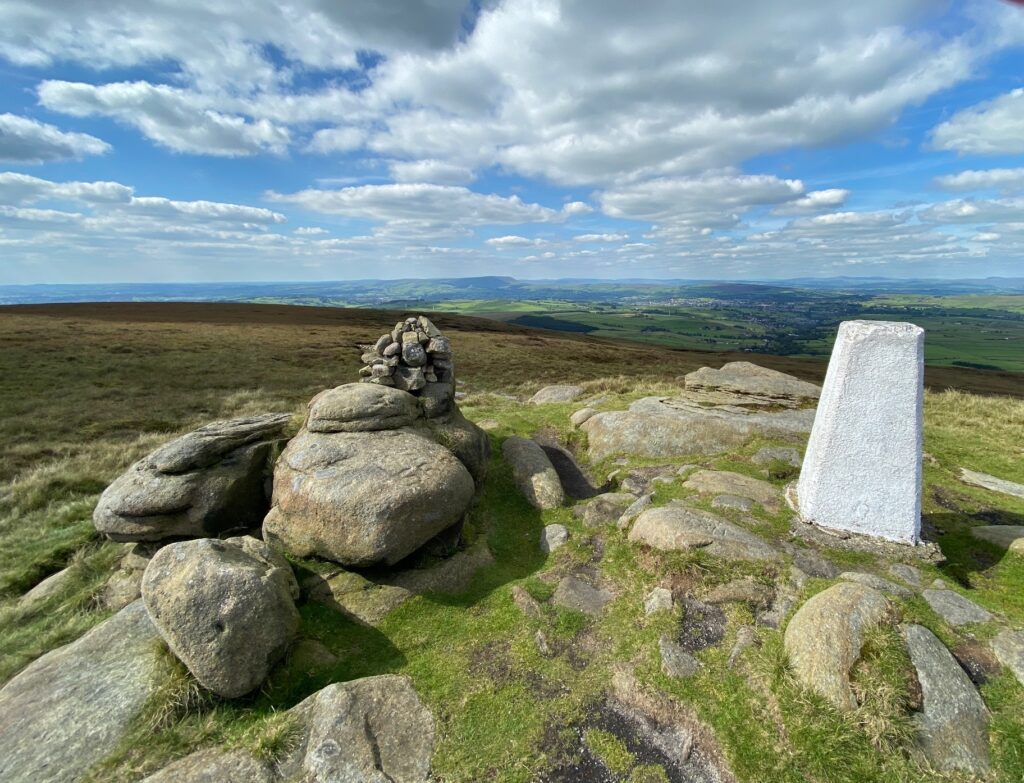
From here we turn right and head along the well trodden path to the summit of Lad Lowe with its trig point (517m).
Just to the SE of here you can see a ridge over a fence and a small shallow valley, which is the boundary with Yorkshire. From here to Whitworth, around 20 miles away, we will be never be far away from firstly the border with Yorkshire and then with Greater Manchester as we head south along the very eastern most fringes of Lancashire.
From the summit of Lad Law head in a NW direction taking the distinct path back down to the track that is the PW/PBW. Turn left and continue along the PW/PBW in a SW direction. Pass the wood on your right and then about 250m further on the PW continues straight on and we must finally leave our trusty PW and turn left and continue to follow the PBW. The split in the paths is marked by a prominent way marker.
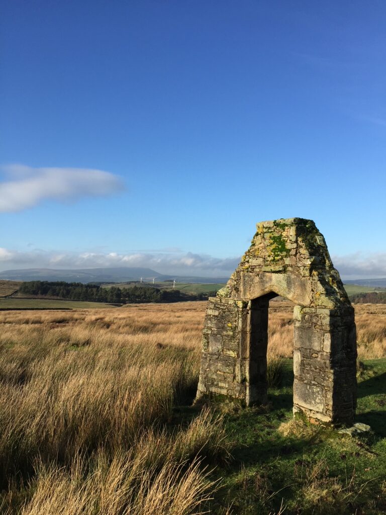
Shortly after the split you will come across the remains of New House. Only the doorway remains as it was demolished in the 1920s. It was built by a Robert Parker and on the lintel across the columns is carved the legend “Robert Parker and Jane his wife, May 2nd 1672”, although it is barely legible now! Robert Parker was a relation of the Parkers of Brewsholme Hall near Clitheroe.
After almost 1km you will come to some gates and then join a road. Carry straight on for about 25m and then as the road bears left and starts to descend steeply look out for a stile on your right, which takes you into some woods – note the old Bronte Way sign. Follow the good path which snakes down through the woods to a track at the bottom. Turn left, cross over the bridge to a minor road. This is the end of the stage, which is in the tiny hamlet of Thursden.
The road is a good stopping point if you do not fancy tackling the next stage as well. There is no public transport but it is a good car pick up point or can be easily accessed by taxi, as you are only about 5 miles away from Burnley to the west, with accommodation. The road to the east actually goes to Hebden Bridge in Yorkshire.
END OF STAGE 48
Click here to go directly to Stage 49
CIRCULAR/DAY WALKS
After having descended from Lad Law and have joined the main track again look out for the path just a few metres on your right. Follow this across a field and then over a stream and up to a track. Follow the track into the village of Trawden. Continue down through the valley and the village. Just after the Trawden Arms and the Community Centre, take the Keighley Road on your right. At the top of the steep hill take the path that heads to Winewall. From here descend down to the Ball Grove Park. You can then use the paths through this lovely park all the way back to Laneshaw Bridge.

