STAGE 53 – EDENFIELD TO EDGWORTH
8.25 miles – 4 hours walk.
929 feet climbed – highest point 1,370 feet – Bull Hill on Holcombe Moor
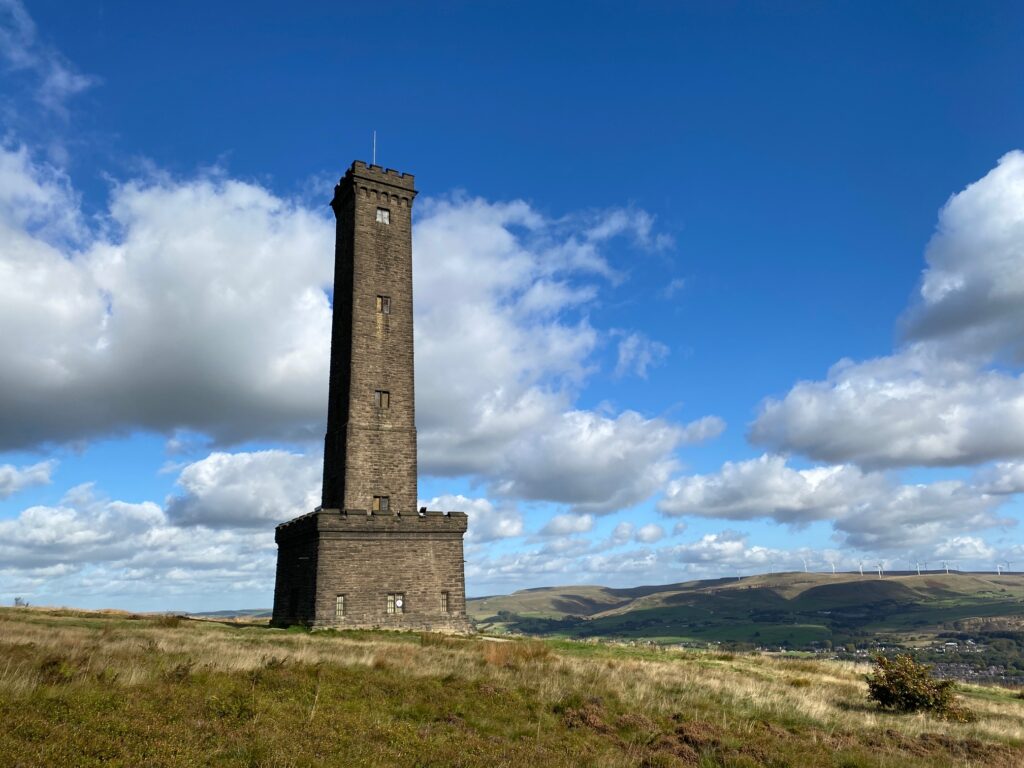
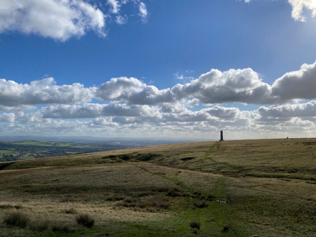
This stage is dominated by Holcombe Moor with the historic and iconic monument called Peel Tower. But there is more than just the Tower with the “Pilgrim’s Cross”, the Stubbins Estate and the village of Crowthorn, with its unusual history, which is still very visible today, all adding interest.
The map of Stage 53 can be found below courtesy of Ordnance Survey maps. You can subscribe yourself using this link, https://osmaps.ordnancesurvey.co.uk, which will enable you to import the GPX file which can be downloaded below. There is a small annual charge of around £30.
Download file for GPS
To download the GPX file for this stage click on the link above.
We initially continue to follow the Rossendale Way. From the Duckworth Arms cross the A56 and look out for the tarmaced single track road just before a terrace of about four houses opposite to the path at the end of yesterday’s Stage. Follow the track which bears around to the left and then runs parallel to the M66 on your right. Take the first right and cross over the M66. Follow the track down the slope and then turning right continuing along the track towards some properties. When you approach the entrance to these, turn left and follow the stony track down towards the River Irwell. At the bottom of the slope, just before the river, the track bends right and follows the river upstream. Exit on to a main road – A676 in the village of Stubbins. We are now back in Lancashire!
We now LEAVE the Rossendale Way. It follows Chatterton Road on the east side of the river but the bridge that it uses to cross the Irwell was severely damaged and removed so you cannot cross the river! Cross the road, turn left and cross the bridge over the river – there is pedestrian bridge alongside the road bridge. Turn immediately right into a small commemorative garden. Pick up the path at the back of the garden and follow this between houses and their gardens with the Irwell on your right. Then pick up the path along the side of the river and follow for about 500m until you come to a house and a road. We REJOIN the Rossendale Way for a short while.
Turn left and pass under two bridges. The first is the line of the East Lancashire Railway with its steam engines so you may be lucky and see these pass over, but please note they do not run every day. Immediately after the second bridge turn right and follow the lane. Pass the entrance to the cycleway on your right and then turn left and then follow the track around the back of a property. Please ignore the stile and footpath on your right to the side of the property. Pass through a metal stile gate and continue on the track up the hill with waterfalls on your left. When you come to a footbridge on your left ignore this and bear right through a gate. We are now entering the Stubbins Estate, which is maintained by the National Trust and there is a metal National Trust sign to mark this.
Continue into the woods and continue to head west and climb out of the Irwell valley.
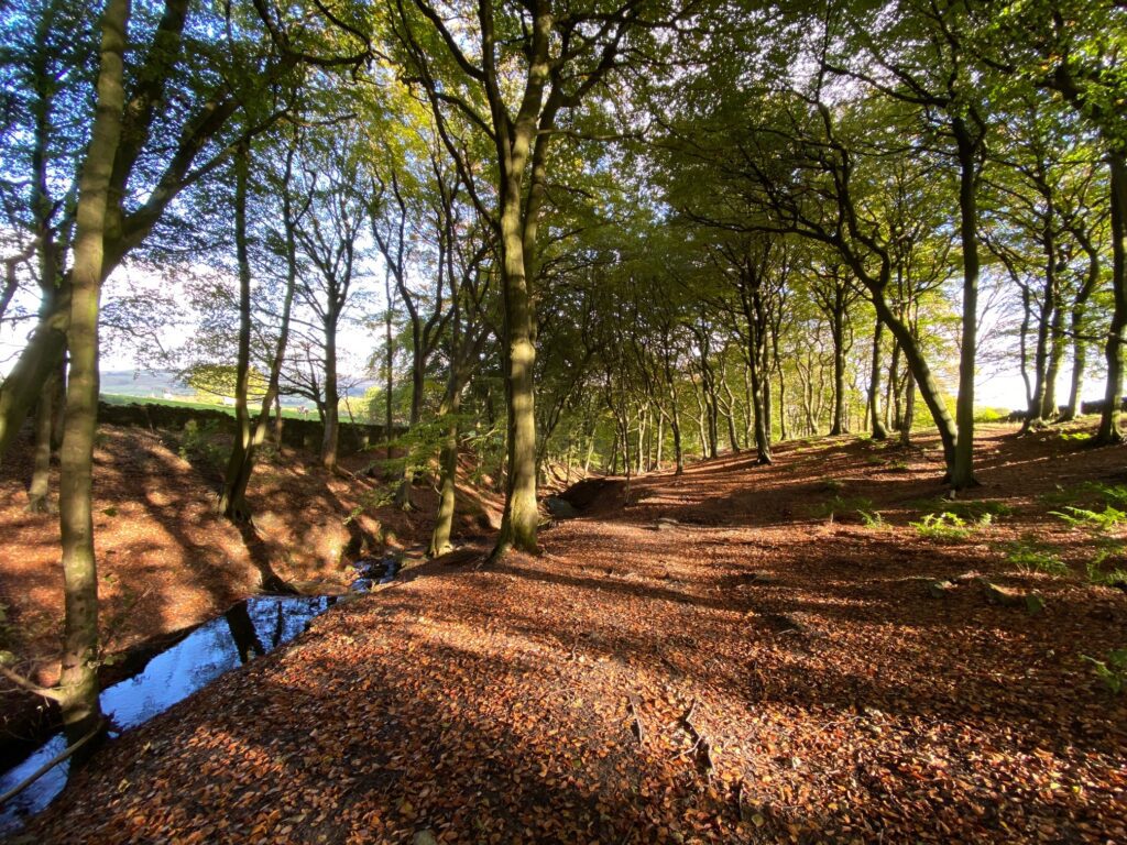
You will then come to a junction of paths and it is at this point that we LEAVE the Rossendale Way and do not return to it for another 20 miles or so. The Rossendale Way now bears right and down to the stream that we have been following on our right and then continues up the other side. However, it is simpler and easier to continue straight on in the same direction through the woods to a main road. Cross the main road and find the gap in the wall, which is behind a crash barrier. Enter the woods – Buckden Woods – and follow the path up through these lovely woods to exit through a wooden stile gate on to a track.
The Rossendale Way is just to our right. I suspect that the path that we followed through these lovely woods has only become a right of way since the Rossendale Way was created. We will not re-join the Rossendale Way, which now heads up to Beetle Hill and from there north. The reason for this is that the Rossendale Way is constrained by remaining in Rossendale, whilst we will be heading further west into the southern part of the Borough Council of Blackburn with Darwen, which has some lovely and unmissable countryside including the Wayoh, Jumbles and Entwistle Reservoirs. There is also another difficult decision at this point. About 2km to the south of our current position is the iconic monument called Peel Tower, which we have seen in the distance previously. Unfortunately this is now in Greater Manchester and so the dilemma is whether to cross the border to visit this. Well the Lancashire way does in fact visit Peel Tower as it really cannot be missed, it is Lancashire really and we are only out of modern Lancashire for about an hour. And it is not for the first time that the Lancashire way strays over the border for a short time.
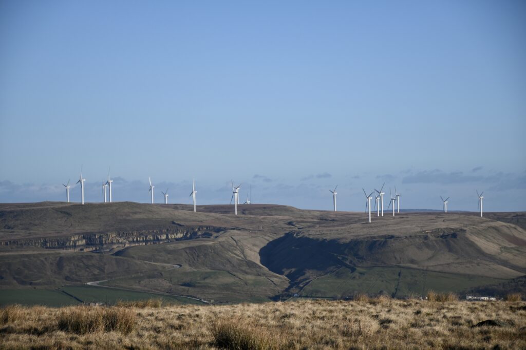
Turn left and head south along the good stony track. There are great views back across the Irwell valley to Scout Moor.
Pass through a metal gate and then a wooden gate just after two disused properties on your right. There is another metal National Trust sign by the gate informing you that we are now on Holcombe Moor. Continue on for about 1km, pass two large occupied properties and then shortly afterwards you will come to two tracks on your right together with a prominent bench with more good views of the end of Stage 53, including Scout Moor and Cowpe Lowe. Throughout this part of the route you may hear the steam trains in the valley below.
Ignore the first tarmac track on your right but take the second stony path up the hill. When the track splits bear left to the corner of a wall. Continue along the track which follows the wall on your left up hill to a cattle grid. Continue up the track to the Peel Monument.
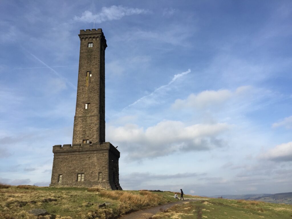
The memorial tower to Sir Robert Peel, also known as “Holcombe Tower”, high above Ramsbottom was planned and erected at the same time as Bury was preparing its statue to the then recently deceased statesman who was born in Bury.
The tower occupies a prominent position on Harcles Hill (known locally as “Holcombe Hill” due to its location next to Holcombe village) 1,100 feet (335 m) above sea level. The monument is believed to have been designed by members of the memorial committee who included the local textile entrepreneur and philanthropist William Grant. Grant was said to have been responsible for the site, which was in a direct line from his own house, Nuttall Hall and St Andrew’s Church.
A public subscription provided the £1,000 needed to build the tower. The stone for the tower was obtained from the hillside. The Peel Tower was opened in September 1852, the day after the inauguration of the Baily’s statue in Bury.
As at the earlier ceremony Frederick Peel, the son, was the principal guest of honour, and he declared the monument to be a splendid memorial to his father and to the principles of free trade. Local speakers included Joshua Knowles and John Robinson Kay. Unfortunately, large numbers who had travelled by excursion train from Salford arrived too late to witness the ceremony.
Inside the entrance to the tower is an extract from Peel’s speech to the House of Commons in 1846. It emerged later that the tower had been planned and built in such haste that the necessary permission had not been obtained from the owner of the land, the Duke of Buccleuch. This matter was eventually rectified in 1868 when the land was transferred into the keeping of six trustees, on the condition that it would not be used for contentious public meetings.
If the tower, in the words of the Manchester Guardian, is not “a specimen of architectural beauty”, it does provide a conspicuous landmark, and it also has a viewing platform from which to look across the surrounding countryside NB rarely accessible. The original internal staircase eventually became unsafe and was bricked up; later, the tower was reconditioned and a new staircase provided. The tower is 128 feet (39 m) high. A local Easter tradition entails people walking up the hill on Good Friday, often rolling hard-boiled eggs down the steep sides, because “a rolling stone gathers no moss”.
The tower was renovated in 1929 and at various other times. The tower closed after the Second World War in 1947 and was reopened and rededicated in November 1985 by Conservative Councillor Alice Maders.
Sir Robert Peel, 2nd Baronet, FRS (5 February 1788 – 2 July 1850) was twice Prime Minister of the United Kingdom (1834–1835 and 1841–1846) and twice Home Secretary (1822–1827 and 1828–1830). He is regarded as the father of modern British policing, owing to his founding of the Metropolitan Police Service. Peel was one of the founders of the modern Conservative Party.
The son of a wealthy textile-manufacturer and politician, Peel was the first prime minister from an industrial business background. He earned a double first in classics and mathematics from Christ Church, Oxford. He entered the House of Commons in 1809 and became a rising star in the Tory Party. Peel entered the Cabinet as Home Secretary (1822–1827), where he reformed and liberalised the criminal law and created the modern police force, leading to a new type of officer known in tribute to him as “bobbies” and “peelers”. After a brief period out of office he returned as Home Secretary under his political mentor the Duke of Wellington (1828–1830), also serving as Leader of the House of Commons. Initially a supporter of continued legal discrimination against Catholics, Peel reversed himself and supported the repeal of the Test Act (1828) and the Roman Catholic Relief Act 1829, claiming that “though emancipation was a great danger, civil strife was a greater danger”.
After being in Opposition between 183 and 1834, he became Prime Minister in November 1834. Peel issued the Tamworth Manifesto (December 1834), laying down the principles upon which the modern British Conservative Party is based. His first ministry was a minority government, dependent on Whig support and with Peel serving as his own Chancellor of the Exchequer. After only four months, his government collapsed and he served as Leader of the Opposition during Melbourne’s second government (1835–1841). Peel became Prime Minister again after the 1841 general election. His second government ruled for five years. He cut tariffs to stimulate trade, replacing the lost revenue with a 3% income tax. He played a central role in making free trade a reality and set up a modern banking system. His government’s major legislation included the Mines and Collieries Act 1842, the Income Tax Act 1842, the Factories Act 1844 and the Railway Regulation Act 1844. Peel’s government was weakened by anti-Catholic sentiment following the controversial increase in the Maynooth Grant of 1845. After the outbreak of the Great Irish Famine, his decision to join with Whigs and Radicals to repeal the Corn Laws led to his resignation as Prime Minister in 1846. Peel remained an influential MP and leader of the Peelite faction until his death in 1850.
Peel often started from a traditional Tory position in opposition to a measure, then reversed his stance and became the leader in supporting liberal legislation. This happened with the Test Act, Catholic Emancipation, the Reform Act, income tax and, most notably, the repeal of the Corn Laws. Historian A. J. P. Taylor wrote: “Peel was in the first rank of 19th century statesmen. He carried Catholic Emancipation; he repealed the Corn Laws; he created the modern Conservative Party on the ruins of the old Toryism.”
We will now head to Crowthorn and then Edgworth, which marks the end of the stage. Facing the front door (sorry you cannot enter it!) of the Peel Tower ie the east facing side, turn right and pick up the grassy path to the right of a large hole/discussed quarry and head NNW. Pass through a double wooden stile gate. From here we will roughly maintain the same bearing all the way to the “Pilgrims Cross”. Ignore the path that crosses our path and then after a small stream head up the steep slope of Harcles Hill to a cairn.
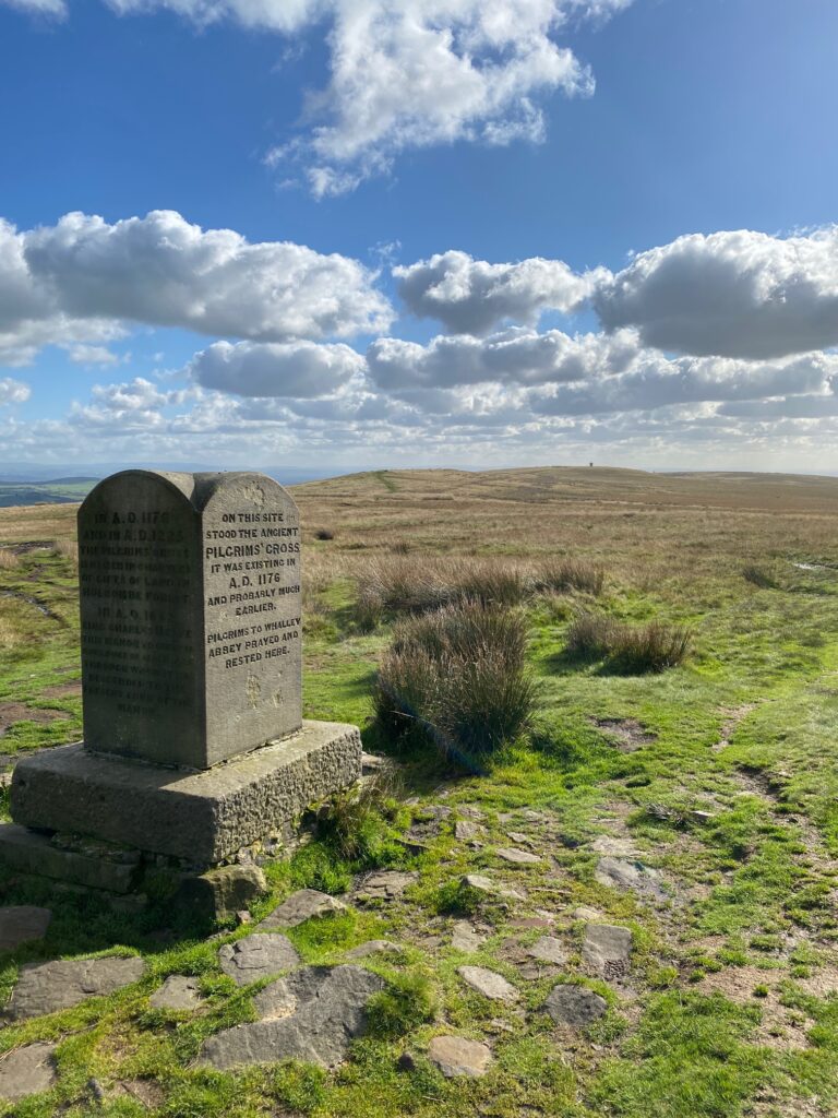
Continue along the top of Holcombe Moor in the same direction along a wide path to the Cross or more precisely a stone monument that marks the position of the Pilgrims Cross. Just shortly before you get to the monument we cross back into Lancashire.
The four sides of this rectangular monument tell it’s story and history. These are
1.“On this site stood the ancient Pilgrims Cross. It was standing in A.D. 1176 and probably much earlier. Pilgrims to Whalley Abbey prayed and rested here.”
2.“In A.D. 1176 and in A.D. 1225 the Pilgrims Cross is named in charters of gifts of land in Holcombe forest. In A.D. 1662 King Charles II gave this manor to General Monk, Duke of Abermarle through whom it has descended to the present lord of the manor.”
3.“Nothing is known of the removal of the ancient cross, but its massive socketed foundation remained here until August 1901”
4.“This memorial stone was placed here May 24th 1902 by the copyholders of the manor and others”.
The monument would have been an important way marker on the moor in poor weather when travelling from Whalley to Manchester.
From the cross continue in the same direction ie take the left hand of two paths heading approximately northwards. Continue up the slope and then along the top to the trig point, which marks the top of Bull Hill at 418m, the highest point on Holcombe Moor. Bull Hill is actually within a Military Range and occasionally is closed to the public. If this is the case then you will have to take the path that bears right from the Pilgrim’s Cross and skirt around Bull Hill and the Range.
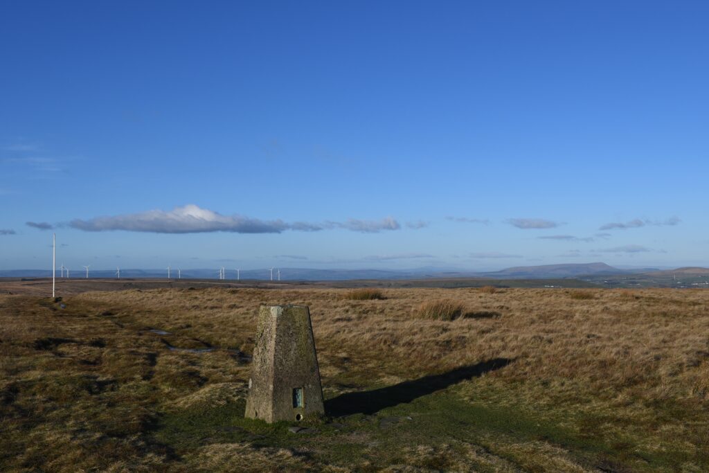
The summit of Bull Hill with Pendle Hill in the background. On a good day you can also see Ingleborough
From the trig point continue straight on to a white flag pole. Pass to the left of the pole and then bear left and follow the path down the slope to the bottom and a Military warning sign. The next 10-15 minutes may be amongst some of the wettest under foot on the whole of the Lancashire Way as we cross over Wet/Black Moss. There are ways around this but it is fine in the summer and is quickly crossed and avoids lengthy detours. At the bottom of the slope you will see a wide often muddy/boggy path, which crosses the flat boggy plateau ahead. Take the right hand of the two paths which heads approximately WSW. After a small stream it bears left and then heads in a SW direction. After about 10 minutes you will come to a wooden marker post and then the end of the boggy plateau which necessitates jumping down off the peat! Ahead of you is the corner of a stone wall. From here bear right and follow the wall with it on your left. When the wall turns right you need to cross over the wall ( new metal gate stile now in place!) and then follow the remains of a wall in SE direction. NB When I was last here the wall was being rebuilt and it had cut off the previous path and I could not be sure whether a wall stile was being built into wall. However, the OS map clearly shows a public right of way so you are within your rights to climb over the wall. I can confirm, thanks to Peter Bearon, that a metal gate stile has indeed been built at the corner when the wall turns right.
Follow the remains of the wall to a track. Turn right and bear right onto another track which heads towards a building with a gate and fencing surrounding it. Turn right ie away from the building and head down the part concrete track to a metal gate. This may look as if it is padlocked but it never has been so pass through the gate and bear right on to a single track tarmac track. I have been informed that it was recently padlocked so you may need to climb over or squeeze through a gap at the side. Pass through a cattle grid, pass the farm and then head down the road, past the small reservoir (see below) and into Crowthorn.
Crawthorn was the site of a National Children’s Home. The school began in 1872 when the Revd Thomas Bowman Stephenson, a Methodist minister in London, was contacted by a wealthy Bolton mill owner in reply to an advert placed in the Methodist Recorder. The Bolton man, James Barlow, a staunch Methodist and temperance advocate, had purchased a run-down inn on the moorland above the village of Edgworth. He donated it, with 80 acres of surrounding land plus £5,000, so that Stephenson could open the first NCH children’s home outside London.
Barlow saw his gift as two fold; in buying the Wheatsheaf Inn, not only would he be helping the abandoned children who had been living on the streets of London, but he would be ridding Edgworth village of a den of iniquity. The inn had a reputation for Sunday drinking, dog fighting, cock fighting and rat baiting.
The young boys that lived in the school helped to build their homes and to transform the surrounding bog-land into farm land which would help sustain their community throughout the decades. They helped to quarry stone from the top of Crowthorn Hill to build a reservoir to provide fresh water for the home. We passed this on the way down from Crowthorn Hill.
Eventually the home would have its own farm with cattle, a dairy, bakery, laundry, blacksmiths, carpenters and a clog maker’s workshop. The stone- built houses where the children lived would span outwards from the Wheatsheaf building down Moorside Road and Broadhead Road. The houses still stand and from the outside are recognisable to returning children.
The National Childrens Home began a scheme of emigration from their homes to Canada where a large body of Methodists could provide work opportunities for boys and girls, mainly in farming and domestic service, for which these children had gained the necessary skills at Edgworth.
Turn left at the junction with the main road. Head down the road past the impressive properties, which are now largely residential. The first large buildings are Howarth and Jubilee House, the first houses built to accommodate the children and then there is what was a hospital and back at the junction was a School and Methodist Chapel. There are other impressive buildings of various origins in the village. There were eventually around twenty children’s houses with more than three hundred children in residence. On the main road north ie in the opposite direction to our route you can see the Governor’s House and what is apparently the Wheatsheaf Inn, with a stone engraved with these words.
Continue down the main road and out of the village. When the road turns left take a track on the right hand side of the road opposite a house and just before a farm. There is a wooden footpath sign here. Continue along the track and then bear left on to another track and down to a main road. Note the lovely cottages opposite on the corner of Hob Lane.
Turn left and follow the main road (Blackburn Road) into the centre of Edgworth at the double mini roundabout. Whilst you are walking this final short 500m take in the fact that you are walking along one of the main Roman roads in Lancashire, which went from Manchester to Ribchester via Blackburn. It is clearly marked on the OS Map and can be traced for most of its length.
END OF STAGE 53
Click here to go directly to Stage 54
There is no accommodation in Edgworth and bus services are few and far between. The best option is to finish the stage a few hundred meters early when you reach the main road into Edgworth. Take Hob Lane which is opposite and follow this down and over the Wayoh reservoir and up to Entwistle railway station. Trains go south to Bolton or north to Blackburn. Bolton has a Travelodge and a Holiday Inn. Alternatively complete the six miles of Stage 54, which also ends at Entwistle Railway Station.
CIRCULAR/DAY WALKS
Begin in Stubbins and walk the Stage as far as Bull Hill. Descend Bull Hull to the boggy plateau. Rather than cross the plateau to Crowthorn turn right and circle around the northern end of Bull Hill to Beetle Hill. When you reach the wall do not follow it east but bear right and pick up the Rossendale Way. which will take you down to the top of Buckden Wood. Follow the Lancashire Way backwards through the Stubbins Estate. When you come to the footbridge in the woods turn right coming off the Lancashire Way and make your way back via the Stubbins Estate factory.

