STAGE 63 (W4) – KIRKHAM TO SALWICK BRIDGE
3.75 miles – 1.5 hours walk
142 feet climbed – highest point 97 feet on the road just before Salwick Bridge
A quick walk through the centre of Kirkham including its War Memorial and St Michael’s Church and then it’s north to Wesham and then east along one long track/road to the end. A simple stage!
A map of Stage 63 can be found below courtesy of Ordnance Survey maps. You can subscribe yourself using this link, https://osmaps.ordnancesurvey.co.uk, which will enable you to import the GPX file which can be downloaded below.
Download file for GPS
To download the GPX file for this stage click on the link above.
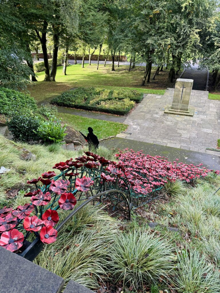
From the crossroads continue straight on up the hill which is the high street of Kirkham. Pass the turning to Morrisons and then the United Reformed Church. Just after the top of the hill turn left at the corner of the Old Bank into Birley Street. Continue to the end and take the pedestrian gate into the Memorial Park. Turn left and you come to the top of the memorial. It’s a good one covered in metal poppies. Use the steps on either side to descend to the bottom. Carry straight on to a path and then turn right and head for St Michael’s church – please see notes on Kirkham Grammar school. Next door is St Michael’s Primary school, which incorporates some of the previous 19th Century buildings of the Grammar school.
Exit the park and turn left in front of the church. Follow the track down towards the farm and then take the gate into the field before you enter the farm itself. Follow the track straight ahead and then bear right and under the railway. Carry straight on, through a stile and then up the slope. Follow the path through into an area fenced on either side and then enter the next field. After 100m take a stile on the right over into the adjacent field. Head straight across the field to a stream and wood area. Cross the stream, turn left and follow the path to the road.
Turn right. The next three miles or so are quite simple. Head east firstly along a road passing Mowbreck Park and Hall Farm which then turns into a track. At the end of the track carry straight on along the road through the pleasant village of Treales. Pass the closed pub, Derby Arms, and then at the next junction bear right keeping on the main road. Note the windmill on the left just further on. You can walk up to it as a footpath passes it. Follow this road for almost two miles and you will arrive at the Hand and Dagger pub next to the Lancaster canal. This is the end of the Stage.
END OF STAGE
Click here to go straight to Stage 64 (W5)
If you are planning on ending the day here then you will more than likely be heading towards Salwick railway station, which is just over a kilometre to the south. Take the road opposite the pub – Station Road. However, please note there are only four trains a day that stop here so make sure that your timing is spot on. The alternative is to complete the first 2.5 miles of Stage W5 and come off the canal at Swillbrook and walk up the road to a bus stop in Catforth. It is opposite the Village Hall on the corner of School Lane. In theory the bus will stop for you on the Catforth Road on the corner of Blackleach Lane, which is where you can come off the canal. The Service is number 74 and links Fleetwood and Preston.


