Uncategorised
The Original Lancashire Way?
Ever since I first conceived of the Lancashire Way I have always been conscious of the fact that www.lancashireway.com might not have been the first attempt at putting together a long distance walk that covered the county of Lancashire. However, until recently I had not been able to find anything tangible.
The nearest to the Lancashire Way was the “Lancashire Trail” written by Brain Smailes first published in 2003 by Challenge Publications. It is a 70 mile linear route linking the Sandstone Trail and the Pennine Way. It starts in St Helens and ends at Thornton-in Craven and was based upon a 1980 route created by The St Helens & District CHA and HF Rambling Club.
There is also the North West Way by Steve Garrill which is a 13 day walk from Preston to Carlisle, which was first published in 2013 by Trail Guides Publications.However, inspite of some similarities initially, after just 40 miles or so out of a total of 205, it sadly exits the county of Lancashire.
There have also been some interesting LDWA Challenge Walks created in Lancashire. In 1991 there was the Lancastrian 100 Challenge walk – a route of 100.5 miles starting and finishing in Lancaster to be completed in 48 hours. It has many similarities with the Northern and Central loops taking in places such as Hornby, Croasdale Fell, Dunlop Bridge, Slaidburn, Grindleton, Barley, Chipping, Scorton and Condor Green.
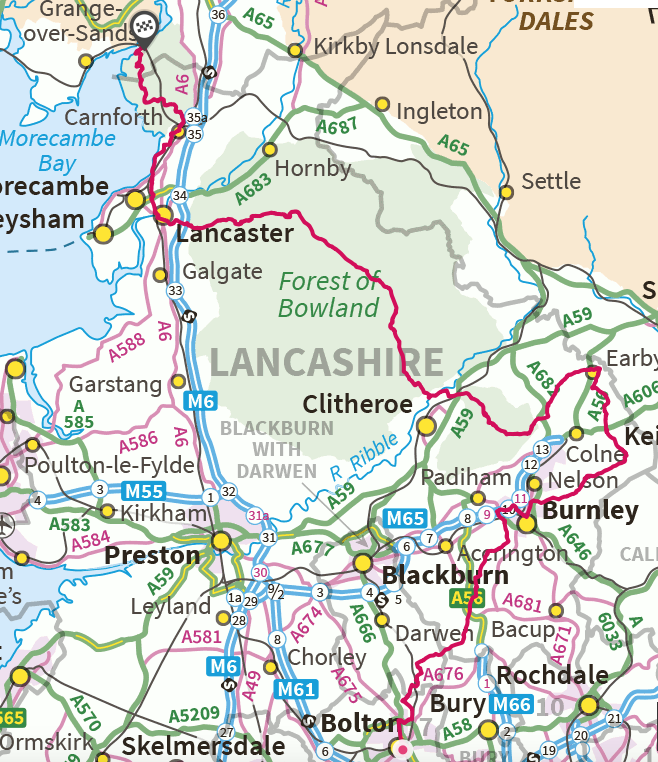
In 2015 there was the Red Rose 100 beginning and ending at Rivington. Below is an extract of the route summary which again has many similarities.
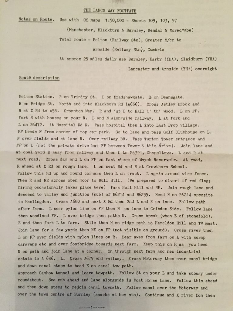
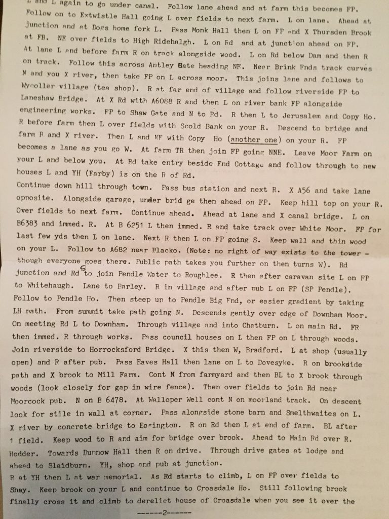
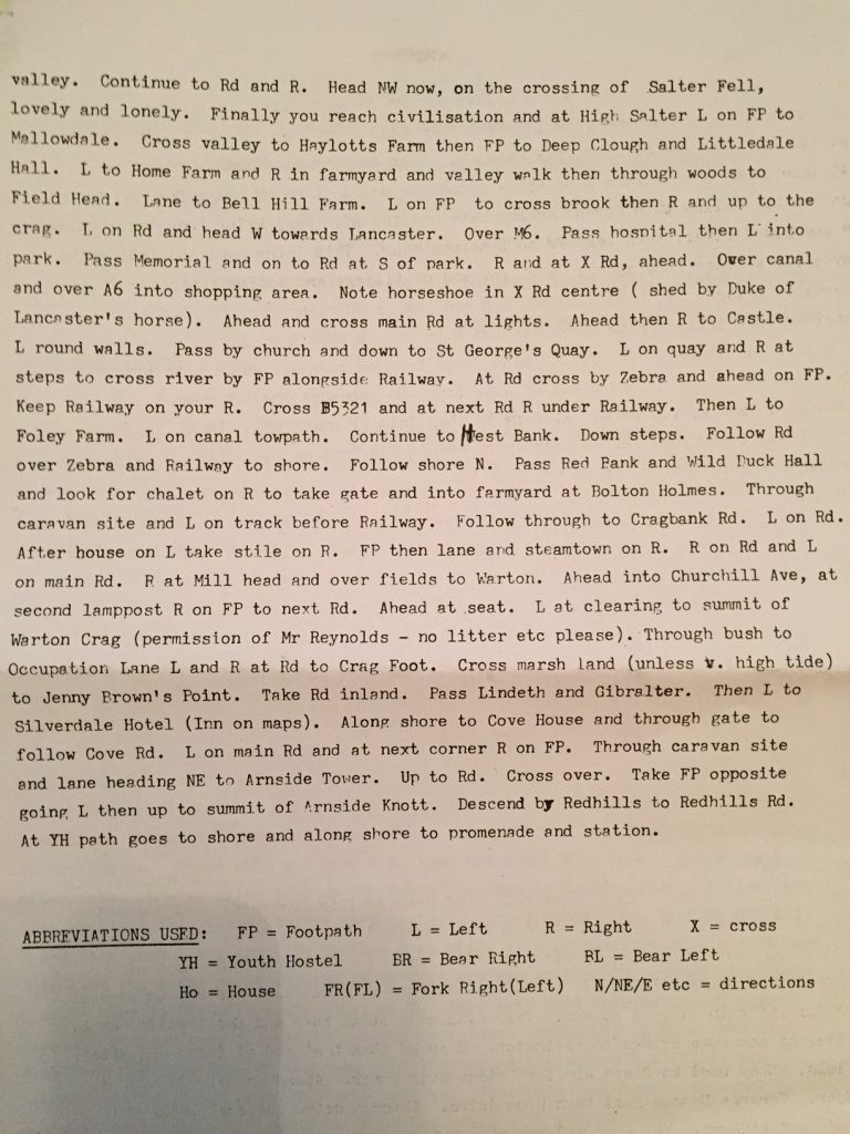
I am sure there are many more similar walks but it was only recently that I was introduced to what I was told was the original Lancashire Way by Jeff Parr on a recent LDWA walk. Intrigued I asked Jeff to send any information that he had and a few days later I received an envelope with a copy of the route. This can be found below. It was devised by Frank Hodson and is called “The Lancs Way Footpath” – so a slightly different description! I have tried to follow the route on the current OS Maps, which was not easy but I think I have managed to do so, which is a testament to the route description as it has been condensed into just three pages!! I am not sure when it was put together but I am hoping to make contact with Frank at some point soon so will give an update after that.
The route maps out at just 99.5 miles, starts in Bolton (now Greater Manchester) and finishes in Arnside (now Cumbria) but is within Lancashire for most of its length. I do wonder therefore if it was created before the Local Authority Boundary changes in 1974 or shortly thereafter?
Below you can see the three pages of a very succinct route description, which focuses upon over night stopping points with Youth Hostels.
The initial part of the route is very different and there are only common parts between Barley and Downham over the summit of Pendle Hill, from Slaidburn to Salter via the Hornby Road and parts of Lancashire Way from Hest Bank to Silverdale. I hope to walk this route one day soon as it is a fascinating alternative to the Lancashire Way and after all these years I think it would be great to give some recognition to Frank’s Lancs Way Footpath.





2 Comments
ian barker
Hi Neil,
I came across ‘The Lancashire Way’ by noticing the waymarks on my local paths. Anything that gets paths being used and thereby maintained is great by me. I see, by this article, that you are interested in any other walks around the county. I have website ‘ian’s Hikes’, with my own efforts, which you might be interested in taking a look at. The most relevant one is a long-distance path that vaguely follows the old boundary of Lancashire. it’s called the ‘Palatine Plod’ and can be done in 26 stages using public transport.
neil.harwood
Ian,
Really sorry – I have been busy with work so that I have not been into my website for some time. I normally get an e mail confirming receipt of a comment but did not this time. I have downloaded the GPX and had a quick look at the route . I am always fascinated to see what route alternative walks take. There are some similarities, which is a good to see. I also like the fact that you have made it accessible with public transport. That is the downside with a long distance walk these days – few people have the time to do these in the traditional day after day format. They want to do a day at time and return to the start. I will spend more time looking at this and probably come back to you then. Meanwhile if you use the e mail address [email protected] that will ensure that I see any replies. All the best, Neil